Map of Alabama – Cities and Roads

About the map
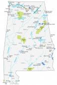
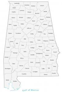
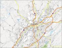
This Alabama map features cities, roads, rivers, and lakes. Montgomery is the capital of the state of Alabama. Birmingham, Mobile, and Huntsville are some of the major cities shown on this map of Alabama.

Alabama is where the confederacy started. So, you have landmarks all over from the Civil Rights movement. In fact, Montgomery was the birthplace of the Confederacy because it was where the secession convention took place.
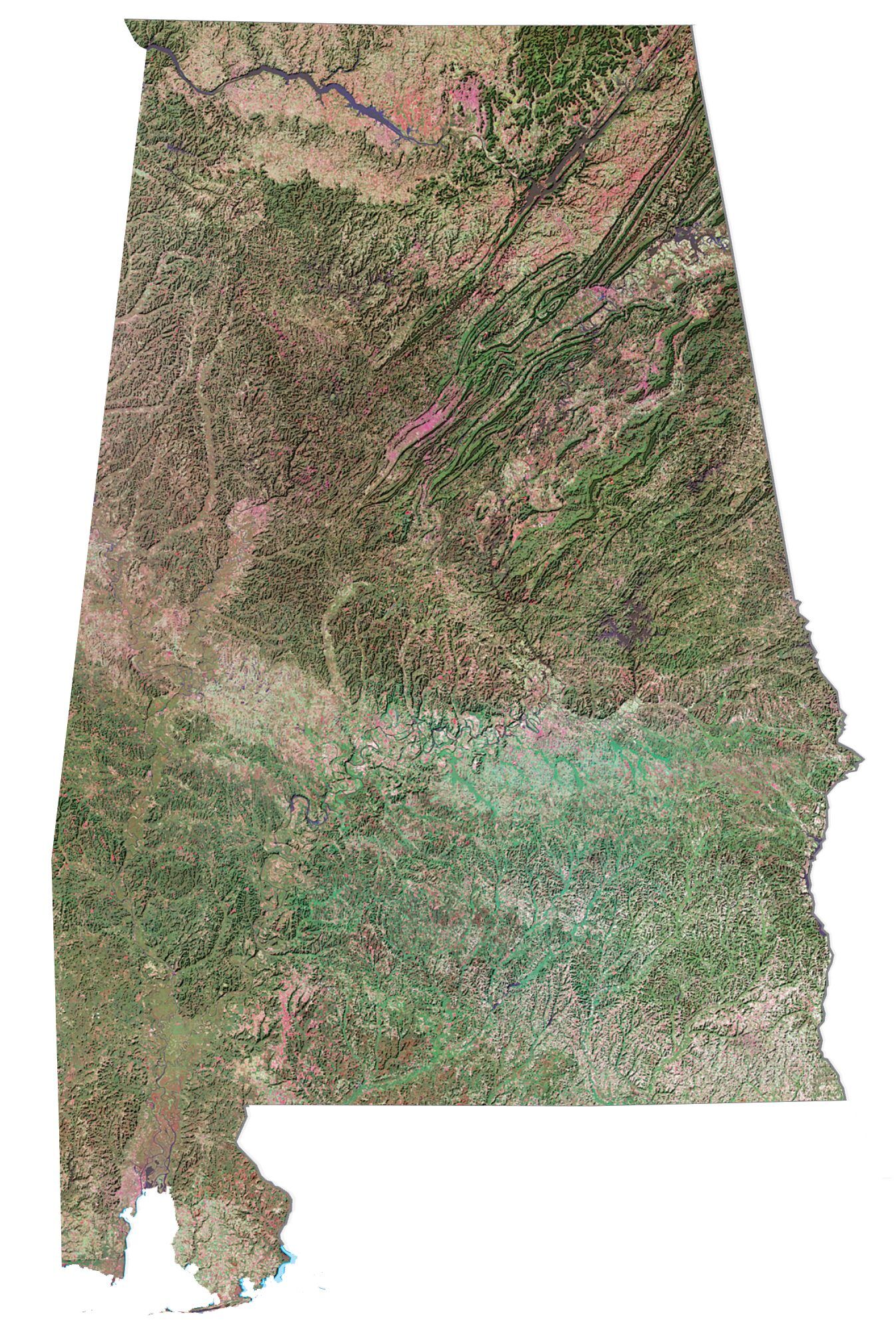
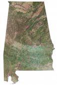
In terms of its geography, Alabama is primarily coastal plains. But the north consists of hills and mountains including the Appalachian Mountains. For example, Cheaha Mountain is just over 2400 feet in elevation and is north of Talladega National Forest. Birmingham is the largest city in Alabama with over 1 million people.
Alabama map collection

You are free to use our reference map of Alabama for educational and commercial uses. Attribution is required. How to attribute?
State capital
Montgomery
Interstate highways
Interstate 10 (I-10)
Interstate 20 (I-20)
Interstate 25 (I-25)
Interstate 59 (I-59)
Interstate 65 (I-65)
Interstate 85 (I-85)
Cities, towns and villages
Birmingham
Huntsville
Mobile
Auburn
Bessemer
Decatur
Dothan
Florence
Gadsden
Madison
Phenix City
Prichard
Tuscaloosa
Hoover
Homewood
Alexander City
Andalusia
Athens
Atmore
Bay Minette
Brewton
Chickasaw
Clanton
Demopolis
Elba
Enterprise
Eufaula
Evergreen
Fayette
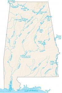
Lakes, rivers and creeks
Lakes and reservoirs
Weiss Lake
Lewis Smith Lake
Martin Lake
West Point Lake
Mobile Bay
Walter F George Lake
Wheeler Lake
Mitchell Lake
Guntersville Lake
Rivers and streams
Tennessee River
Coosa River
Tombigbee River
Alabama River
Chattahoochee River
Conecuh River
Black Warrior River
Sipsey River
Tallapoosa River
Coosa River
I need The Cullman And Vinemont map
How do I get different maps for different states. I have some but my collection is not complete. I would like the actual real map and not a download version. Please steer me in the right direction.
what do you mean by the actual, real map?
I bet she means the old fashioned kind that used to fold up and we could pick them up in gas stations, now in Welcome Centers when you enter a state.