Birmingham Map, Alabama

Map of Birmingham
Sweet Home Alabama! This map of Birmingham, Alabama shows major roads/highways, things to do, and general landmarks. Also, it features an interactive map that highlights local attractions, restaurants, and hotels.
Birmingham is the second-largest city in Alabama with just over 200,000 people. The city of Birmingham has the best of both worlds. With a rich history and a diverse culture, it’s the perfect place to explore.
Birmingham Alabama is home to shopping, restaurants, museums, music venues, and more. Get more out of your next trip to Birmingham by using this map to find the best attractions and things to do.
Jump To: Interactive Map | Printable Road Map | 10 Things to Do | Reference Map
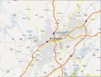
Birmingham map collection
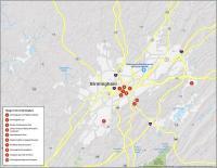
Interactive Map of Birmingham
The Birmingham interactive map helps visitors get around the city. It features amenities such as restaurants, shopping centers, parks, and more. Whether you are visiting or living in Birmingham, navigate the city with this interactive map.
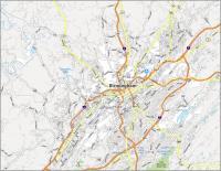
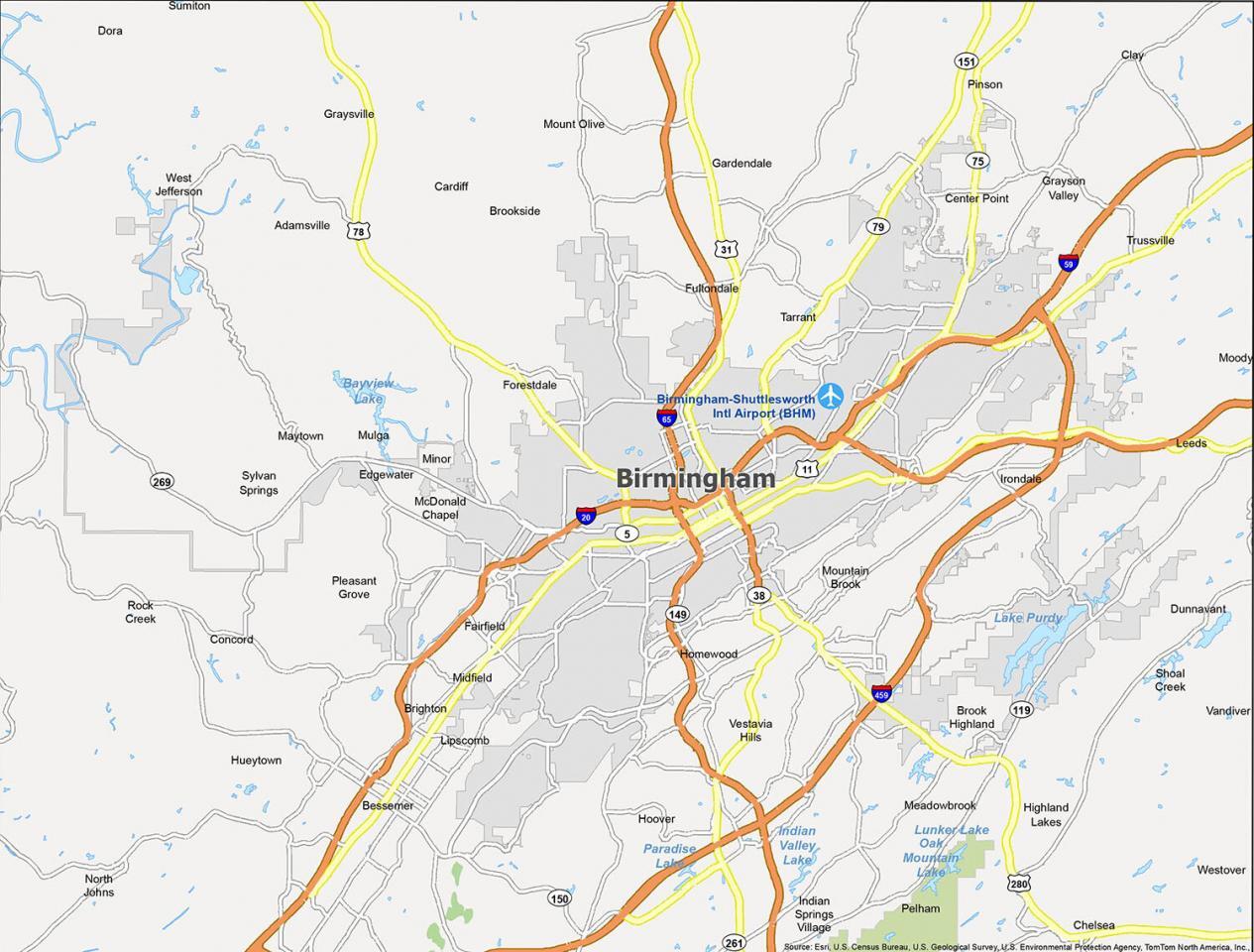
Birmingham Road Map
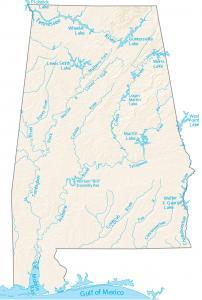
If you have never been to Birmingham Alabama, then this detailed map is perfect. If you’re traveling to this city, Birmingham, Alabama is accessible from I-20 and I-65. But if you’re looking for the big picture of the “Heart of the Dixie”, then check out this Alabama road map. You’ll get a bird’s eye statewide view of interstates, highways, and major roads.
Interstate Highways: I-20, I-59, I-65, I-459
US Highways: 11, 31, 42, 56, 75, 77, 78, 79, 93, 119, 143, 269, 280, Bankhead Hwy, Bessemer Super Hwy, Decatur Hwy, Gadsden Hwy
Parkways: Center Point Pky, Pinson Valley Pky, Roebuck Pky,
Major Roads: 1st Ave, 20th St, 24th St, 3rd Ave, 4th Ave, 5th Ave, 8th Ave, 9th St, Arkadelphia Rd, Bessemer Rd, Birmingport Rd, Cahaba Valley Rd, Carraway Blvd, Crestwood Blvd, Eastern Valley Rd, Finley Blvd, Forestdale Blvd, Montevallo Rd, Oporto Madrid Blvd, Tallapoosa St, Vanderbilt Rd
10 Things To Do in Birmingham
Birmingham has lots to see and do. With this Alabama map in hand, you will be able to easily find your way around. Enjoy some incredible cuisine and traditional southern cooking. Or, just head downtown to the historic Railroad Park.
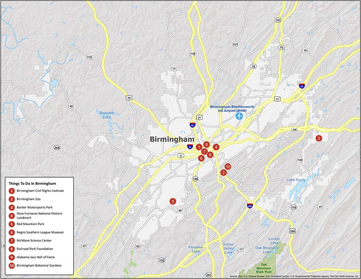
- Birmingham Civil Rights Institute
- Birmingham Zoo
- Barber Motorsports Park
- Sloss Furnaces National Historic Landmark
- Red Mountain Park
- Negro Southern League Museum
- McWane Science Center
- Railroad Park Foundation
- Alabama Jazz Hall of Fame
- Birmingham Botanical Gardens
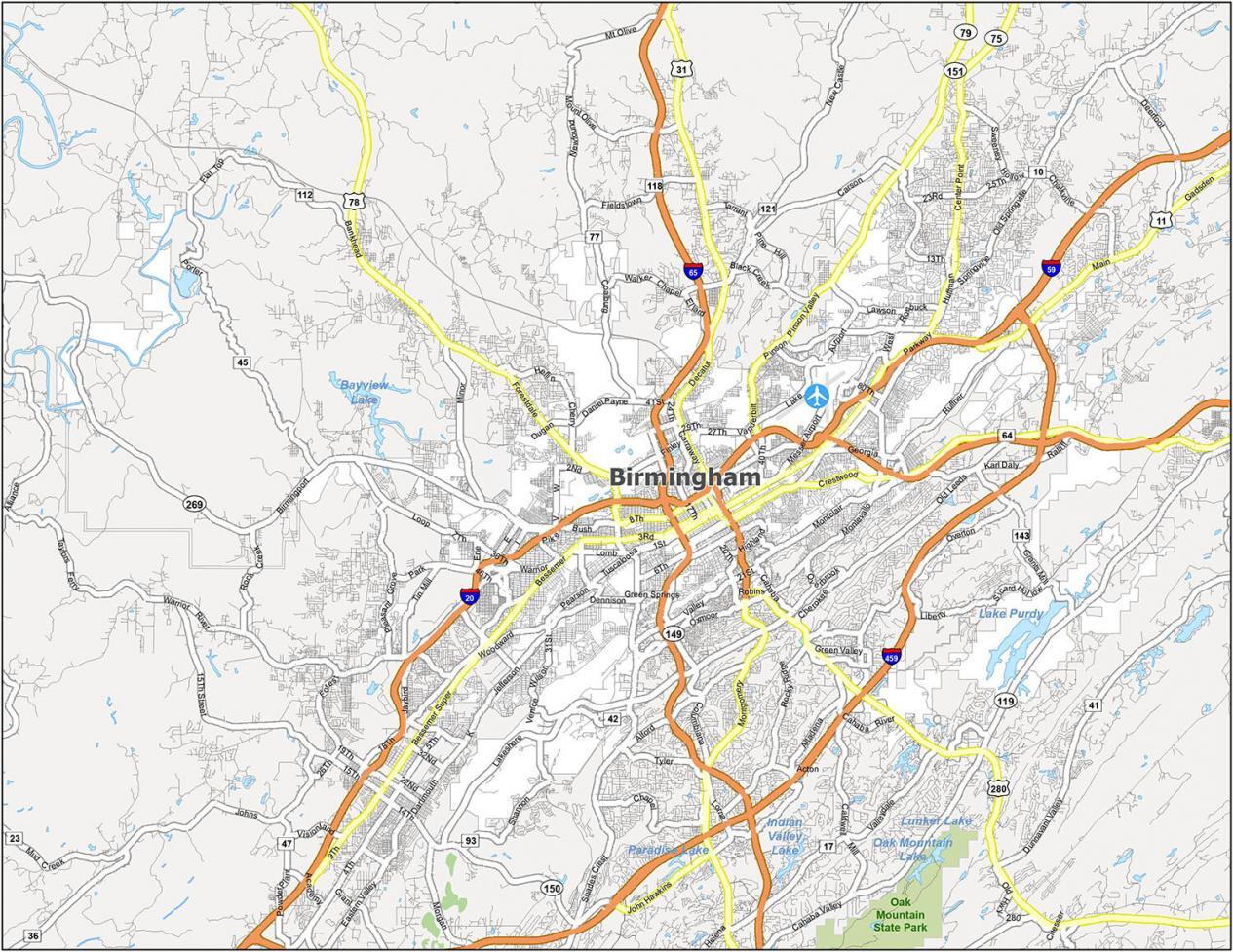
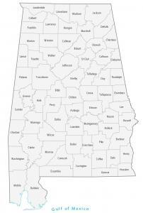
Birmingham Reference Map
Birmingham is a city with a rich history in Alabama. It was established in 1871 and was named after Birmingham, England. Today, the population is over 200,000 residents and growing. Birmingham has been a cultural hub in the south since its founding. Get to know the city with this detailed layout.
Airport: Birmingham-Shuttlesworth International Airport (BMH)
Cities: Adamsville, Bessemer, Birmingham, Brighton, Center Point, Chelsea, Clay, Dora, Fairfield, Fultondale, Gardendale, Graysville, Homewood, Hoover, Hueytown, Indian Springs Village, Irondale, Leeds, Lipscomb, Midfield, Moody, Mountain Brook, Pelham, Pinson, Pleasant Grove, Sumiton, Tarrant, Trussville, Vestavia Hills
Towns: Brookside, Cardiff, Maytown, Mulga, North Johns, Sylvan Springs, West Jefferson, Westover
Census-Designated Places (CDP): Brook Highland, Concord, Dunnavant, Edgewater, Forestdale, Grayson Valley, Highland Lakes, McDonald Chapel, Meadowbrook, Minor, Mount Olive, Rock Creek, Shoal Creek, Vandiver

Still outdated. US Interstate 22 is now complete from Birmingham to Memphis.
Huntsville is also considerably older than Birmingham but badly lacks Interstate Highways. Fortunately, the local/state roads are well-designed and maintained.
This information is dated, Huntsville Alabama is now the largest city in the State of Alabama!!! Where is information about Huntsville?
It was already listed as the SECOND largest city in Alabama. That’s correct. Huntsville is the largest city in the state.
I’ll try to create a map for Huntsville by the end of this year. We appreciate the suggestion at GISGeography.