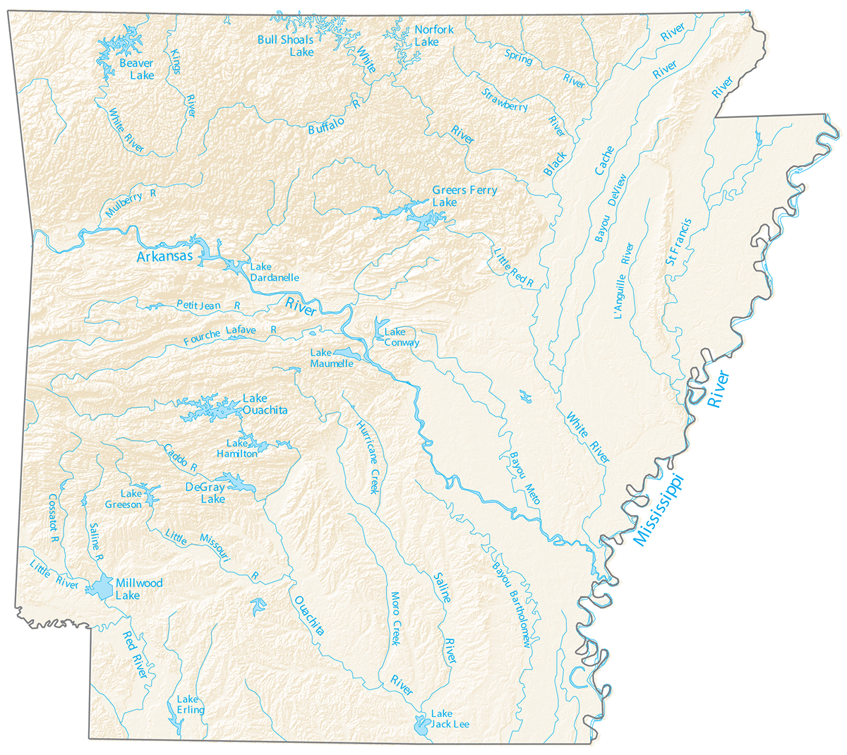
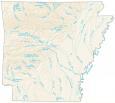
Arkansas Lakes and Rivers Map
About the map
Arkansas has over 600,000 acres of lakes and rivers. For example, the largest lakes in Arkansas are Lake Ouachita, Bull Shoals Lake, and Lake Dardanelle. An icon in Arkansas, Lake Ouachita offers 40,000 acres of clear water nestled in the Ouachita National Forest.
Rivers in Arkansas play a role in delineating boundary lines. For example, the Arkansas River cuts through the city of Little Rock, dividing it into a north and south. And it’s the Mississippi River that creates the eastern boundary for Arkansas.
In general, the rivers and streams of Arkansas flow southward. This map displays Arkansas Lakes, rivers, and creeks such as the Arkansas River.
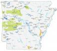
Arkansas map collection

You are free to use our lakes and rivers map of Arkansas for educational and commercial uses. Attribution is required. How to attribute?
Arkansas lakes and rivers
Arkansas Rivers
Mississippi River
Arkansas River
White River
Black River
Cache River
St. Francis River
Ouachita River
White Buffalo River
Saline River
Red River
Little Missouri River
Fourche River
Lafave River
Petit Jean River
Kings River
Spring River
Little Red River
L’Anguille River
Mulberry River
Strawberry River
Cossatot River
Caddo River
Arkansas Lakes
Bull Shoals Lake
Norfork Lake
Beaver Lake
Greers Ferry Lake
DeGray Lake
Millwood Lake
Lake Erling
Lake Greeson
Lake Hamilton
Lake Maumelle
Lake Dardanelle
Lake Jack Lee
Arkansas Creeks
Hurricane Creek
Moro Creek
Arkansas Bayous
Bayou DeView River
Bayou Bartholomew
Conway Bayou
Why isn’t Lake Columbia on this map.