13 Open Source Remote Sensing Software Packages
There is an abundance of choice for open source remote sensing software. This list of 13 free applications describes what each one brings to the table.

There is an abundance of choice for open source remote sensing software. This list of 13 free applications describes what each one brings to the table.
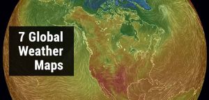
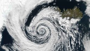
As weather is location-based, GIS can deliver weather information like no other. Rain or shine, these interactive weather maps will brighten your day

The two primary GIS certification types are the GISP and Esri Technical certification. But is it worth the time, effort and money to get a GIS certificate?

A horizontal datum provides a reference frame for latitude and longitude coordinates on the Earth. A datum is constructed through surveys and triangulation.
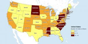
Some of the best GIS weather data available can be found at NWS, PRISM, MADIS and Weather Source. This GIS weather data dates back from past to present.

From over 50 industries, here are 1000 GIS applications to open your mind of our amazing planet, its interconnectivity with location intelligence in mind.

Python minimum and maximum values in ArcGIS can be obtained from multiple fields. This is done with min and max commands using Python and Field Calculator.

Changing NoData values to zero in arcGIS can be accomplished by using the “Con Tool”

We look at the image classification techniques in remote sensing (supervised, unsupervised & object-based) to extract features of interest.
The equal interval classification method divides attribute values into equal size range taking the data’s minimum and maximum values.