Spectral Signature Cheatsheet in Remote Sensing
Every object has its own unique composition. This is equivalent to it having its own spectral signature. Choose the spectral bands for ideal classification

Every object has its own unique composition. This is equivalent to it having its own spectral signature. Choose the spectral bands for ideal classification
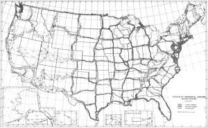
Meade’s Ranch was the focal point of the NAD27 with all positions relative to it. First-order triangulation was used with approximately 26,000 survey points
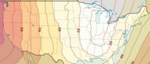
NAD27 and NAD83 may differ in tens of meters for horizontal accuracy on location. Datum transformations correct your data from one datum to another.

If you’re in search for a GIS job, we list 10 GIS career tips to instantly help you start mapping like a rockstar (and get paid to do it).

The key to finding GIS jobs is knowing where to search. Tech-saavy GIS practitioners can go beyond other graduates because of their talented skill-sets.

What are your GIS salary expectations? We give a glimpse of what to expect in a GIS career and how far you can move up the GIS job pyramid.

Viewing and analyzing data on a map impacts our understanding of data. Geographic Information Systems (GIS) helps us understand what belongs where.

This list is a collaborative effort of the most valuable Esri ArcMap tips and tricks. Follow these golden rules and you will save time and improve workflow.
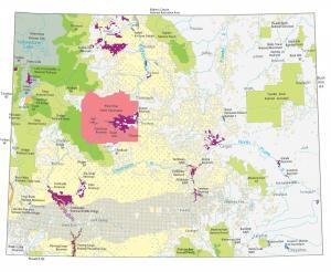
A Wyoming State Map showing major landmarks, populated places, national forests, military bases, parks, wildlife refuges and other federal lands in Wyoming.
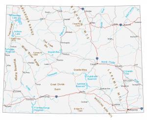
This Wyoming map contains cities, roads, rivers and lakes. Casper, Laramie and Cheyenne are some of the major cities in this map of Wyoming.