Baltimore Map, Maryland

Map of Baltimore
When you think of Baltimore, the first thing that probably comes to mind is its harbors and seaports… (the backdrop for the popular TV show House of Cards). Coupled with its friendly people living there, this is probably why it’s nicknamed the “charm city”.
Baltimore is the most populous city in Maryland with close to 600,000 people. Besides its inner harbor, history lovers can explore Annapolis and Baltimore County. Other highlights are Oriole Park at Camden Yards stadium, Highlandtown, and Fells Point.
Use our Baltimore map before you head out to explore the city. We show major routes/highways, landmarks, and things to do. Don’t forget to have some crab cakes and other seafood when you’re there.
Jump To: Interactive Map | Printable Road Map | 10 Things to Do | Reference Map
Baltimore map collection
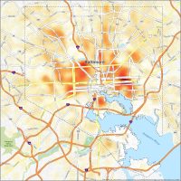
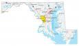
Interactive Map of Baltimore
This interactive map helps you plan your visit to Baltimore. It has details about attractions, things to do, transportation, and more. You can zoom, pan, and explore all its neighborhoods, landmarks, and businesses. It’s not only for sightseeing. But you can also view Baltimore’s scenery like the Piedmont Plateau and the Atlantic coast.
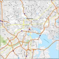
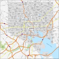
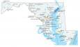
Baltimore Road Map
It’s easy to get lost in a big city like Baltimore. So that’s why we suggest that you print this map of Baltimore to help navigate around. Baltimore is rich in history. So, this map is a great starting point for getting around the city. But if you’re going to travel out of state, give try out this Maryland road map for a road trip.
Interstate Highways: I-95, I-70, I-83, I-395, I-695, I-895
US Highways: 1, 2, 25, 26, 40, 41, 45, 129, 134, 139, 140, 144, 147, 150, 151, 173, 295, 372, 395, 542, 648, Pulaski Hwy
Parkways: Perring Pky, University Pky
Major Roads: 29th St, 31st St, 33rd St, Annapolis Rd, Baltimore National Pike, Baltimore St, Bellona Ave, Broadway, Curtis Ave, Druid Hill Ave, Eastern Ave, Falls Rd, Falls Road Ter, Fayette St, Forrest St, Fulton Ave, Greene St, Hanover St, Harford Ave, Hillen Rd, Hilton St, Lafayette Ave, Lanvale St, Lee St, Liberty Heights Ave, Loch Raven Blvd, Lombard St, Martin Luther King Jr Blvd, Maryland Ave, Monument St, Moravia Rd, Orleans St, Pennington Ave, Pennsylvania Ave, President St, Reisterstown Rd, Russell St, Southwestern Blvd, Swann Dr, The Alameda, Washington Blvd, York Rd
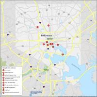
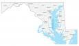
10 Things To Do in Baltimore
Baltimore, Maryland is a large city with lots to do. Inner Harbor, Oriole Park at Camden Yards, and Fort McHenry top the list. Our Baltimore Maryland map is an easy way for you to keep yourself up-to-date.
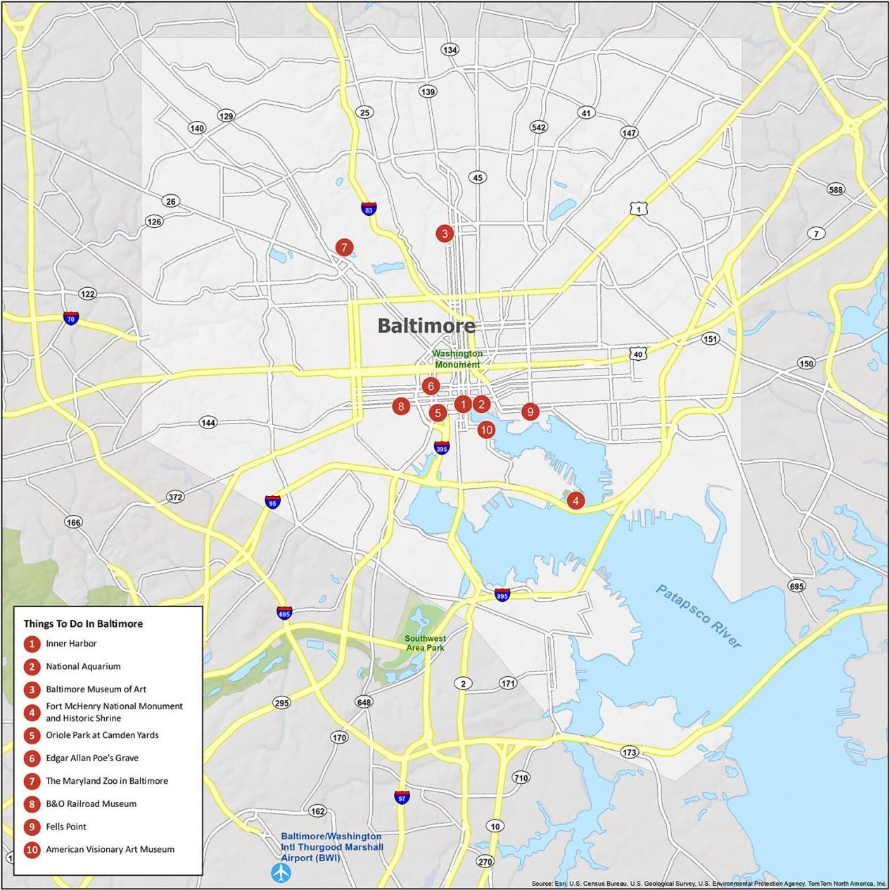
- Inner Harbor
- National Aquarium
- Baltimore Museum of Art
- Fort McHenry National Monument and Historic Shrine
- Oriole Park at Camden Yards
- Edgar Allan Poe’s Grave
- The Maryland Zoo in Baltimore
- B&O Railroad Museum
- Fells Point
- American Visionary Art Museum
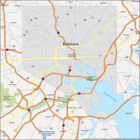
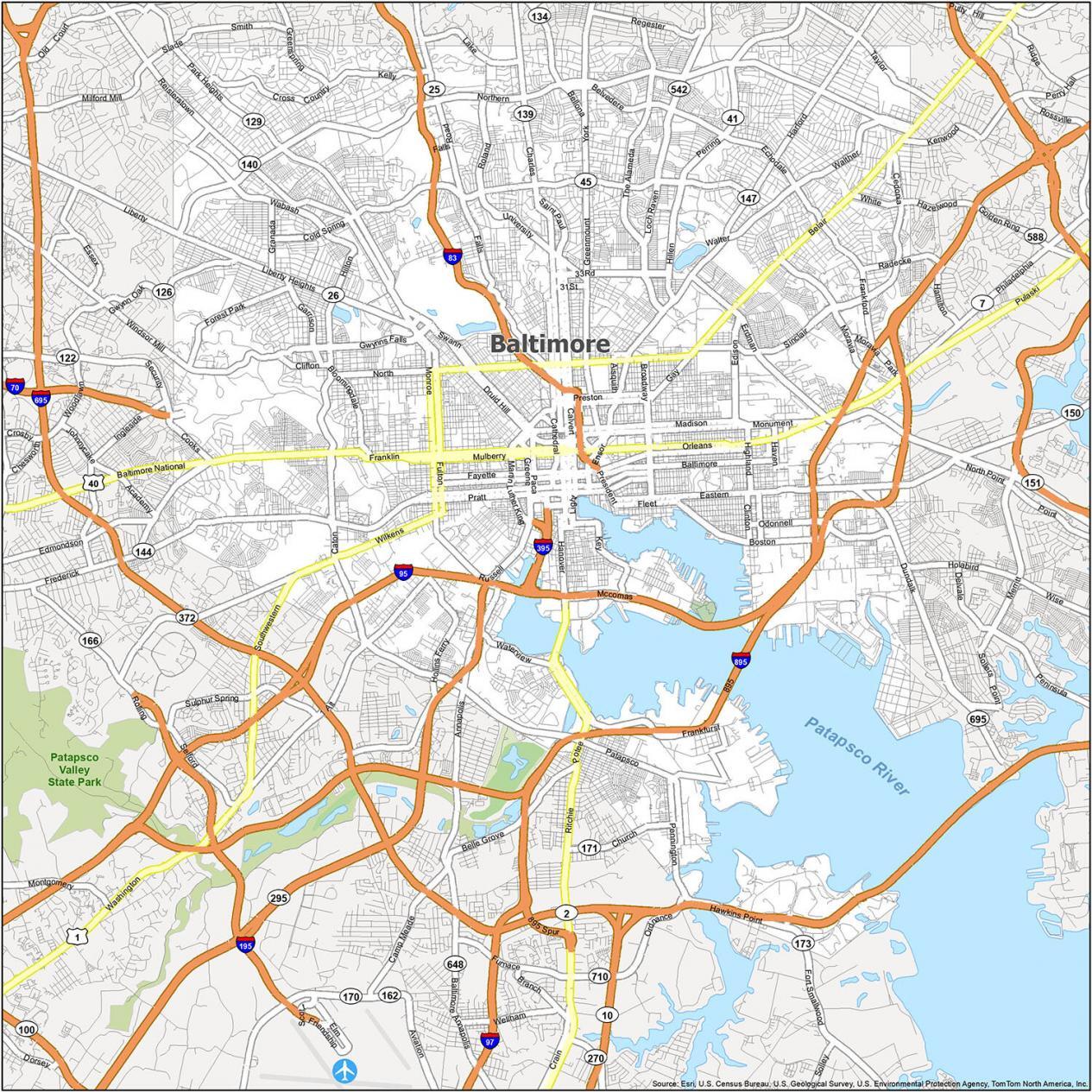
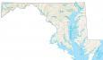
Baltimore Reference Map and Surrounding Area
As I mentioned already, Baltimore is a city that’s rich in history and culture. Its identity comes from its special foods, neighborhoods, and the people who call it home. Each neighborhood has its own unique characteristics. Each has molded Baltimore into what it is today. If you want to see the different neighborhoods, this map is the perfect way to explore the city.

Airport: Baltimore/Washington International Thurgood Marshall Airport (BWI)
Cities: Baltimore
Census-Designated Places (CDP): Arbutus, Baltimore Highlands, Brooklyn Park, Catonsville, Dundalk, Edgemere, Elkridge, Essex, Ferndale, Glen Burnie, Ilchester, Lansdowne, Linthicum, Lochearn, Middle River, Milford Mill, Overlea, Parkville, Pasadena, Perry Hall, Pikesville, Randallstown, Riviera Beach, Rosedale, Rossville, Towson, White Marsh, Woodlawn
You left off Gwynns Falls Parkway from the Parkway list.
You left off Northern Parkway off the list of Parkways. Just FYI 😊