Map of Baton Rouge, Louisiana
Map of Baton Rouge
If you ever plan to go to Baton Rouge, use our collection of maps for the capital city of Louisiana. This includes a road map, 10 things to do, and a general reference map. We also have an interactive map of Baton Rouge to learn more about this intriguing city.
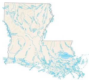
French for “Red Stick”, Baton Rouge is actually named for a red stick! The city of Baton Rouge was founded more than 300 years ago, when explorers found a stick stained with the blood of fish and animals.
With a population of over 225,000 and an area of 230 square kilometers, it is located in southeastern Louisiana along the Mississippi River. This city is known for its French roots that go back hundreds of years.
Jump To: Interactive Map | Printable Road Map | 10 Things to Do | Reference Map
Baton Rouge map collection
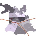
Interactive Map of Baton Rouge
In this zoomable and scrollable map, you can explore the city of Baton Rouge and discover the best places to visit. The map depicts the Greater Baton Rouge area. It also contains major highways, airports, shopping centers, restaurants, hospitals, and much more.
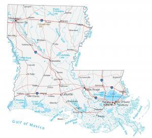
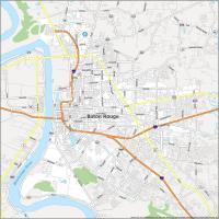
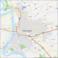
Baton Rouge Road Map
Get a quick overview of Baton Rouge. On the eastern bank of the Mississippi River, this city straddles I-110 and I-12. These interstates connect across the river. This map is perfect for anyone who needs to know where they are or to find a new place to explore. And if you plan on exploring beyond Baton Rouge, make sure to take a look at our Louisiana map for statewide highways and roads.
Interstate Highways: I-10, I-12, I-110
US Highways: 19, 30, 37, 61, 67, 73, 190, 327, 408, 423, 427, 991, 1068, 3064, Airline Hwy, Scenic Hwy
Major Roads: 3rd St, Acadian Thwy, Chippewa St, Drusilla Ln, Essen Ln, Florida Blvd, Florida St, Foster Dr, Government St, Greenwell Springs Rd, Harding Blvd, Hooper Rd, Jefferson Hwy, Joor Rd, Nicholson Dr, Park Blvd, Perkins Rd, Plank Rd, River Rd, Riverside St, Saint Louis St, Scotland Ave, South Blvd, Terrace Ave, Thomas Rd, Veterans Memorial Blvd
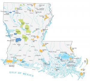
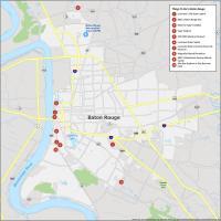
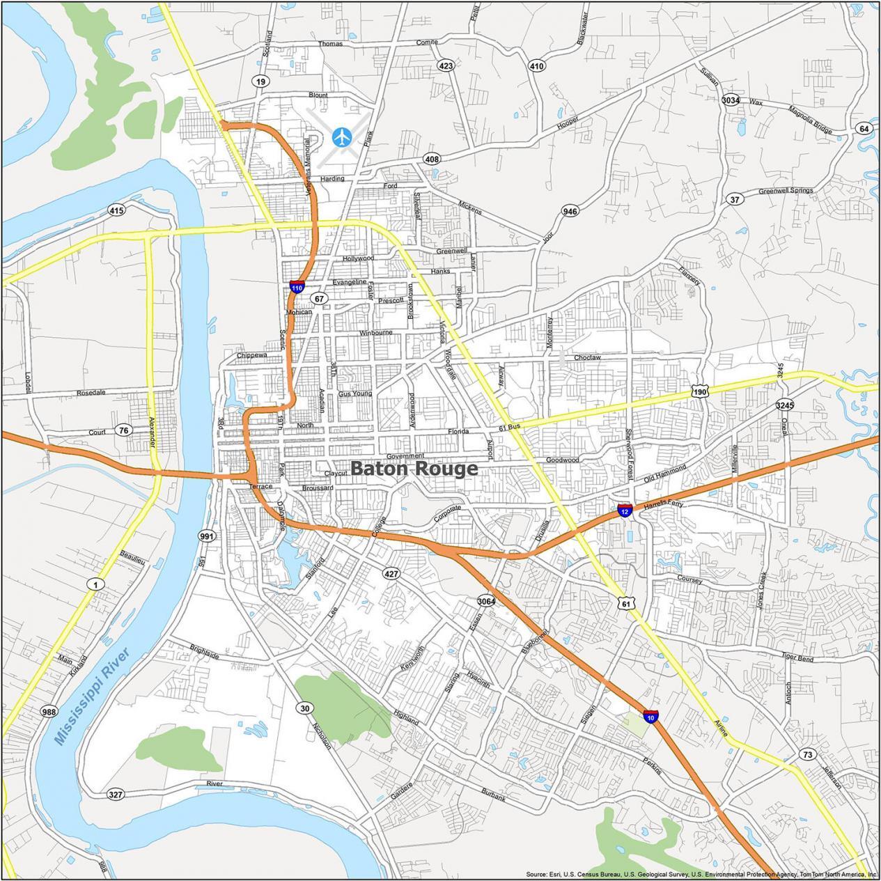
10 Things To Do in Baton Rouge
Baton Rouge has museums, food and drink, shopping, nightlife, and more. With cultural festivals throughout the year, people flock to this city year-round. Explore all of the interesting places in Baton Rouge with this landmarks map. Or take a look at our Louisiana landmarks map for much more travel information.
- Louisiana’s Old State Capitol
- BREC’s Baton Rouge Zoo
- Mike the Tiger’s Habitat
- Tiger Stadium
- USS KIDD Veterans Museum
- Louisiana State Capitol
- Louisiana State University Rural Life Museum
- Magnolia Mound Plantation
- BREC’s Bluebonnet Swamp Nature Center
- Alex Box Stadium at Skip Bertman Field
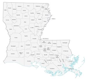
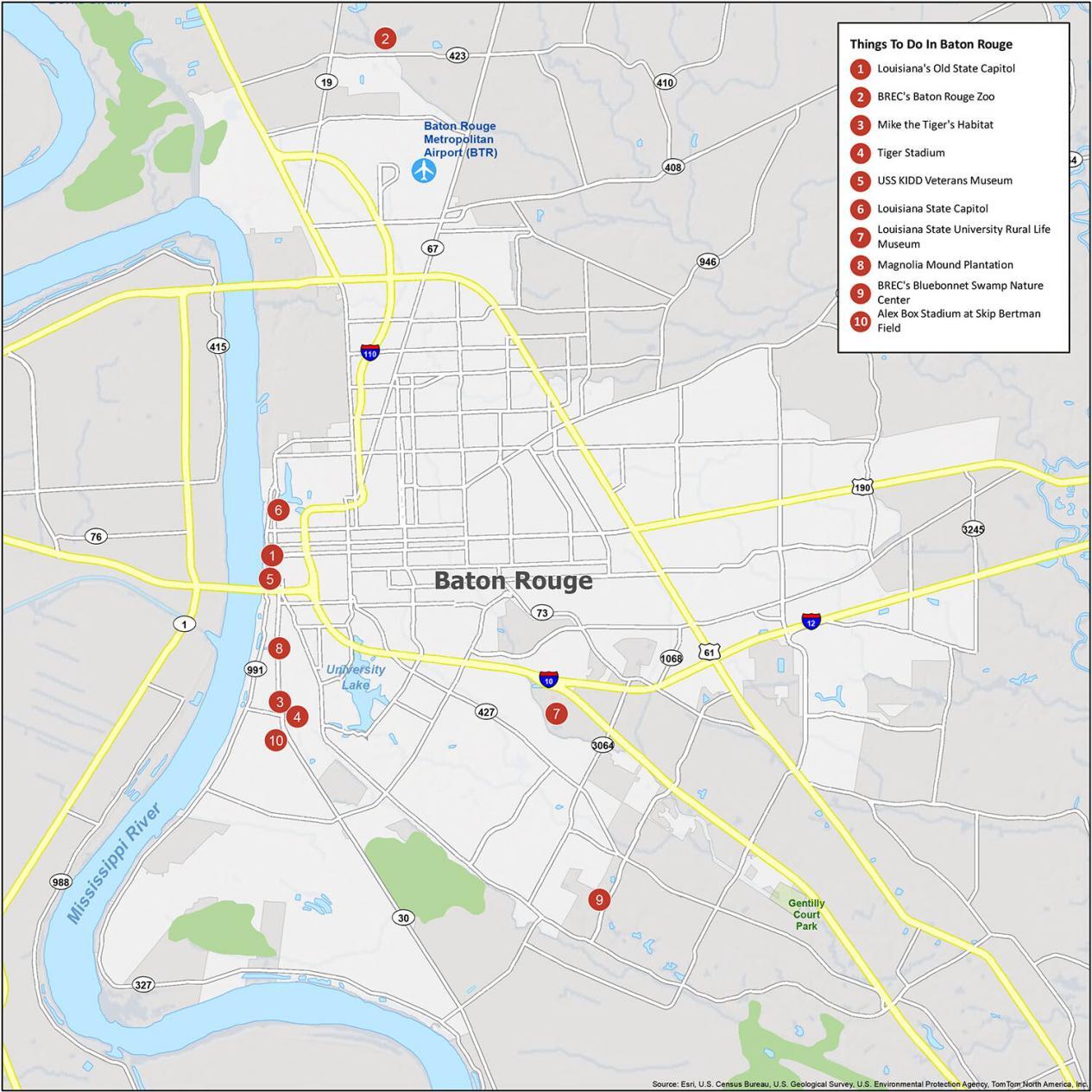
Baton Rouge Reference Map
Baton Rouge is home to many expansive neighborhoods. For example, Highland Road and Old North Baton Rouge are known for their large community gardens. As the second-largest metropolitan area in Louisiana (after New Orleans), this map gives you a sense of how the city is laid out. Gain a better understanding of the geography of Baton Rouge. Then, take your pick of the city’s most popular destinations for your itinerary.
Airport: Baton Rouge Metropolitan Airport (BTR)
Cities: Baker, Baton Rouge, Central, Denham Springs, Port Allen
Towns: Addis, Brusly
Census-Designated Places (CDP): Brownfields, Gardere, Inniswold, Merrydale, Monticello, Oak Hills Place, Old Jefferson, Prairieville, Shenandoah, Village St. George, Westminster