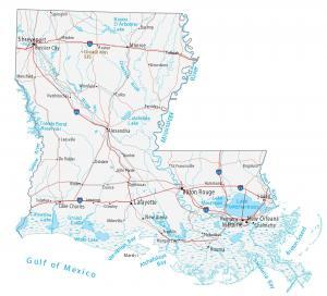
Map of Louisiana – Cities and Roads

About the map
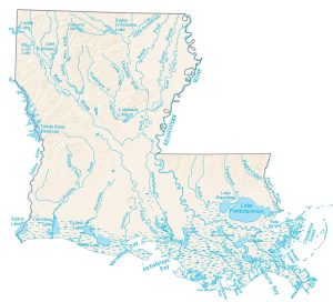
This Louisiana map displays cities, roads, rivers, and lakes. For example, New Orleans, Baton Rouge, and Shreveport are major cities shown in this map of Louisiana.
The “Pelican State” is known for bayou, fish and crabs, reptiles, and swamp creatures. Louisiana boasts a diverse landscape, from its southern swamps to its northern forests.
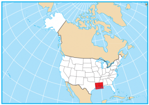
Louisiana has concentrated francophone communities that speak French. The largest city in Louisiana is New Orleans with its world-renowned Mardi Gras festival. But the capital city is Baton Rouge. Louisiana borders only 3 other states including Texas, Arkansas, and Mississippi.
Louisiana map collection

You are free to use our map of Louisiana for educational and commercial uses. Attribution is required. How to attribute?
State capital
Baton Rouge
Major cities and towns
New Orleans
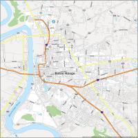
Baton Rouge
Shreveport
Metairie
Lafayette
Alexandria
Bossier City
Houma
Kenner
Lake Charles
Monroe
New Iberia
Slidell
Chalmette
Abbeville
Bastrop
Bogalusa
Bunkie
Crowley
De Ridder
Eunice
Ferriday
Franklin
Hammond
Jennings
Kinder
Leesville
Mansfield
Minden
Morgan City
Natchitoches
Oakdale
Opelousas
Ruston
Sulphur
Tallulah
Thibodaux
Tullos
Ville Platte
Winnfield
Springhill
Winnsboro
St Francisville
Interstate highways
Interstate-10 (I-10)
Interstate-12 (I-12)
Interstate-20 (I-20)
Interstate-49 (I-49)
Interstate-55 (I-55)
Lakes, rivers and bays
Mississippi River
Red River
Ouachita River
Pearl River
Sabine Lake
Toledo Bend Reservoir
Lake Pontchartrain
Calcasieu Lake
Grand Lake
White Lake
Lake D’Arbonne
Catahoula Lake
Lake Maurepas
Breton Sound
Atchafalaya Bay
Vermilion Bay
Barataria Bay
Landmarks in Louisiana
Driskill Mountains
Starting a “Main Street” project in Jonesville LA. is there a way to get a map of this town with all the streets labeled but none of the extraneous stuff automatically included on google maps. We want to create our own labels as we go.
We plan on adding many more maps to our collection as we’ve had requests. We will consider this suggestion. But we don’t use Google Maps as our source of data and streets are from the US Census.
“The “Pelican State” is known for bayou, fish and craps, reptiles, and swamp creatures. ”
The Pelican State is known for its fish and craps? Is that supposed to be crabs? Crops maybe? Surely not craps. I’m thinking it’s crabs.
Haha. I can’t believe this has been unnoticed for years. I’ve fixed the error and very much appreciated!