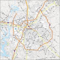
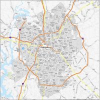
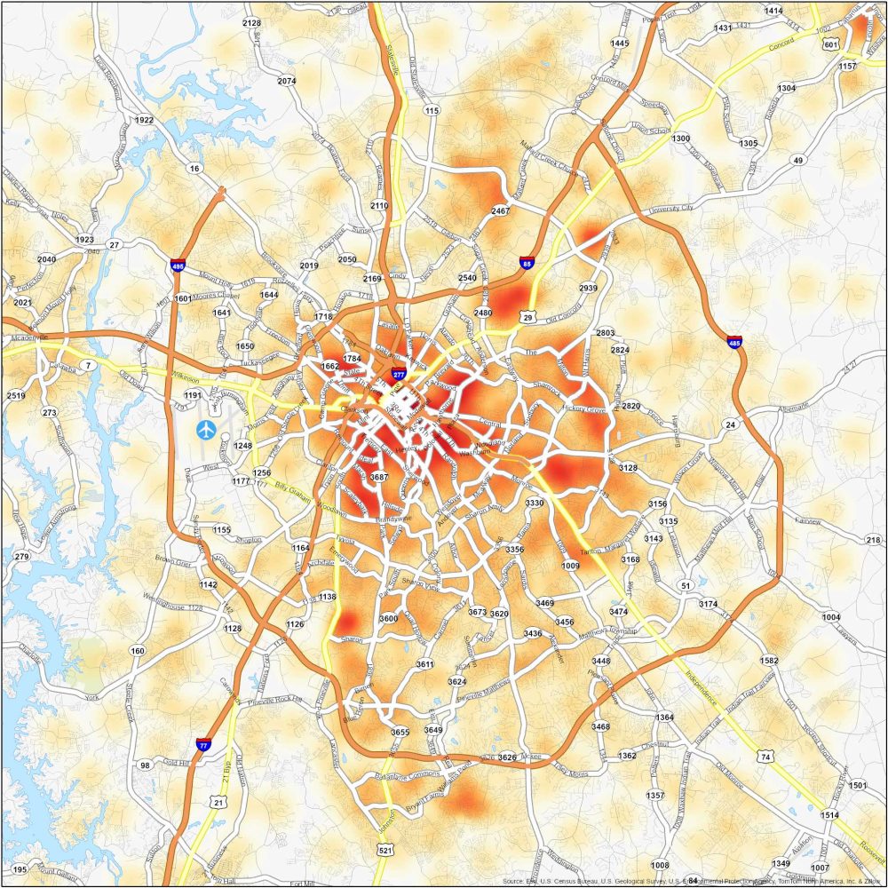
Charlotte Crime Map
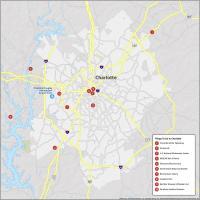
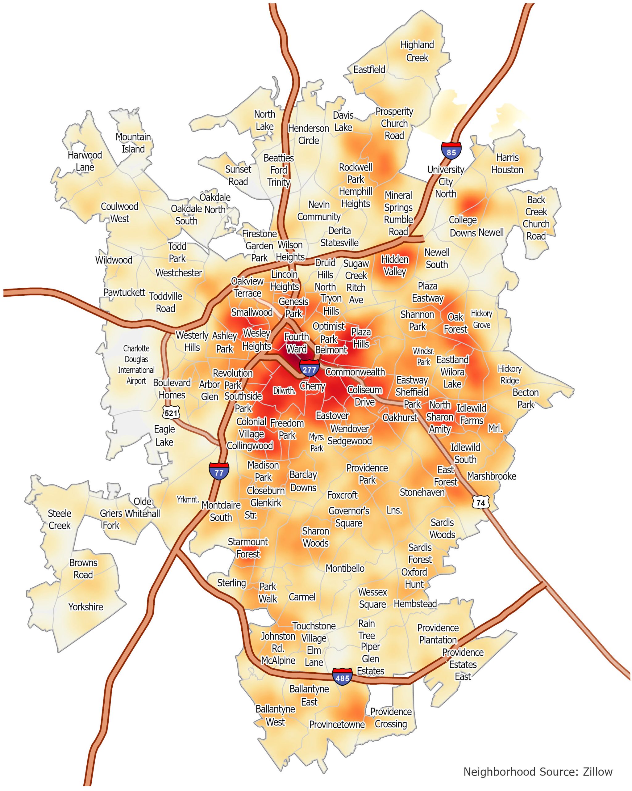
Charlotte Crime Map Neighborhoods
For Charlotte, you’ll see that crime is concentrated in the city’s central area. But there are also pockets of crime in other neighborhoods. Here are some of the most dangerous neighborhoods in Charlotte, North Carolina.
| Neighborhood | Description | Types of Crimes |
|---|---|---|
| West Charlotte | West of Uptown. A mix of residential and commercial | High drug-related crimes. But has seen a downtick in crimes. |
| Hidden Valley | North Charlotte near University City | Thefts, burglaries, and assaults especially near Sugar Creek at I-85. |
| Beatties Ford/Trinity | Northwest Charlotte including the historic district | Higher crime rate than the national average. Includes more property crimes and occasional violent incidents. |
Hidden Valley, Beatties Ford Road, and parts of the West Boulevard corridor have higher rates of crime compared to others.
Charlotte Crime Map
Click on the image to see our original Charlotte Crime Map with major interstate highways and neighborhoods.