Dallas Crime Map
Dangerous Neighborhoods in Dallas
Howdy and welcome to our Dallas crime map. This is your trusty guide for keeping an eye on the crime scene in the Big D.
| Neighborhood | Location | Types of Crimes |
|---|---|---|
| South Dallas | South of Downtown, near Fair Park | Violent crimes and property crimes. |
| Oak Cliff | Southwest of Downtown and a diverse residential area | Incidents of thefts, burglaries, and some violence. |
| Pleasant Grove | Southeast Dallas, largely residential | Assaults, robberies, and property crimes. |
| West Dallas | West of Downtown. Area includes industrial and residential areas | Higher incidence of property crimes and occasional violent incidents. |
| Deep Ellum | East of Downtown, known for nightlife | Frequent incidents of thefts, vandalism, and assaults. |
| Northwest Dallas | Northwest of Downtown, includes Love Field area | Property crimes and occasional violent incidents. |
| Greenland Hills | East Dallas, known as “M Streets” (colloquial term) | Lower crime rates but occasional property crimes and thefts. |
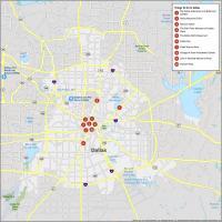
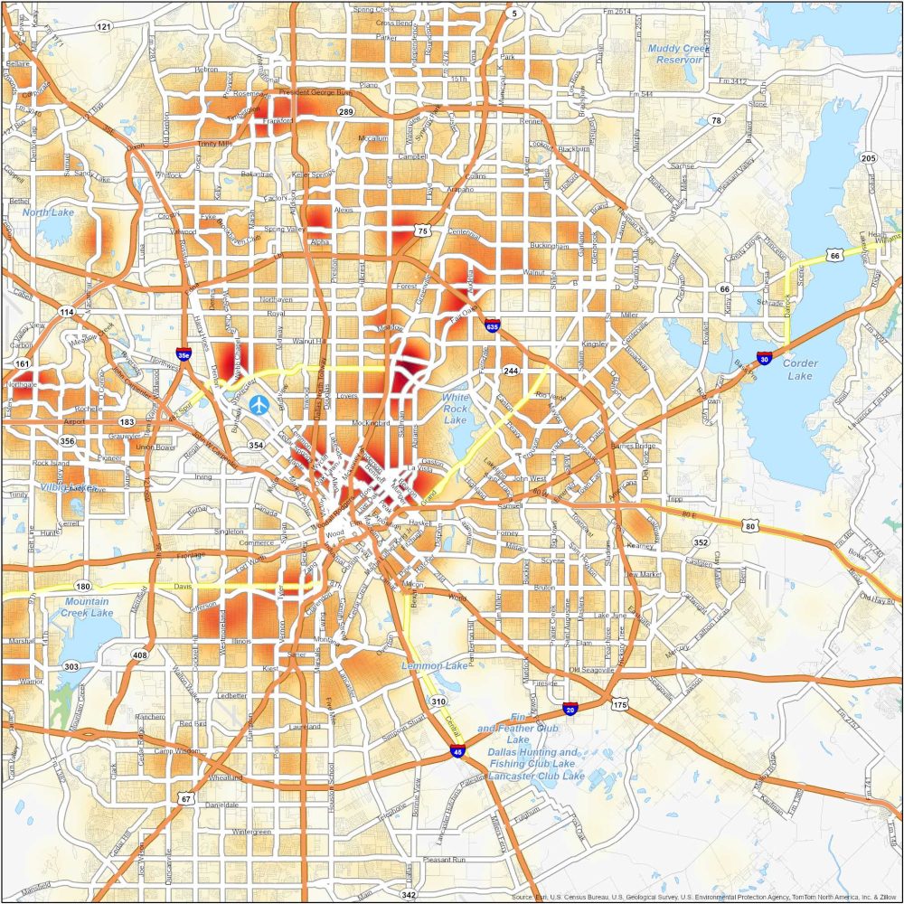
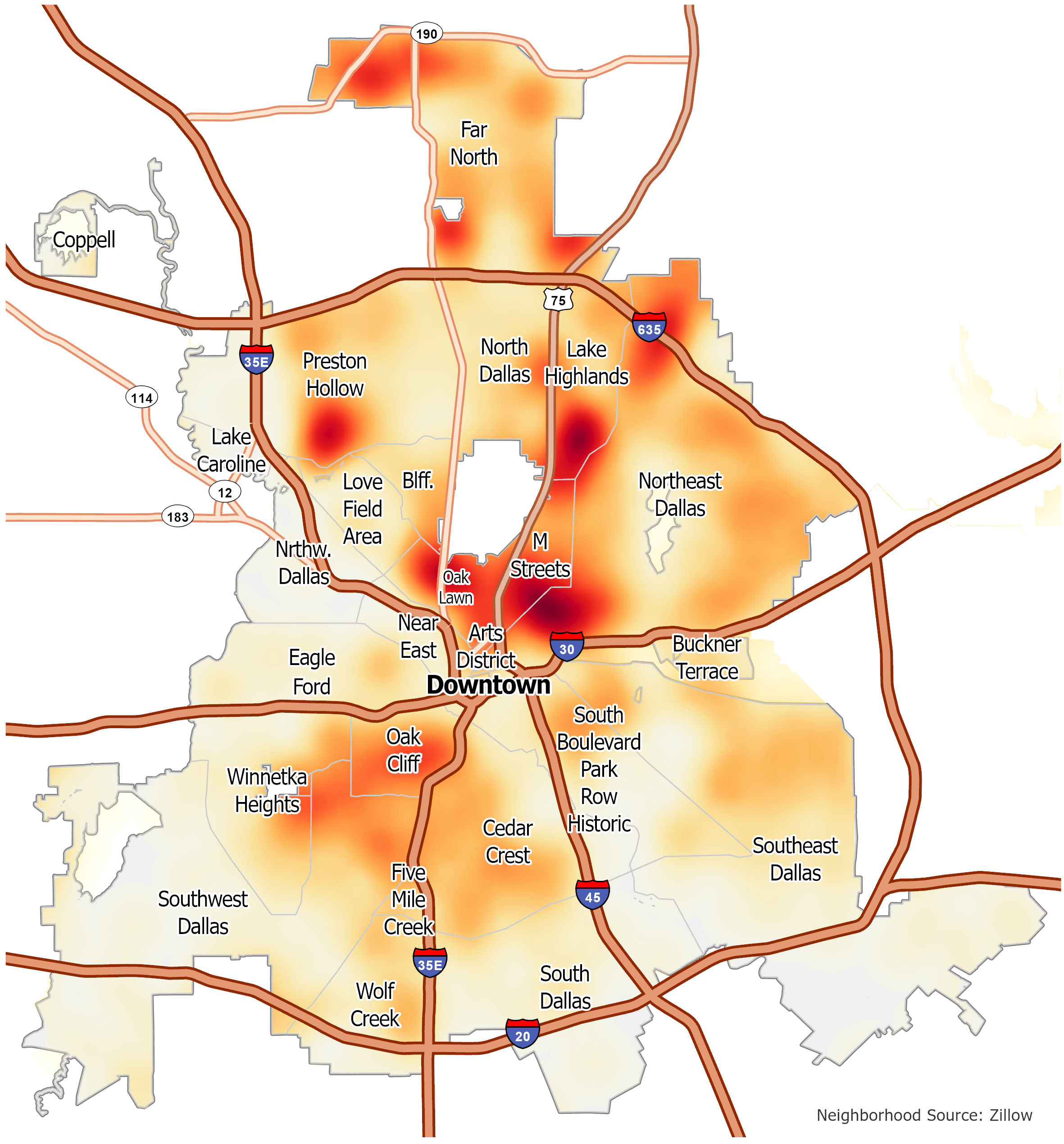
Downtown Dallas Crime Map
Are you looking to get a glimpse of crime in the downtown area of Dallas? Check out the map below to learn about safety in areas like the Arts District and Oak Cliff.
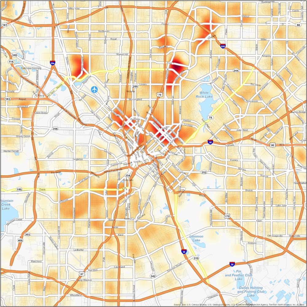
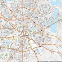
Dallas Crime Map
Click on the image to see our original crime map of Dallas with interstate highways and neighborhoods.