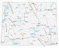
Grand Teton National Park Map
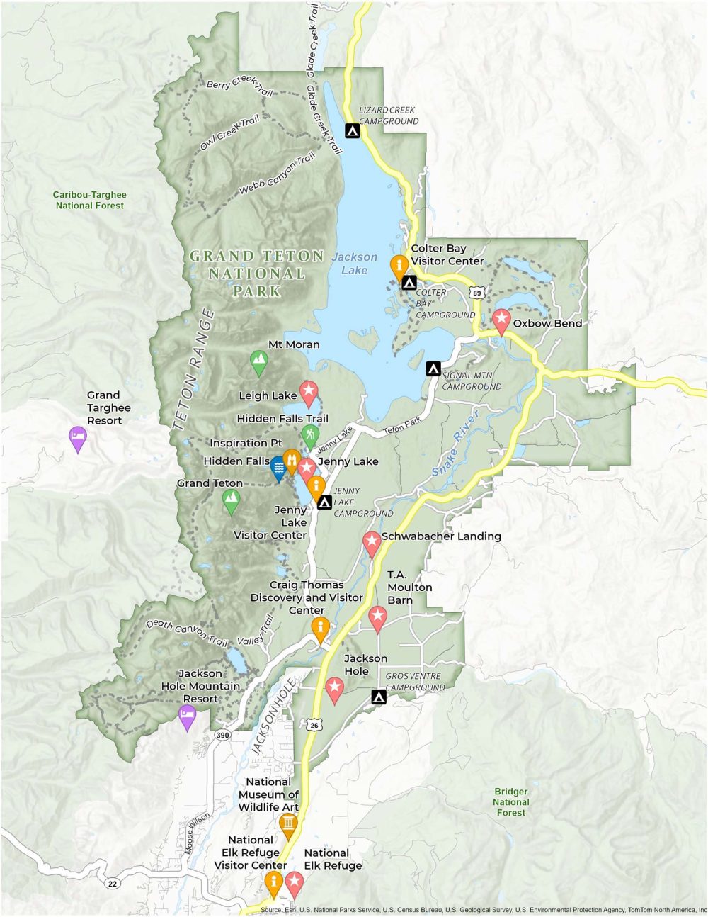
About the map
Embrace the adventure that awaits in the heart of the Teton Range with our map of Grand Teton National Park. This map is your key to exploring its jagged mountain peaks, serene valleys, and abundant wildlife.
Plan your visit to Wyoming’s natural treasure using this Grand Teton National Park map. Navigate over 200 miles of trails, stunning lakes, and iconic viewpoints.
Key attractions on this map include Jackson Hole, the Jenny Lake area, and Schwabacher Landing. Find your path and experience the grandeur of the Tetons on your journey.
You are free to use our Grand Teton National Park map for educational and commercial uses. Attribution is required. How to attribute?
Top Things to Do
- Grand Teton: The highest peak in the Teton Range, Grand Teton stands at 13,775 feet.
- Jenny Lake: A crystal-clear lake known for its scenic boat rides, hiking trails, and the nearby Jenny Lake Visitor Center.
- Jackson Hole: A renowned valley with wildlife viewing and skiing opportunities.
- National Elk Refuge: Located just outside the park, visitors can witness herds in their natural habitat, alongside bison and wolves.
- Inspiration Point: A popular hiking destination with panoramic views of Jenny Lake.
- Schwabacher Landing: A serene spot along the Snake River. Photographers take photos of its reflection of the Teton Range.
- Leigh Lake: Leigh Lake is ideal for canoeing and kayaking, with spectacular views of Mount Moran.
- Oxbow Bend: This bend in the Snake River is famed for birdwatching and the picturesque Mount Moran.
- Mount Moran: A distinctive, rugged peak known for its geological features like the Black Dike and Skillet Glacier.
- T.A. Moulton Barn: Part of the historic Mormon Row, this iconic barn is a symbol of the rich history of settlement in the area.
Discovery and Visitor Centers
Craig Thomas Discovery and Visitor Center
Jenny Lake Visitor Center
Colter Bay Visitor Center
Flagg Ranch Information Station
National Elk Refuge & Greater Yellowstone Visitor Center
Campgrounds
Jenny Lake Campground
Signal Mountain Campground
Gros Ventre Campground
Colter Bay Campground
Lizard Creek Campground
Trails
Hidden Falls Trail
Death Canyon Trail
Valley Trail
Webb Canyon Trail
Owl Creek Trail
Berry Creek Trail
Glade Creek Trail
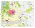
Landforms/Physical Regions
Caribou Targhee National Forest
Teton Range
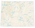
Jackson Lake
Snake River
Bridger National Forest
Jackson Hole
Highways and Major Roads
US Highway 26
Highway 89
Teton Park Road
Jenny Lake Road
Moose-Wilson Road (WYO 390)
Other Landmarks
National Museum of Wildlife Art
Jackson Hole Mountain Resort
Grand Targhee Resort
References
- Grand Teton National Park (National Park Service)
- USGS Grand Teton National Park Map
- Topographic Maps of Grand Teton NP (USGS)