Kazakhstan Map and Satellite Image
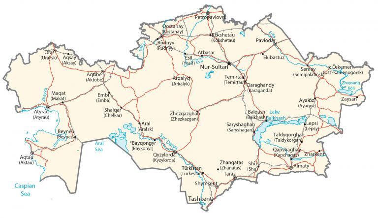
This map of Kazakhstan features its major cities, towns, roads, lakes, and rivers. Satellite imagery and an elevation map reveal its mountains, depressions, deserts, and grasslands.
Kazakhstan map collection
You are free to use our Kazakhstan map for educational and commercial uses. Attribution is required. How to attribute?
About the map
Kazakhstan occupies an area of 2,724,900 square kilometers (1,052,100 sq mi), which makes it the 9th largest country in the world. One of the major geographic features in Kazakhstan is the Kazakh Steppe (Great Dala).
This vast swath of open grassland lies in the northern region covering 800,000 square kilometers. Another prominent feature is the Betpaqdala Desert, which is a mostly flat desert in eastern Kazakhstan.
Forests cover anywhere from 1 to 5% of Kazakhstan and are one of the least forested countries in terms of area. While the Irtysh River is the longest river, the Caspian Sea is its largest lake.
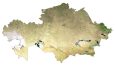
SATELLITE IMAGERY
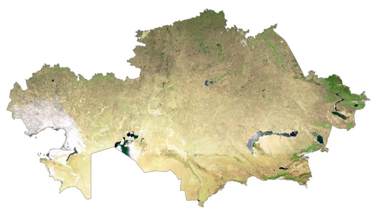
Kazakhstan Satellite Map
Kazakhstan occupies an area of 2,724,900 square kilometers (1,052,100 sq mi), which makes it the 9th largest country in the world. One of the major geographic features in Kazakhstan is the Kazakh Steppe (Great Dala).
This vast swath of open grassland lies in the northern region covering 800,000 square kilometers. Another prominent feature is the Betpaqdala Desert, which is a mostly flat desert in eastern Kazakhstan. Forests cover anywhere from 1 to 5% of Kazakhstan and is one of the least forested countries in terms of area. While the Irtysh River is the longest river, the Caspian Sea is its largest lake.
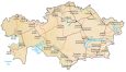
PHYSICAL MAP
Kazakhstan Physical Map
The country of Kazakhstan is mostly composed of dry, grassy steppe in the west. Then, it transitions to the Altai Mountains in the east and deserts and Kazakh Upland in the central area. Both the Caspian Depression and Ustyurt Plateau lie in the west.
Whereas the eastern region is dominated by the Alataw and Tarbagatay Ranges. At 7,010 meters (23,000 ft), Khan Tengri is the highest point in Kazakhstan. Whereas the lowest point is Vpadina Kaundy at 132 meters below sea level.
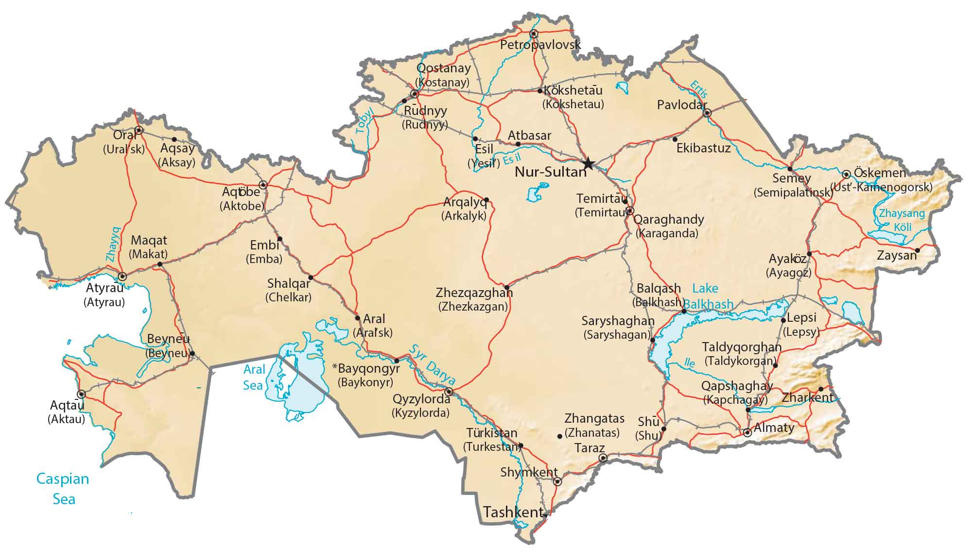
Capital City
Nur-Sultan (Astana)
Major cities and towns
Aktau
Aktobe
Almaty
Atyrau
Karaganda
Kyzylorda
Semey
Shymkent
Taraz
Cities, towns and villages
Aksay
Arkalyk
Ayagoz
Balkhash
Baykonyr
Beyneu
Ekibastuz
Embi
Kapchagay
Kokshetau
Kostanay
Lepsy
Makat
Petropavlovsk
Rudnyy
Saryshagan
Taldykorgan
Temirtau
Turkestan
Uralsk
Ust-Kamenogorsk
Zharkent
Zhezkazgan
Lakes, rivers and creeks
Aral Sea
Caspian Sea
Ertis River
Esil River
Syr Darya River
Lake Balkhash
Lake Zaysan
Tobyl River
Zhayyq River