Turkmenistan Map
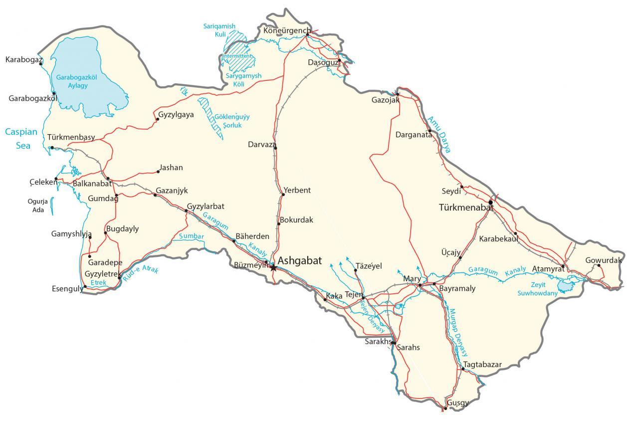
This Turkmenistan reference map displays major cities, towns, roads, lakes, and rivers. It includes a physical map, satellite imagery, and a provincial map of Turkmenistan.
Turkmenistan map collection
You are free to use our Turkmenistan map for educational and commercial uses. Attribution is required. How to attribute?
About the map
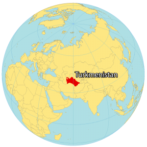
Turkmenistan is located in Central Asia, next to the Caspian Sea which is the world’s largest inland body of water. It borders Kazakhstan to the north, Uzbekistan to the northeast, Afghanistan to the southeast, and Iran to the southwest. Its coastline along the Caspian Sea measures 1,768 kilometers (1,100 mi) in length.
It’s known for its gas reserves, underdevelopment, carpets, and horses. Additionally, it’s recognized as the “crossroads of civilizations” because the historic Silk Road runs through Turkmenistan. Ashgabat is the capital and largest city. Other major cities are Türkmenabat, Daşoguz, and Mary.
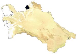
SATELLITE IMAGERY
Turkmenistan Satellite Map
Turkmenistan is mostly flat sandy dunes and deserts. The country occupies an area of 488,100 square kilometers (188,500 sq mi) and is the second-largest country in Central Asia. In comparison, it’s larger than the state of California but smaller than Afghanistan.
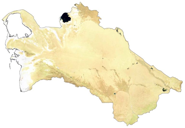
It lies between 35°N and 42.5°N latitude so the climate has mostly cold desert and semi-desert conditions. Turkmenistan’s largest natural inland lake is Lake Sarygamysh with high levels of salinity. Whereas its longest and most important river is the Amu Darya with a total length of 2,540 kilometers (1,580 mi).
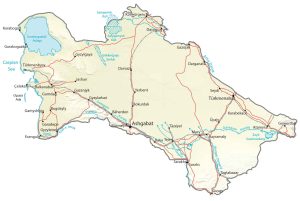
PHYSICAL MAP
Turkmenistan Physical Map
The majority of Turkmenistan is the Karakum Desert in the western and central low-lying region of the country. The remaining area is mostly plateau in the eastern section of Turkmenistan.
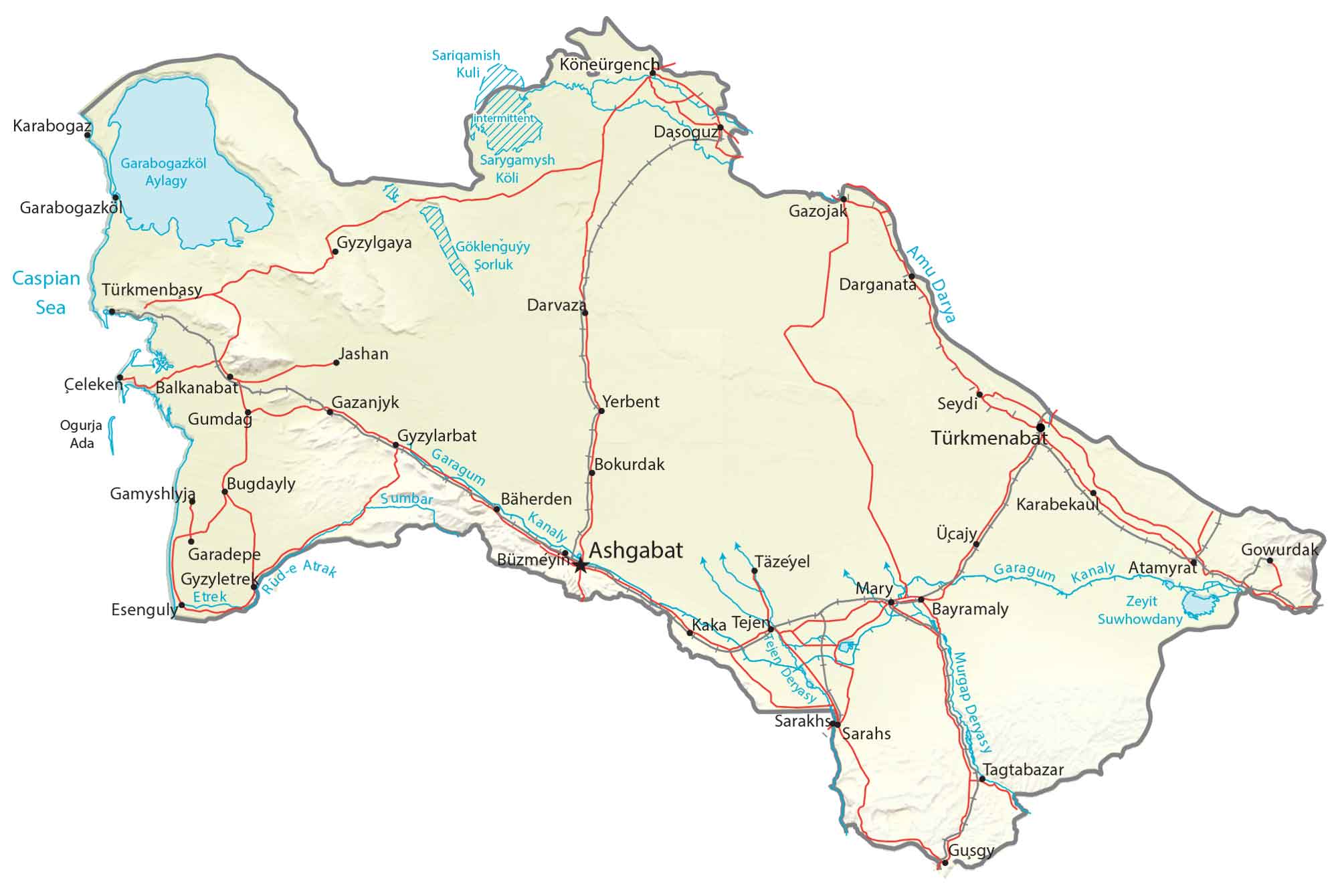
There are mountains in the south (Turkmen-Khorasan Mountain Range), along its border with Iran. But its highest peak is Gora Ayrybaba along its border with Uzbekistan, standing 3,138 meters (10,295 ft) high. This peak is part of the Köýtendag Range and Pamir-Alay parent range.
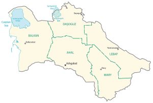
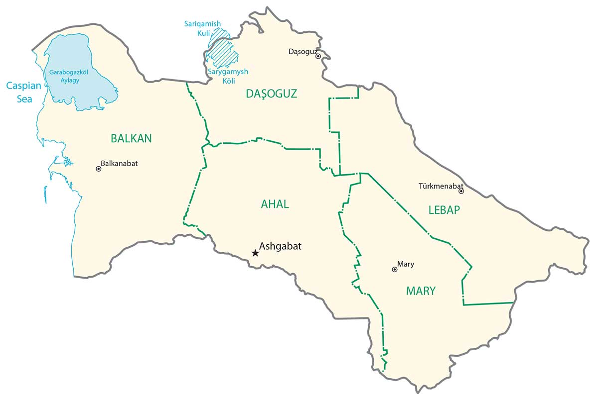
POLITICAL MAP
Turkmenistan Regions Map
Regions are the first-level administrative units in Turkmenistan that are divided geographically and administratively. Currently, there are 5 regions in Turkmenistan. Then, its second-level administrative unit is districts.
Capital City
Ashgabat
Major cities and towns
Balkanabat
Bayramaly
Dasoguz
Gyzylarbat
Mary
Tejen
Türkmenabat
Türkmenbasy
Cities, towns and villages
Atamyrat
Bäherden
Bugdayly
Bokurdak
Büzmeyin
Celeken
Darvaza
Darganata
Esenguly
Etrek
Garabogazkol
Gazanjyk
Gazojak
Gowurdak
Gumdag
Gyzylgaya
Jashan
Kaka
Karabekau
Köneürgench
Sarakhs
Sarahs
Seydi
Tagtabazar
Täzeyel
Üçajy
Yerbent
Zeyit
Lakes, rivers and seas
Amu Darya River
Caspian Sea
Garabogazkol Basin
Goklenguyy Sorluk (Intermittent)
Murgap River
Sariqamish Lake
Sarygamysh Lake
Sumbar River
Tejen Deryasy Stream