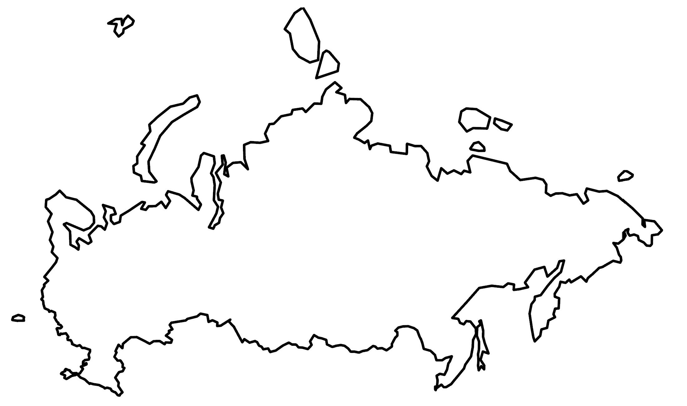
Russia Map
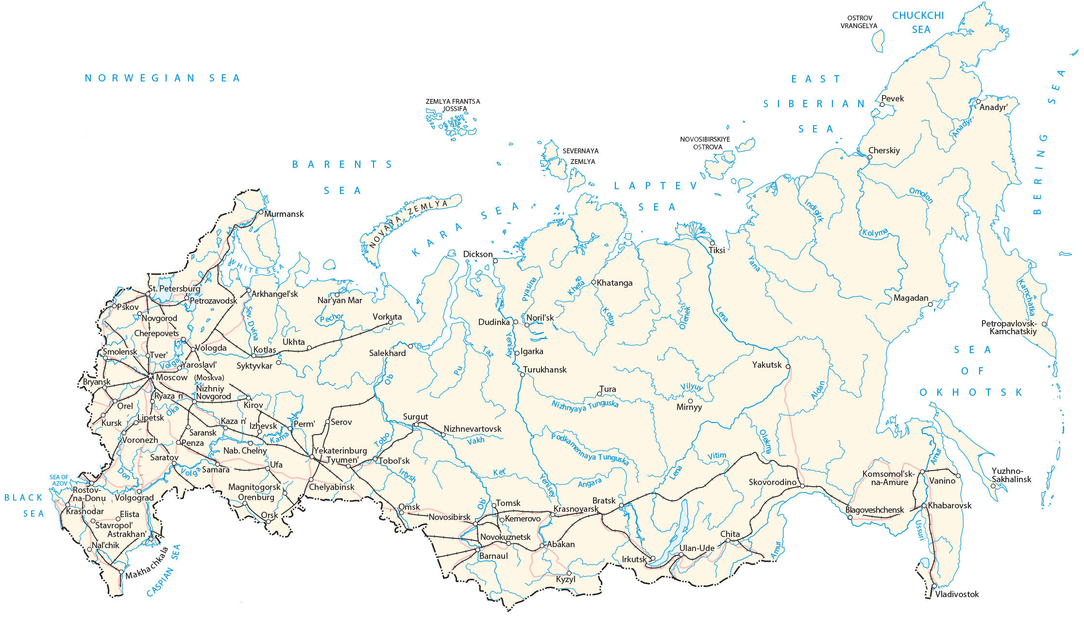
Russia is the largest country in the world. This map of Russia displays cities, towns, highways, roads, lakes, and rivers. Satellite imagery and an elevation map of Russia highlight its topography and Siberia.
Russia map collection

About the map
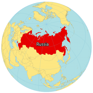
Russia is located in both North Asia and Europe. It borders 14 countries, which is the most of any other country in the world. It includes Azerbaijan, Belarus, China, Estonia, Finland, Georgia, Kazakhstan, North Korea, Latvia, Lithuania, Mongolia, Norway, Poland, and Ukraine.
Russia is the largest country in terms of its landmass in the world at over 17 million square kilometers (6.6 million sq mi). Altogether, this accounts for more than one-eighth of Earth’s inhabited land area. In fact, it’s so large that it crosses eleven different time zones.
Russia is situated along the Arctic Ocean bordering both Europe to the east and Asia to the south. Moscow is the capital and largest city in Russia. But Saint Petersburg, Novosibirsk, and Yekaterinburg are other major cities.
You are free to use our Russia map for educational and commercial uses. Attribution is required. How to attribute?
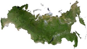
SATELLITE IMAGERY
Russia Satellite Map
Because Russia spans such a wide territory, it has a diverse mix of landscapes. For example, it contains deserts in the southwest to tundra in the north. Overall, Siberia occupies three-quarters of Russia. Despite its massive landmass and frozen land, forests still cover 44% of the land area, which adds up to 882 million hectares. This makes it the most heavily forested country in the world.
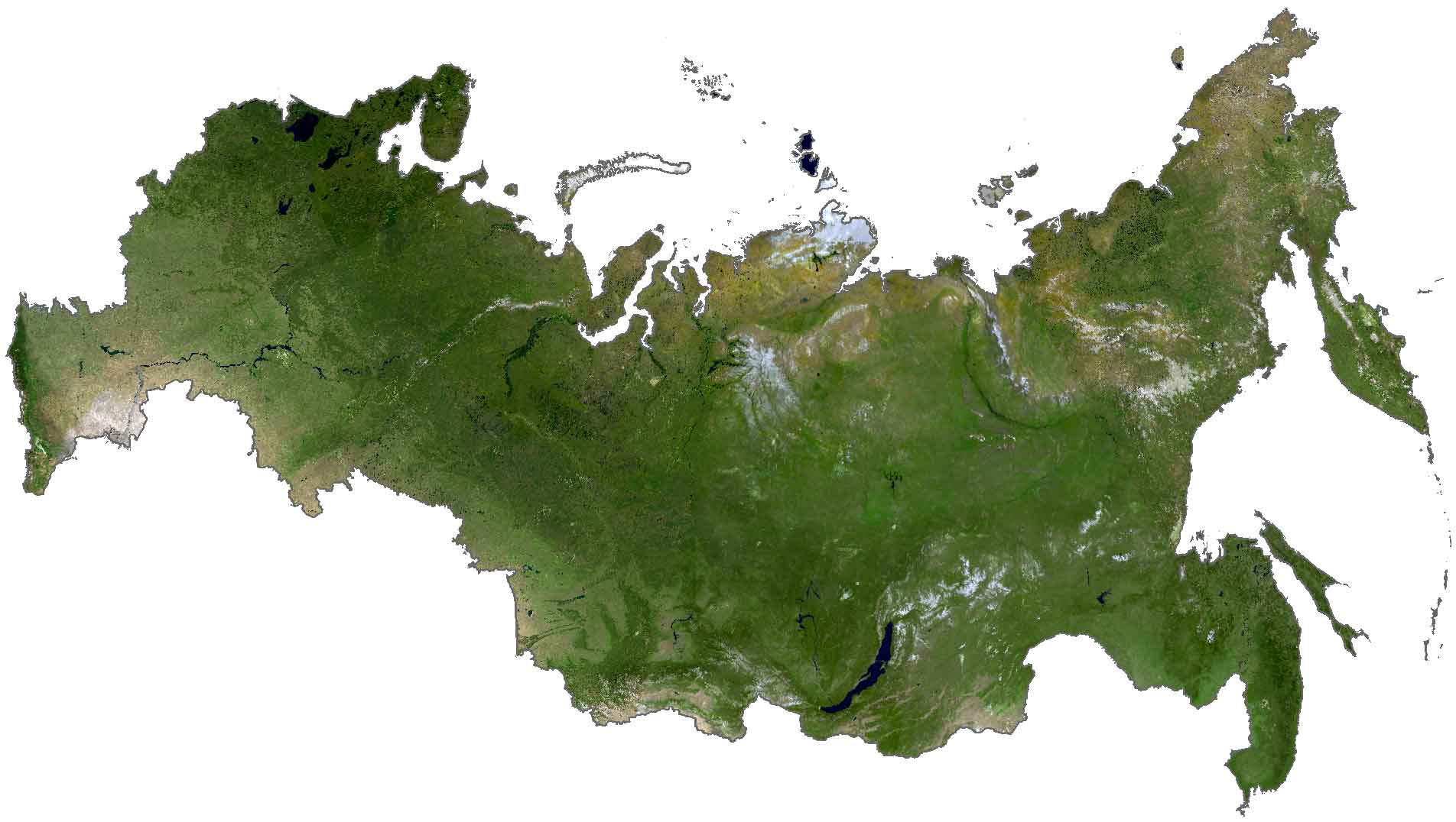
The country spans several climate types like temperate continental in the southeast and a cool tundra to the north. Russia is also home to Lake Baikal, which is the world’s deepest lake, holding one-fifth of the world’s fresh surface water. At a length of 37,653 kilometers (23,396 mi), Russia also has the fourth-longest coastline along three different oceans.
PHYSICAL MAP
Russia Elevation Map
The Ural Mountains split Russia into western and eastern regions. In the west, the terrain is mostly broad plain with low hills. Then to the east, it’s the West Siberian Plain. The north is characterized as mostly tundra and vast coniferous forest in Siberia and at the Arctic Circle.
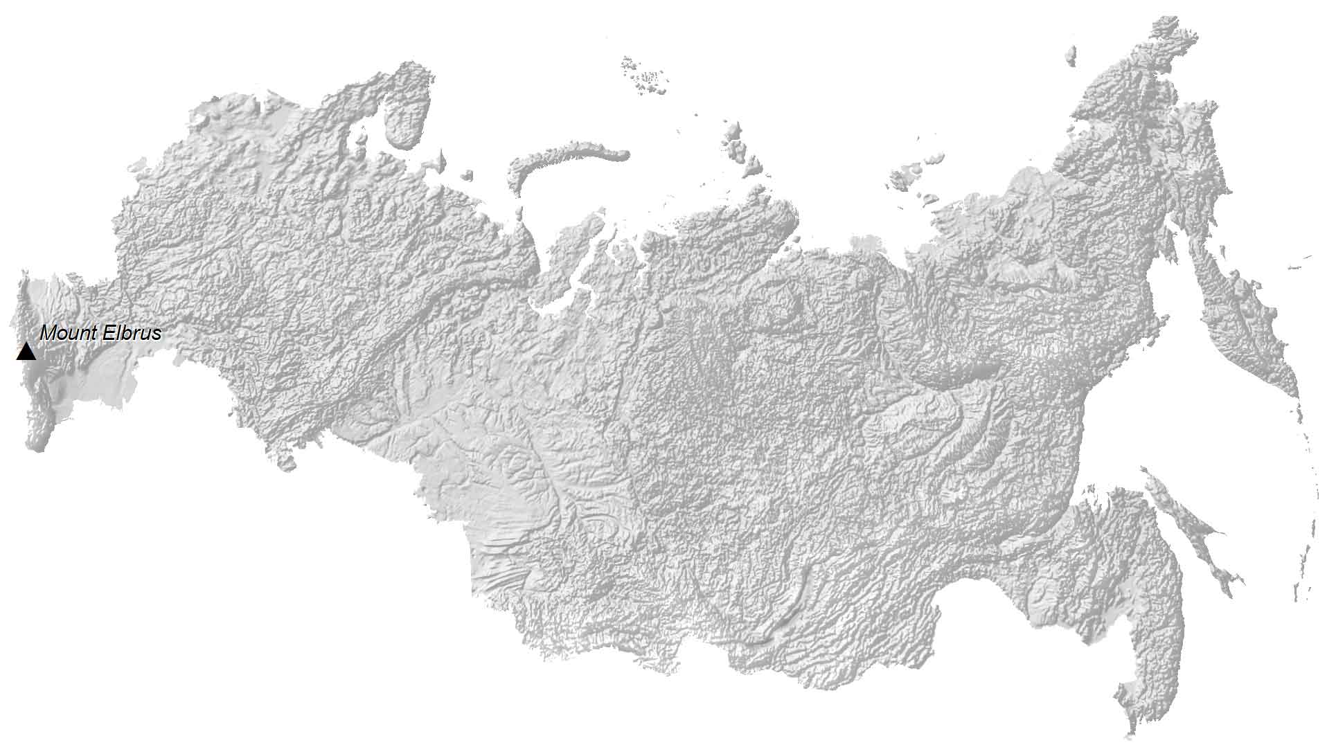
Along Russia’s southern border regions, it consists of mostly highland and rugged mountains. For example, Mount Elbrus, which is a dormant volcano, is Europe’s tallest peak at 5,642 meters (18,510 ft) high. Whereas its lowest point is the Caspian Sea at −28 meters (−92 ft) below sea level.
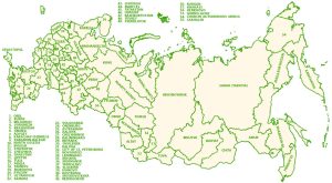
POLITICAL MAP
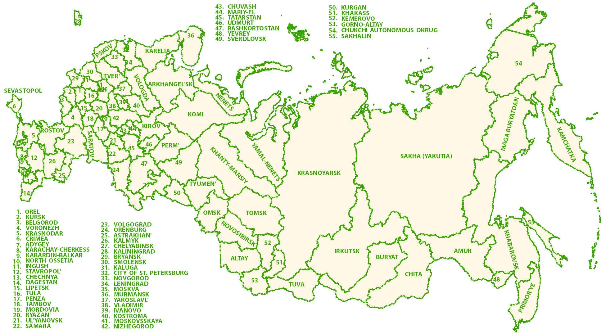
Russia Federal Map
The administration divisions in Russia are a mix of federal subjects. It includes 22 republics, 9 krais, 46 oblasts, 3 federal cities, 1 autonomous oblast, and 4 autonomous okrugs. Every federal subject contains a head, a parliament, and a constitutional court.
Capital City
Moscow (Moskva)
Major cities
Chelyabinsk
Kazan
Krasnoyarsk
Nizhniy Novgorod
Novosibirsk
Omsk
Samara
Saratov
St. Petersburg
Ufa
Voronezh
Yekaterinburg
Cities, towns and villages
Abakan
Anadyr
Arkhangelsk
Astrakhan
Barnaul
Blagoveshchensk
Bratsk
Bryansk
Cherskiy
Chita
Dickson
Dudinka
Elista
Irkutsk
Izhevsk
Kemerovo
Khabarovsk
Kirov
Komsomolsk-on-Amur
Kotlas
Kursk
Kyzyl
Lipetsk
Magadan
Makhachkala
Magnitogorsk
Mirnyy
Murmansk
Nab. Chelny
Nalchik
Naryan-Mar
Nizhnevartovsk
Norilsk
Novokuznetsk
Olekma
Omolon
Orenburg
Orsk
Penza
Petropavlovsk-Kamchatskiy
Petrozavodsk
Pevek
Pskov
Pyasina
Ryazan
Salekhard
Saransk
Serov
Skovorodino
Smolensk
Stavropol
Surgut
Syktyvkar
Tiksi
Tobolsk
Tomsk
Turukhansk
Tver
Tyumen
Ukhta
Ulan-Ude
Vladivostok
Vologda
Volg
Vorkuta
Yaroslavl
Yuzhno-Sakhalinsk
Lakes, rivers and water features
Barents Sea
Bering Sea
Black Sea
Caspian Sea
Chukchi Sea
East Siberian Sea
Irtysh River
Kara Sea
Kolyma River
Kura River
Lena River
Norwegian Sea
Nizhnyaya Tunguska River
Oka River
Pyasina River
Sea of Azov
Sea of Okhotsk
Tura River
Tunguska River
Vakh River
Vilyuy River
Vitim River


Thanks for all the help
I am using this for a project, and i wrote, ©2025 GIS Geography Inc. All rights reserved.
Is it inc?
Here’s our page on how to cite – https://gisgeography.com/how-to-cite/
Hello,
I would like to reproduce the “Russia Roads and Cities” map for a publication with the Presses de l’Université de Montréal. Would I be able to do that?
Thanks a lot,
Michael
Yes you can.