Maryland Lakes and Rivers Map
About the map
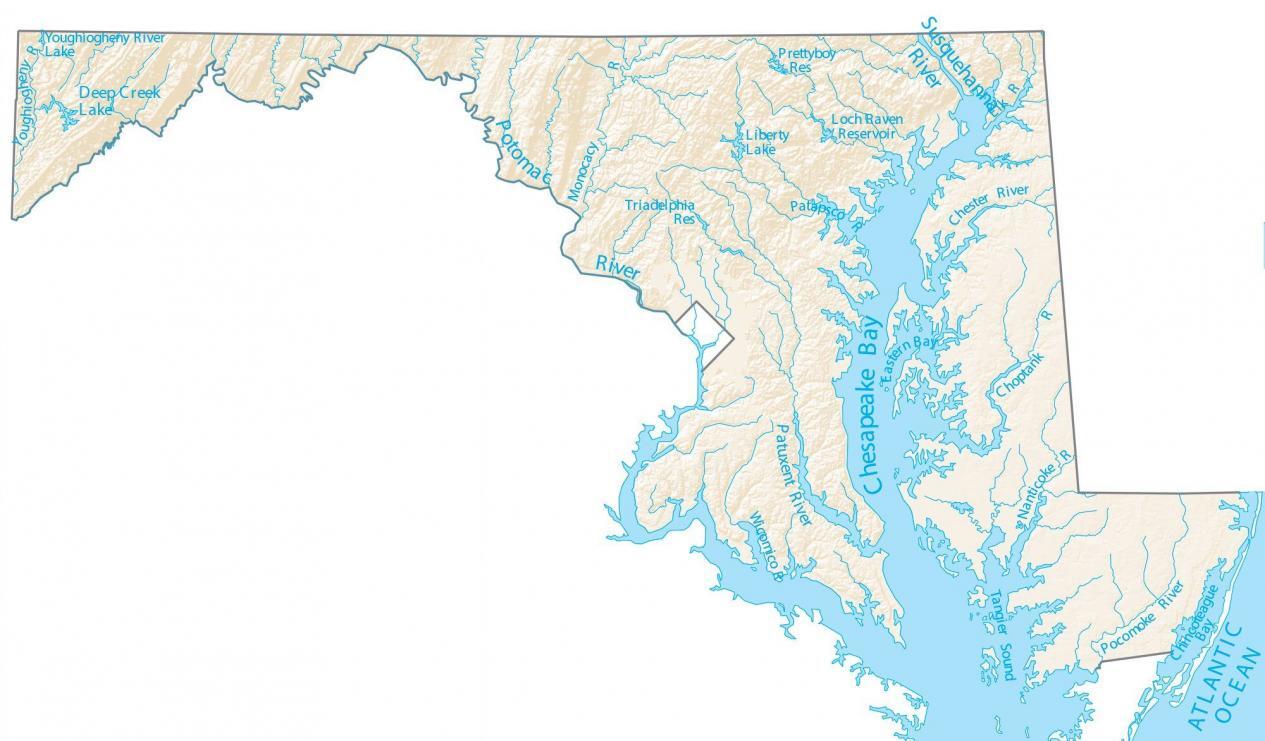
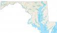
This map shows major rivers, reservoirs, and lakes of Maryland like the Potomac and Susquehanna Rivers. In general, rivers in Maryland flow into the Atlantic Ocean.
One of the biggest features in Maryland is the Chesapeake Bay, which splits Maryland in the east and west. This 200-mile long estuary is an area of environmental concern for Maryland and its people.
One of the major rivers in Maryland is the Potomac River. This river divides Maryland’s border between both West Virginia and Virginia. Deep Creek Lake is the largest lake in Maryland. It’s located in the west of Maryland and is about 3,900 acres in size.
Maryland map collection
You are free to use our lakes and rivers map of Maryland for educational and commercial uses. Attribution is required. How to attribute?
Maryland lakes, rivers and reservoirs
Lakes, bays and reservoirs
Delaware Bay
Chesapeake Bay
Deep Creek Lake
Liberty Lake
Loch Raven Reservoir
Tangier Sound
Chincoteague Bay
Eastern Bay
Prettyboy Reservoir
Triadelphia Reservoir
Rivers and streams
Potomac River
Susquehanna River
Patuxent River
Pocomoke River
Choptank River
Nanticoke River
Monocacy River
Wicomico River
Chester River
Patapsco River
Elk River
Youghiogheny River