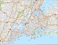
Map of New York City

Map of New York City
New York, New York! The Big Apple! This New York City map collection features roads, highways, major landmarks, and things to do. Plus, it allows you to explore “The City that Never Sleeps” on an interactive map.
As a metropolis, New York City is the most populous city in the United States and the center of the country’s media, entertainment, and commerce. It is home to the United Nations headquarters and is known around the world for its art, culture, and fashion.
New York City is also known for its high-rise buildings, but its history is equally rich and remarkable. Did you know there are more billionaires in NYC than in any other city in the world? If you’re looking to travel to New York City, you can find everything you need in our New York City map collection to get the most out of your trip.
Jump To: Interactive Map | Printable Road Map | 10 Things to Do | Reference Map
New York City map collection
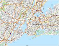
Interactive Map of New York City
From its neighborhoods to its world-class museums, exciting nightlife, and incomparable skyline, there is something for everyone to experience when you travel to New York City. This interactive map helps you explore the city and more.
It includes the best restaurants and bars in New York City and is the perfect way to plan your itinerary for the day. This map is ideal for travelers who want to find the best places to visit, where to get the most out of their time, and where to stay. Find your favorite NYC places like the Empire State Building, Central Park, and Broadway shows on this map.
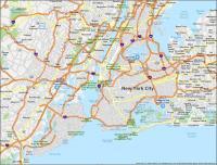
New York City Road Map
We love New York City, but sometimes it can be a little tricky to find your way around. This map is perfect for tourists, drivers, and those who want to find their way around the Big Apple. It includes a New York City road map for Manhattan, Brooklyn, and the 5 main boroughs of NYC so you can get around the city with ease.
For anyone visiting New York City, this road map is a handy resource that you can download and print for free. You can even keep it in your glove box or purse for quick reference so you’ll never get lost. But for any travel outside the city, then check out our road map of New York State with interstates and highway information.
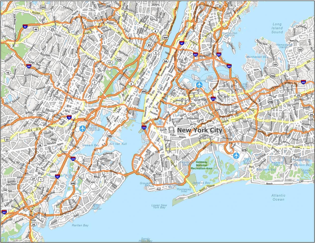
Interstate Highways:
I-78, I-87, I-95, I-278, I-295, I-478, I-495, I-678, I-695, I-895
US Highways:
1, 9, 27, 440, 878,
Expressways/Parkways:
Bronx River Pky, Belt Pky, Cross Bronx Expy, Cross Island Pky, Dr. Martin Luther King Expy, Grand Central Pky, Gun Hill Pky, Henry Hudson Pky, Homer Pky, Hutchinson River Pky, John F Kennedy Expy, Korean War Veterans Pky, Pelham Pky, Queens Midtown Expy, Saw Mill River Pky, Sheridan Expy, Southern State Pky, Whitestone Expy
Major Roads:
1st Ave, 2nd Ave, 8th Ave, 9th Ave, 10th Ave, 11th Ave, 12th Ave, 14th St, 23rd St, 30th St, 34th St, 37th St, 40th St, 42nd St, 177th St, Bowery St, Bruckner Blvd, Canal St, Christopher Ln, Delancey St, Drumgoole Rd, Dyer Ave, FDR Dr, Flatbush Ave, Harlem River Dr, Hudson St, Joe Louis Plz, Kearney Ave, Laight St, Lincoln Tunnel, Mac Donough Pl, Manhattan Bridge, Richmond Ave, Street Via, Tillary St, Triborough Bridge, Tunnel Exit St, United Nations Plz, Victory Blvd, West St, Williamsburg Bridge
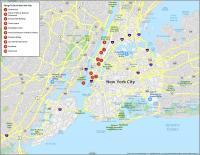
10 Things To Do in New York City
Whether you’re a seasoned globetrotter or you’re traveling for the first time, there’s something for everyone when it comes to exploring this gigantic city. From its history, culture, architecture, arts, food, and outdoor activities, it’s no wonder why so many people want to visit.
This map is the perfect way to explore and discover the best things to do in NYC. From the Empire State Building and Central Park to New York City’s museums and cultural sites, you’ll have all the information you need to make the most of your trip. To experience all that the Big Apple has to offer, download our free New York City map and itinerary guide.
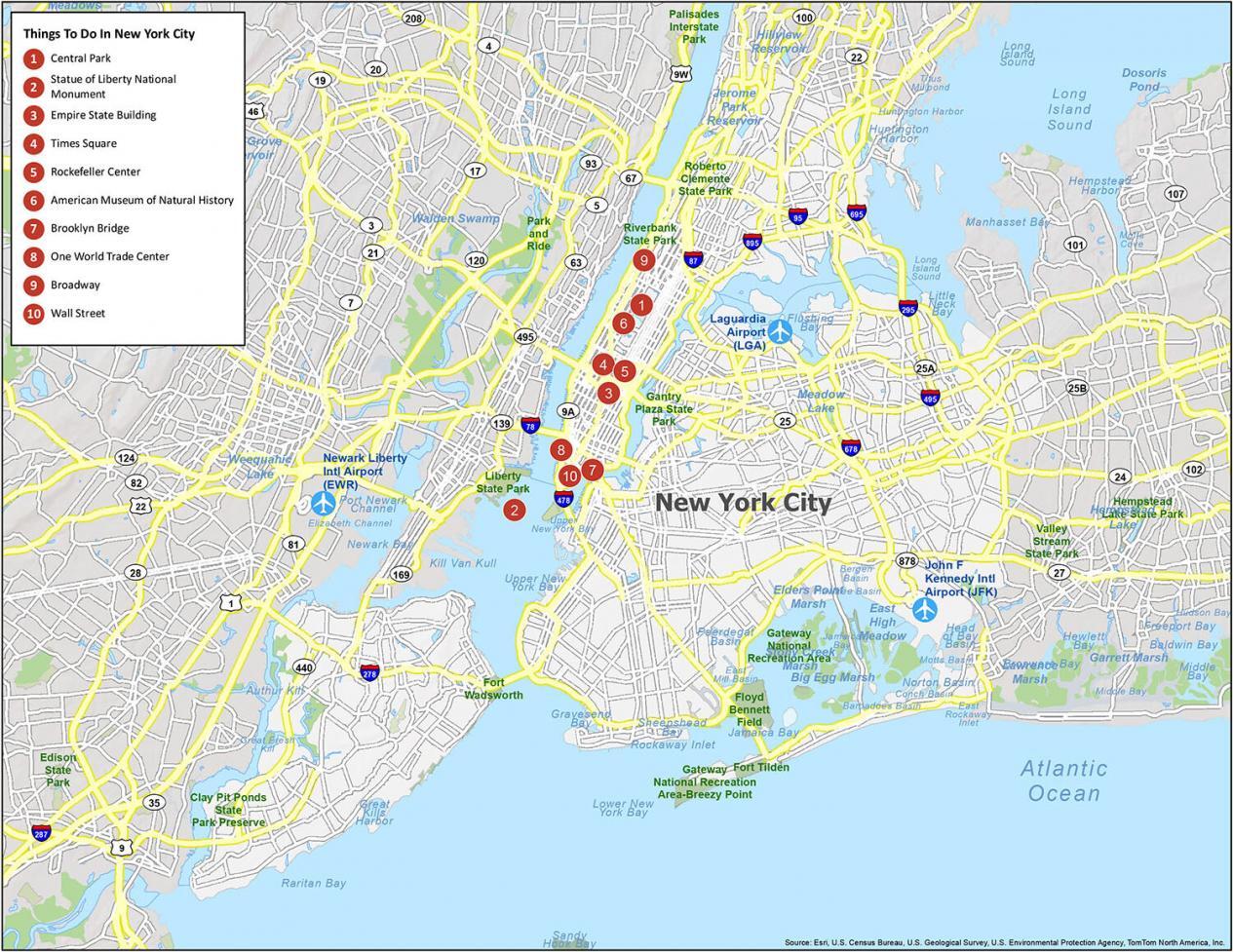
If you could only pick 10 things to do in the “Big Apple”, these would be our recommendations:
- Central Park
- Statue of Liberty National Monument
- Empire State Building
- Times Square
- Rockefeller Center
- American Museum of Natural History
- Brooklyn Bridge
- One World Trade Center
- Broadway
- Wall Street
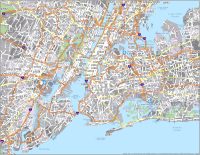
New York City Reference Map
New York City is constantly filled with high energy, from the hustle and bustle of Midtown Manhattan to the quaint neighborhoods in the outer boroughs. Since the city is so massive, it can be hard to know where to begin exploring it. Luckily, this informative map will help you on your journey to New York City.
Whether you’re traveling or just looking to get acquainted with the city, this map will help you navigate your way around. Overall, this map provides you with everything you need to know about the state parks, bays, inlets, airports, and populated areas of NYC.
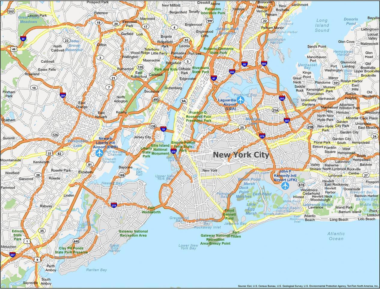
Airports:
LaGuardia Airport (LGA), John F. Kennedy International Airport (JFK)
Cities:
Bayonne, Clifton, East Orange, Elizabeth, Englewood, Garfield, Glen Cove, Hackensack, Hoboken, Jersey City, Linden, Long Beach, Mount Vernon, New Rochelle, New York, Newark, Passaic, Paterson, Perth Amboy, Rahway, Rye, South Amboy, Summit, Union City, Yonkers
Towns:
Guttenberg, Harrison, Kearny, Secaucus, West New York, Westfield
Villages:
Atlantic Beach, Baxter Estates, Bayville, Bellerose, Bronxville, Brookville, Cedarhurst, East Hills, East Rockaway, East Williston, Floral Park, Flower Hill, Freeport, Garden City, Great Neck, Great Neck Estates, Great Neck Plaza, Hempstead, Hewlett Bay Park, Hewlett Harbor, Hewlett Neck, Island Park, Kensington, Kings Point, Lake Success, Larchmont, Lattingtown, Lawrence, Lynbrook, Malverne, Mamaroneck, Manorhaven, Matinecock, Mineola, Munsey Park, New Hyde Park, North Hills, Old Brookville, Old Westbury, Pelham, Pelham Manor, Plandome, Plandome Heights, Plandome Manor, Port Washington North, Ridgefield Park, Rockville Centre, Roslyn, Roslyn Estates, Roslyn Harbor, Russell Gardens, Saddle Rock, Sands Point, Sea Cliff, South Floral Park, Stewart Manor, Thomaston, Upper Brookville, Valley Stream, Westbury, Williston Park, Woodsburgh
Boroughs:
Alpine, Bergenfield, Bogota, Caldwell, Carlstadt, Carteret, Chatham, Cliffside Park, Cresskill, East Newark, East Rutherford, Edgewater, Elmwood Park, Englewood Cliffs, Essex Fells, Fair Lawn, Fairview, Fanwood, Florham Park, Fort Lee, Garwood, Glen Ridge, Haledon, Hasbrouck Heights, Hawthorne, Keansburg, Kenilworth, Leonia, Lincoln Park, Little Ferry, Lodi, Maywood, Metuchen, Moonachie, Mountainside, New Milford, North Arlington, North Caldwell, Palisades Park, Paramus, Prospect Park, Ridgefield, River Edge, Roseland, Roselle, Roselle Park, Rutherford, Sayreville, Tenafly, Teterboro, Totowa, Wallington, Woodland Park, Wood-Ridge
Census-designated place (CDP):
Albertson, Avenel, Baldwin, Baldwin Harbor, Barnum Island, Bay Park, Bellerose Terrace, Brookdale, Carle Place, Colonia, East Atlantic Beach, East Meadow, Eastchester, Elmont, Fords, Franklin Square, Garden City Park, Garden City South, Glen Head, Glenwood Landing, Great Neck Gardens, Greenvale, Harbor Hills, Harbor Isle, Herricks, Hewlett, Inwood, Iselin, Lakeview, Lido Beach, Locust Valley, Malverne Park Oaks, Manhasset, Manhasset Hills, New Cassel, North Lynbrook, North New Hyde Park, North Valley Stream, Oceanside, Point Lookout, Port Reading, Port Washington, Roosevelt, Roslyn Heights, Saddle Rock Estates, Searingtown, Sewaren, Short Hills, Silver Lake, Singac, South Hempstead, South Valley Stream, Uniondale, University Gardens, Upper Montclair, West Hempstead, Woodbridge, Woodmere
What is the “one World Trade Center”
Is there any way you could send me a hard copy of a New York State Map and a hard copy of a New York City Map? Or tell me where I could obtain them?
Thanks so much!
Sorry, but we don’t have any hard copies. You can download and have a print services company create a hard copy for you.