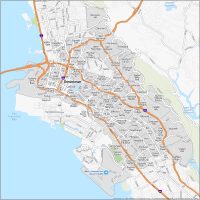
Oakland Crime Map
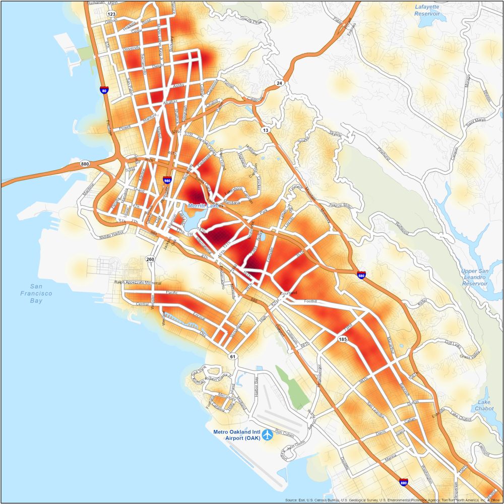
Dangerous Neighborhoods in Oakland
Our Oakland crime map is your key to understanding safety. Here is a list of some of the most dangerous neighborhoods in Oakland.
| Neighborhood | Location | Types of Crimes |
|---|---|---|
| East Oakland | Southeast Oakland, east of Lake Merritt | Property crimes, robberies, assaults, and occasional shootings. |
| Fruitvale | West and southern Oakland area. Near Fruitvale BART station and next to Tidal Canal | Theft, burglaries, assaults, and occasional drug-related offenses. |
| West Oakland | Western Oakland. Near Downtown Oakland bounded by I-880 | Property crimes, robberies, assaults, vandalism, and drug-related offenses. |


Hi there
Can I get the original data of this heat crime map or can you tell me where did you get the data? Thank you so much