Rocky Mountain National Park Map
About the map
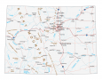
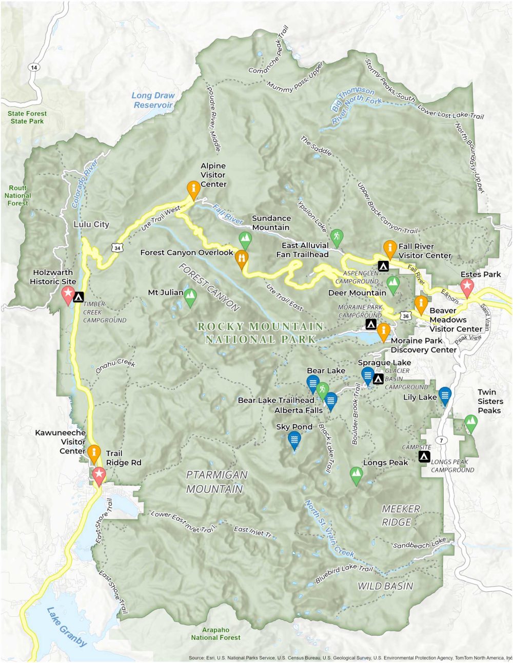
Our map of Rocky Mountain National Park can help you navigate this gem in Colorado. The park itself boasts rugged mountains, serene alpine lakes, and abundant wildlife. To navigate this vast area, our map can help guide visitors to its most picturesque spots.
This map provides detailed information on the park’s highlights. It includes famous peaks like Longs Peak, tranquil spots like Bear Lake, and the scenic Trail Ridge Road. Our map also outlines 300 miles of trails with labels of the most popular routes.
Lastly, the map is practical. You’ll find visitor centers, key geography, and campgrounds. Print yourself a copy of our map of Rocky Mountain National Park. Who knows when you might need it to travel the diverse landscapes of the Colorado Rockies?
You are free to use our Rocky Mountain National Park map for educational and commercial uses. Attribution is required. How to attribute?
Top Things to Do
- Bear Lake: Popular, easy trail encircling a beautiful, serene mountain lake.
- Forest Canyon Overlook: Accessible overlook offering expansive views of the park’s deep forests.
- Alberta Falls: Short hike to a picturesque, cascading waterfall in a lush setting.
- Alpine Visitor Center: Situated at a high altitude, offers educational exhibits and spectacular views.
- Sprague Lake: Gentle trail around a tranquil lake, perfect for families and picnics.
- Lily Lake: Easy, flat loop around a peaceful lake with mountain backdrops.
- Sky Pond: Challenging, rewarding hike featuring waterfalls and dramatic alpine scenery.
- East Alluvial Fan Trailhead: Scenic hiking point through unique sedimentary formations.
- Holzwarth Historic Site: Preserved early 20th-century homestead and artifacts.
- Bear Lake Trail: Picturesque trail around a serene mountain lake.
Discovery and Visitor Centers
Alpine Visitor Center
Moraine Park Discovery Center
Kawuneeche Visitor Center
Beaver Meadows Visitor Center
Holzwarth Historic Site
Campgrounds
Aspenglen Campground
Glacier Basin Campground
Longs Peak Campground
Moraine Park Campground
Timber Creek Campground
Trails
Ute Trail East
Upper Black Canyon Trail
Ypsilon Lake
The Saddle
Ute Trail
Boulder Brook Trail
Black Lake Trail
Lower East Inlet Trail
Bluebird Lake Trail
Sandbeach Lake
East Shore Trail
Comanche Peak Trail
Poudre River Middle
Stormy Peaks Trail
Landforms/Physical Regions
Forest Canyon
Ptarmigan Mountain
Meeker Ridge
Routt National Forest
Wild Basin
Arapaho National Forest
Lake Grandby
Longs Peak
Mount Julian
Sundance Mountain
Twin Sisters Peak
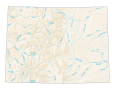
Colorado River
Fall River
Big Thompson River
Long Draw Reservoir
Saint Vrain Creek
Highways and Major Roads
US Highway 36
Highway 7
US Highway 34
Old Fall River Rd
Peak View Dr
St. Vrain Ave
Other Landmarks
Lulu City
Estes Park
References
- Rocky Mountain National Park (National Park Service)
- USGS Rocky Mountain National Park Map
- Topographic Maps of Rocky Mountain NP (USGS)