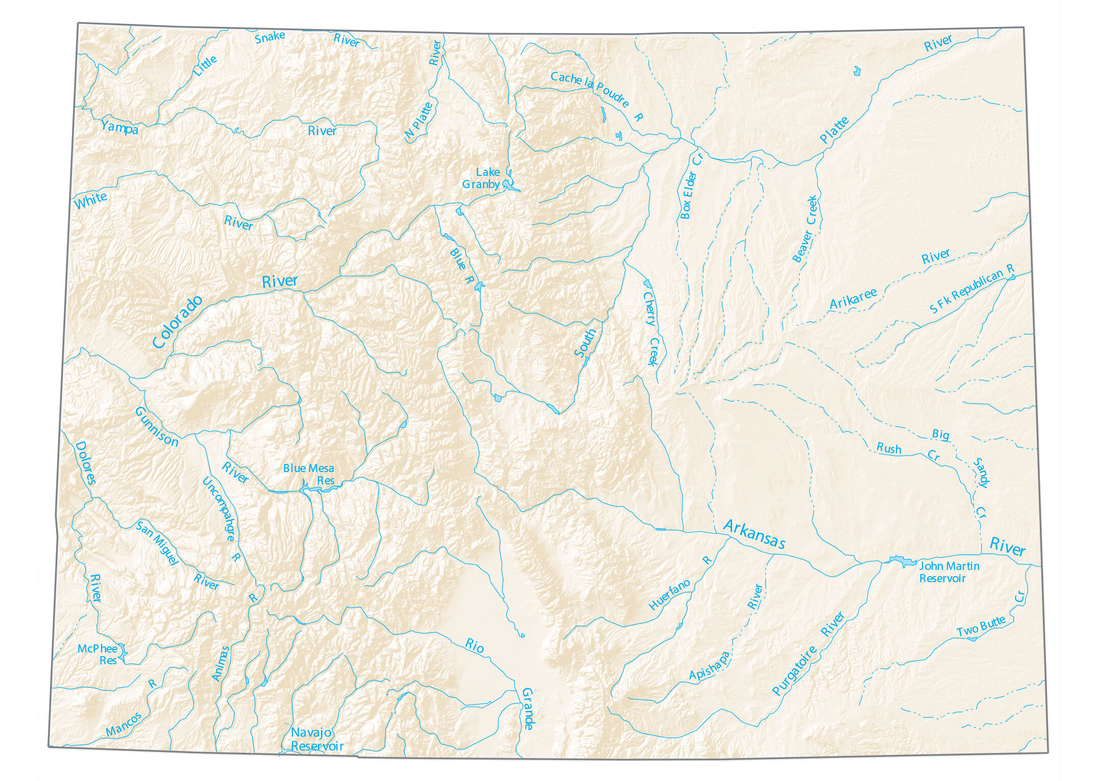
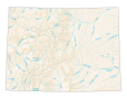
Colorado Lakes and Rivers Map
About the map
Blue Mesa Reservoir, John Martin Reservoir, and Lake Granby are the largest reservoirs in Colorado. Despite the fact that Colorado is landlocked, its lakes provide plenty of shoreline for swimming and recreation.
The Colorado River is one of the largest rivers in the United States. It flows for 1450 miles through Arizona, California, Nevada, Utah, and of course the state of Colorado. In fact, this river starts in the central Rocky Mountains, through the Grand Canyon, until it reaches Lake Mead in Arizona.
In general, rivers in Colorado flow into the Great Basin and southeast. This map shows Colorado lakes, rivers, and streams. For example, the Colorado River, Rio Grande, and Arkansas River are the main watercourses in the state.
Colorado map collection
You are free to use our lakes and rivers map of Colorado for educational and commercial uses. Attribution is required. How to attribute?
Colorado lakes, rivers and reservoirs
Lakes and reservoirs
Navajo Reservoir
John Martin Reservoir
Lake Granby
Blue Mesa Reservoir
McPhee Reservoir
Rivers and streams
Colorado River
Arkansas River
South Platte River
White River
Yampa River
Purgatoire River
Dolores River
Arikaree River
Rio Grande
Gunnison River
South Fork Republican River
Big Sandy Creek
Cache la Poudre River
Blue River
Little Snake River
Animas River
Two Butte Creek
North Platte River
Uncompahgre River
San Miguel River
Mancos River
Huerfano River
Apishapa River
Rush Creek
Cherry Creek
Beaver Creek
Box Elder Creek
Would love to know the scale of this map!