Neighborhood Maps of San Francisco
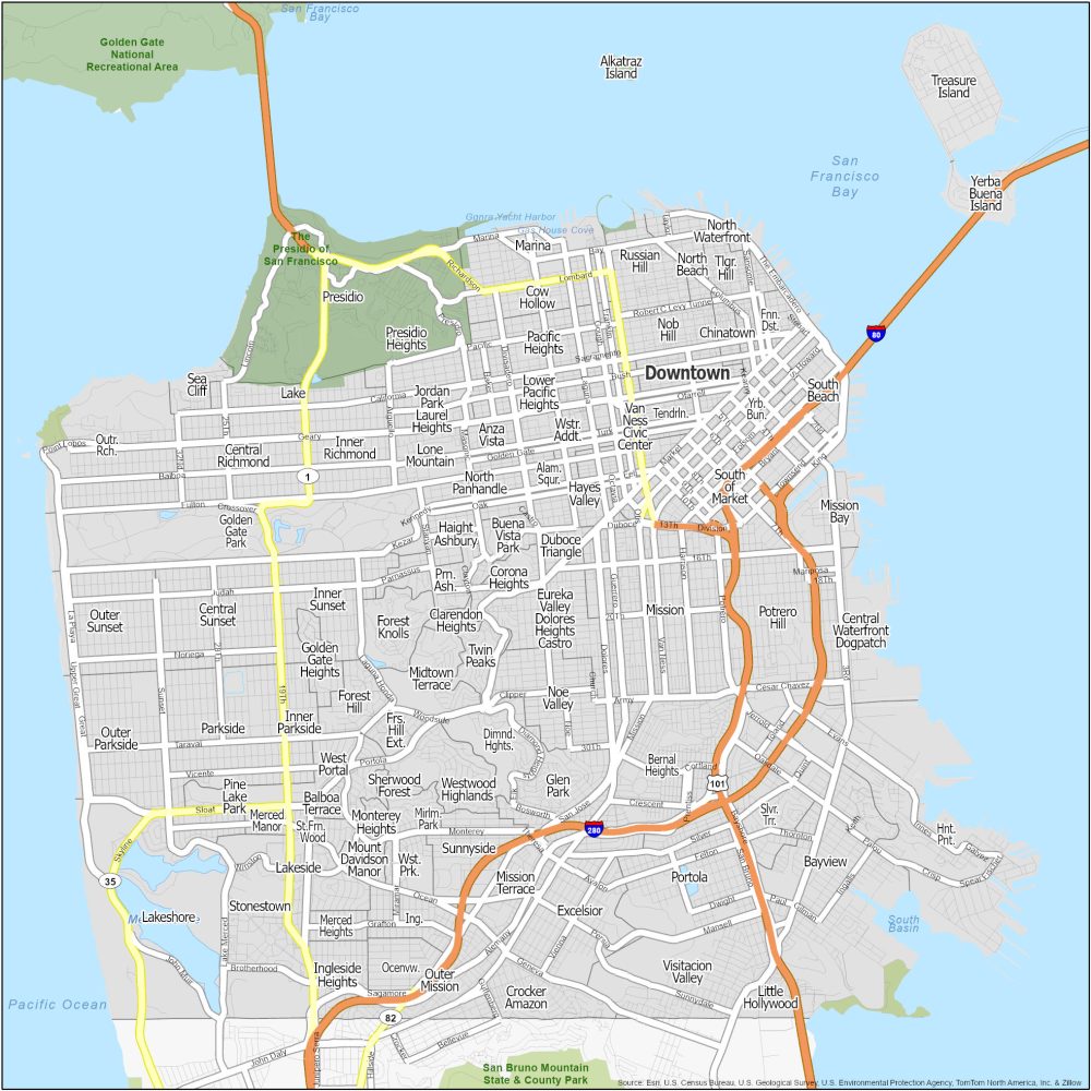
1. Nob Hill Map
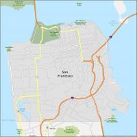
Let’s kick things off with the ritzy Nob Hill. This SF neighborhood is known for its luxury hotels and buildings. Grace Cathedral is a famous landmark here with upscale shops and cable cars that zig-zag through the area.
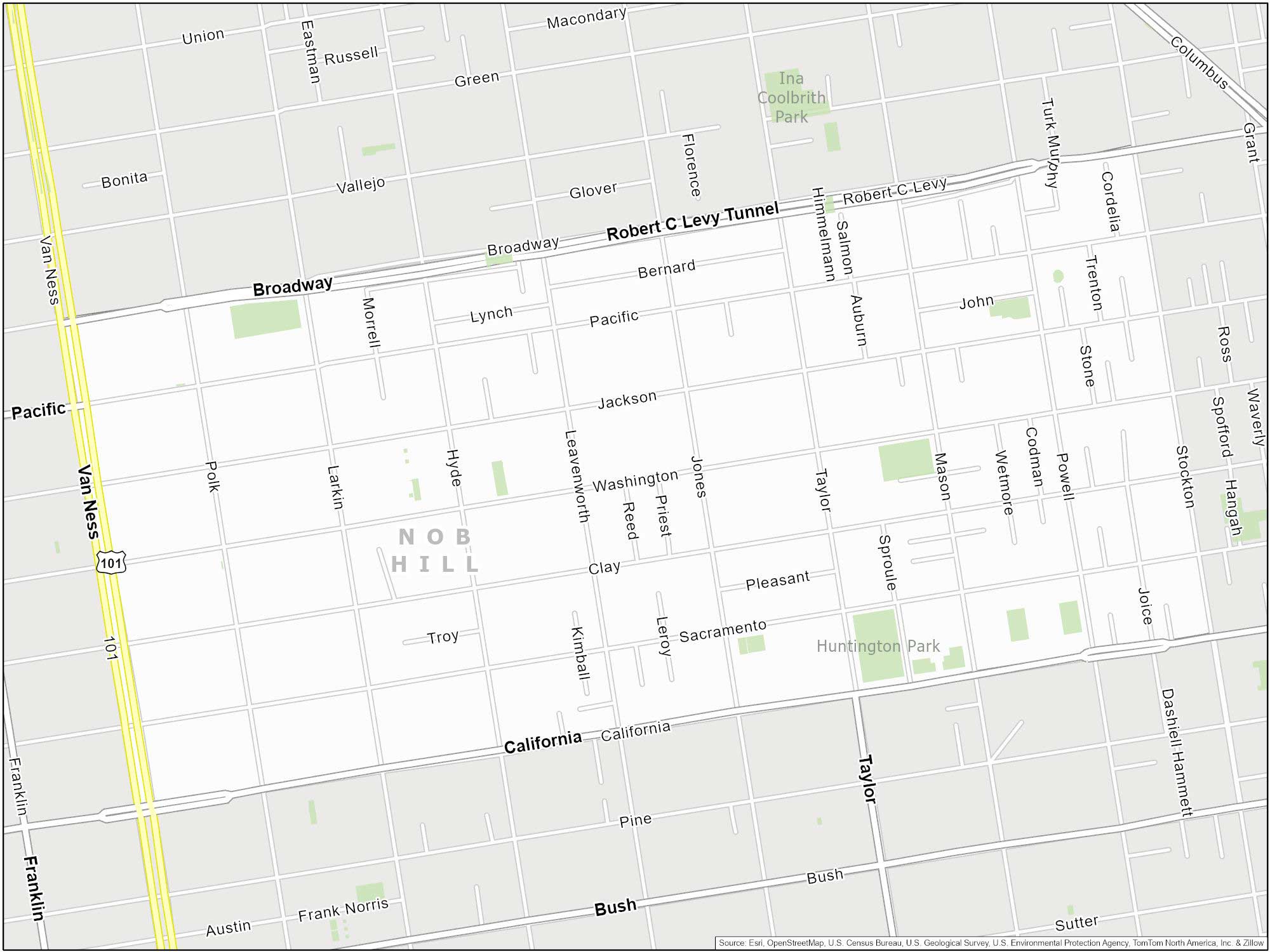
Nob Hill’s neighborhood extent is Van Ness Avenue to the west. California Street (or Pine Street) marks its southern boundary. Finally, Stockton Street and Broadway cut off the east and north.
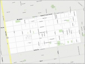
2. Golden Gate Bridge Map
Lost in the fog? Our Golden Gate Bridge map is here to the rescue. And it’s guaranteed to get you from one end of the bridge to the other… unless you’re a seagull.
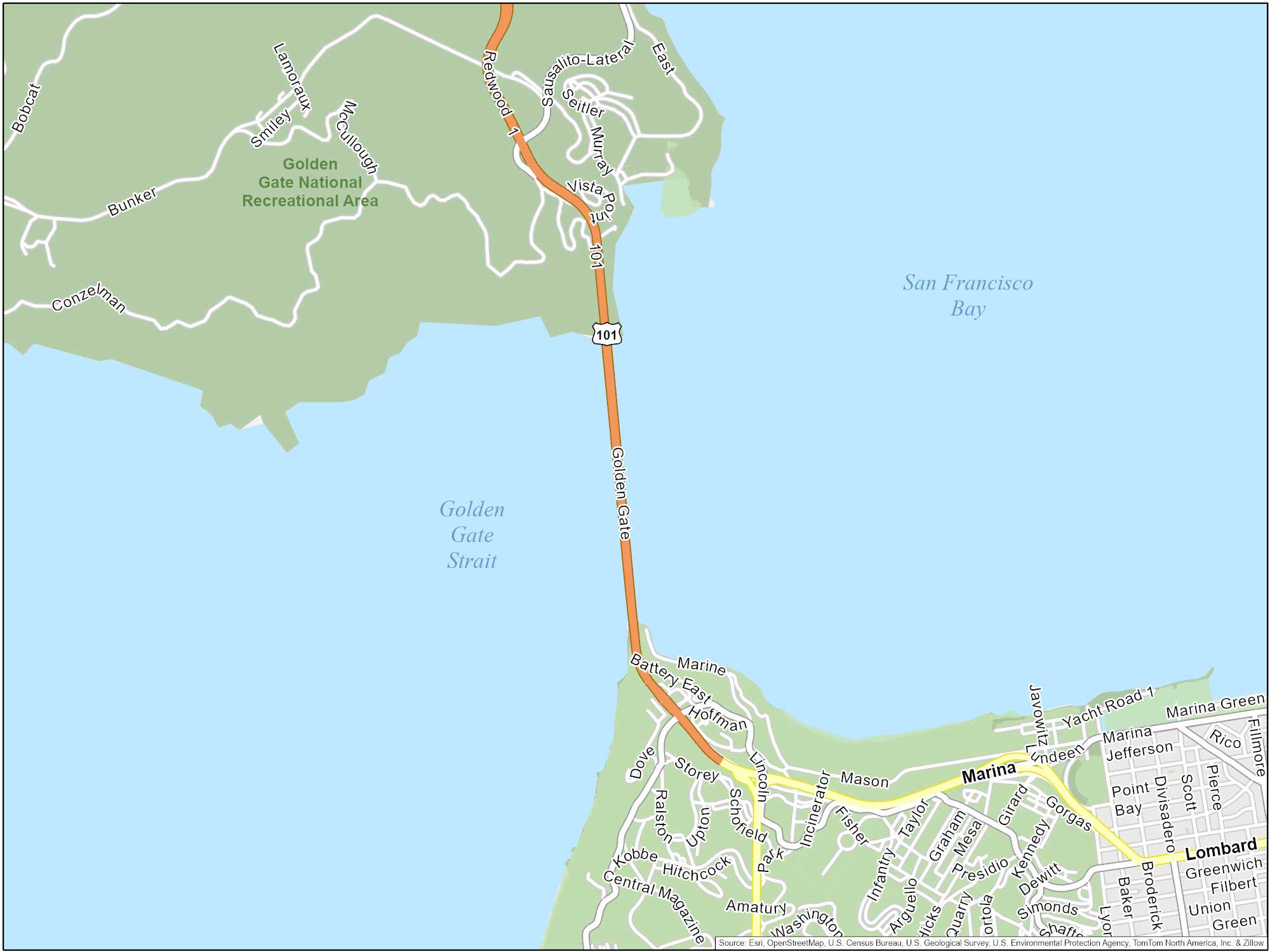
On the south side, we’ve got the Presidio. Swing north, and you’re in Marin. Don’t miss the Vista Point on the north side. It’s the perfect spot for a selfie with you and the Golden Gate Bridge.
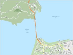
3. Chinatown Map
San Francisco’s Chinatown is the oldest and one of the most iconic Chinatowns in North America. I suggest to stroll through its streets and taste its authentic cuisine. The neighborhood features landmarks like the Dragon Gate and Portsmouth Square.
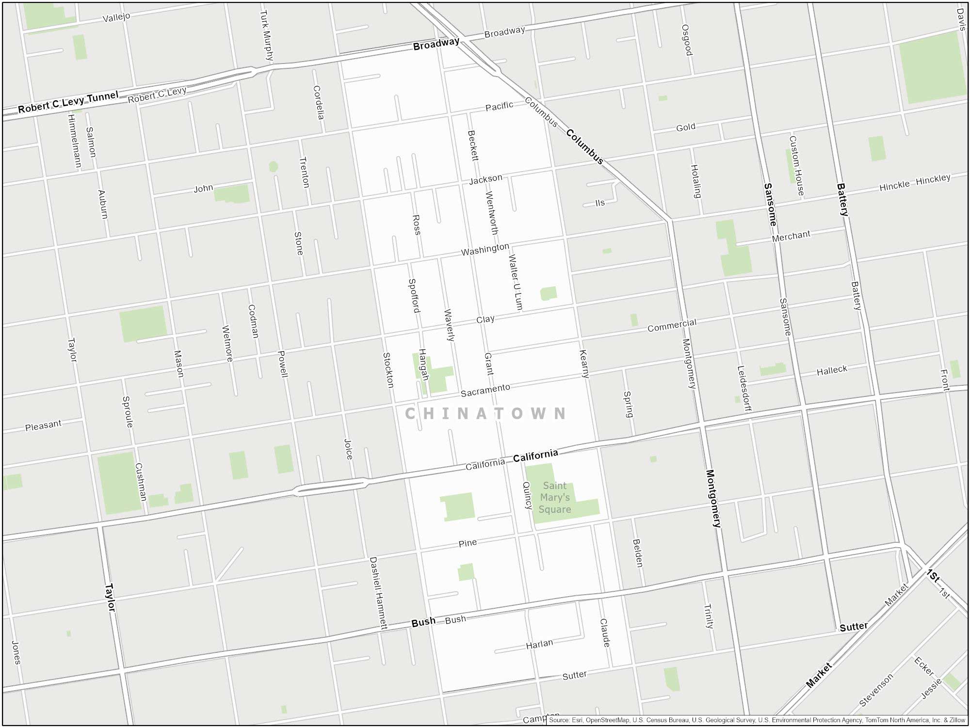
Chinatown in San Francisco is bordered by North Beach to the north and the Financial District to the east. To the south, it meets Union Square. And finally to the west, it borders Nob Hill. The main streets are Grant Avenue and Stockton Street.
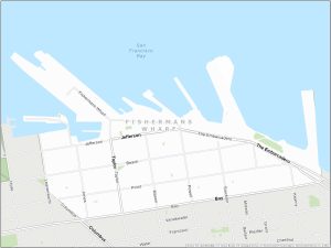
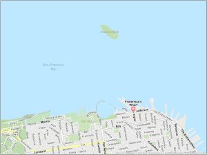
4. Fisherman’s Wharf Map
Ahoy there Anyone who visits San Francisco must visit Fisherman’s Wharf. The area is famous for its seafood restaurants, and attractions like the historic fishing fleet, sea lions at Pier 39, and the San Francisco Maritime National Historical Park. You can also check out Alcatraz Island and the Golden Gate Bridge here.

Fisherman’s Wharf extends along the northern waterfront, from Ghirardelli Square to Pier 39. To the south, it meets North Beach and Russian Hill. Major streets include Jefferson Street and Beach Street.
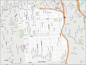
5. Mission District Map
The Mission District is known for its Latino culture. Colorful murals cover buildings throughout the district. One main site is Mission Dolores, which is the oldest building in the city. Dolores Park is a favorite place to relax and enjoy many festivals.
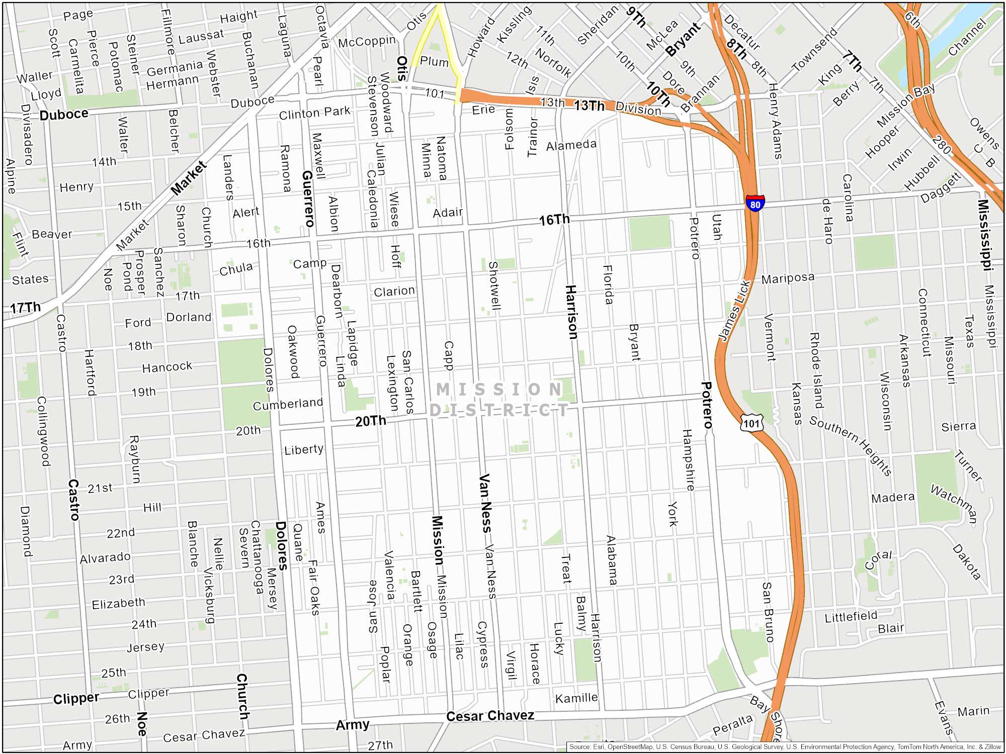
The Mission District neighborhood is bounded by US-101 to the east and Cesar Chavez Street to the south. While 13th Street is its northern boundary, Dolores Street and Valencia are approximately the western extent.
6. Alcatraz
Here we are charting the Rock. But this isn’t your detailed kind of map. Nope, we’re talking big picture here. You can see all the way from the Fisherman’s Wharf to Alcatraz Island with this map.

It’s kind of like a get-out-of-jail-free card. Ready to do some time on the Rock without the whole life-sentence thing? Let’s make a break for it.
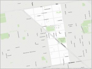
7. North Beach Map
Known as San Francisco’s Little Italy, North Beach is a neighborhood filled with Italian restaurants, coffeehouses, and bookstores. It’s also adjacent to Washington Square Park and within walking distance of Coit Tower.
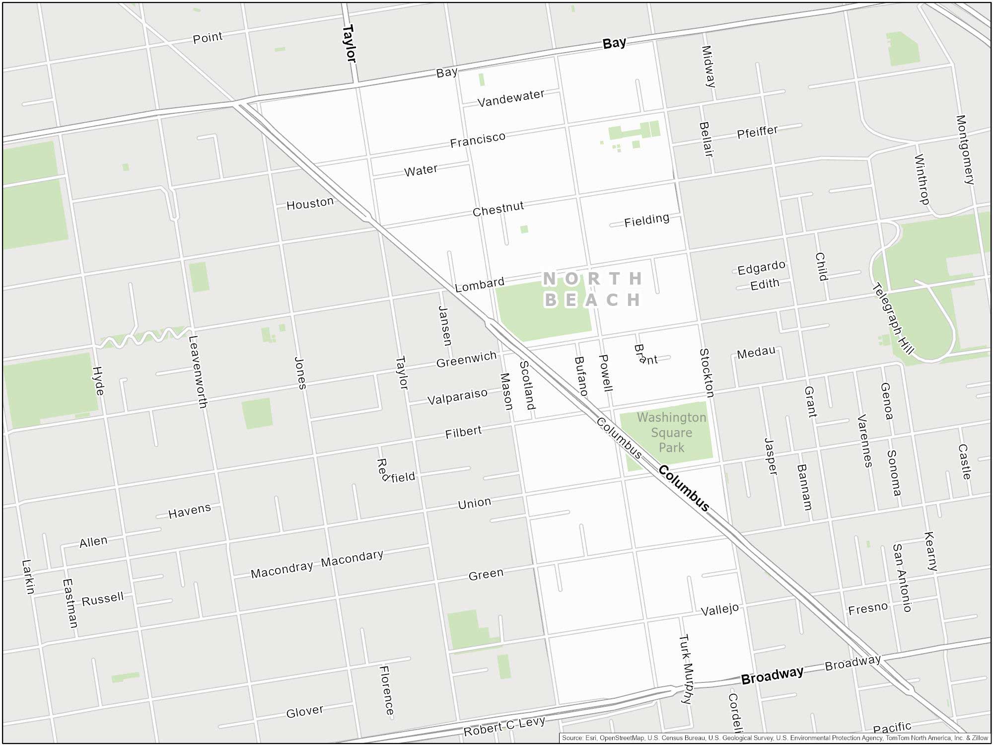
North Beach neighborhood is bordered by Chinatown to the south and Fisherman’s Wharf to the north. To the west, it meets Russian Hill. And finally to the east, it’s bordered by the Embarcadero and the waterfront. Key streets are Stockton and Powell.
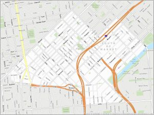
8. SoMa (South of Market) Map
SoMa (South of Market) is a large neighborhood in San Francisco. It stretches from Market Street to the waterfront. The area includes Oracle Park in the east section. It’s home of the MLB Giants with many tech startups and warehouses.
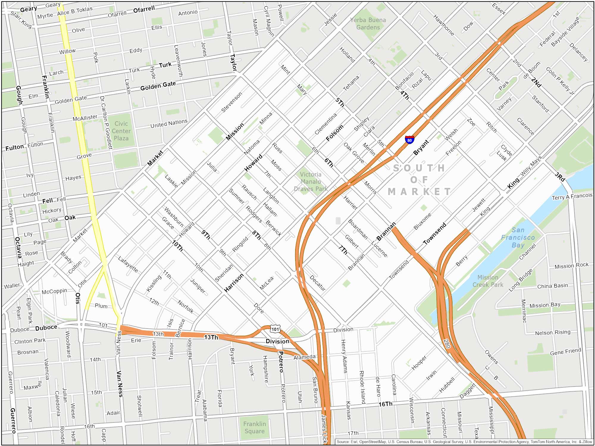
SoMa spans from Market Street in the north to Townsend Street and 16th Street in the south. The neighborhood is near areas such as Yerba Buena, South Beach, and Mission Bay. Major streets include Folsom and Mission Street.
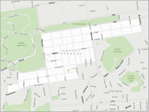
9. Haight-Ashbury Map
Haight-Ashbury has a ’60s spirit and is the birthplace of the hippie counterculture. It is bordered by Golden Gate Park to the west and the Panhandle to the north. To the east, it meets the neighborhoods of Duboce Triangle and the Castro.
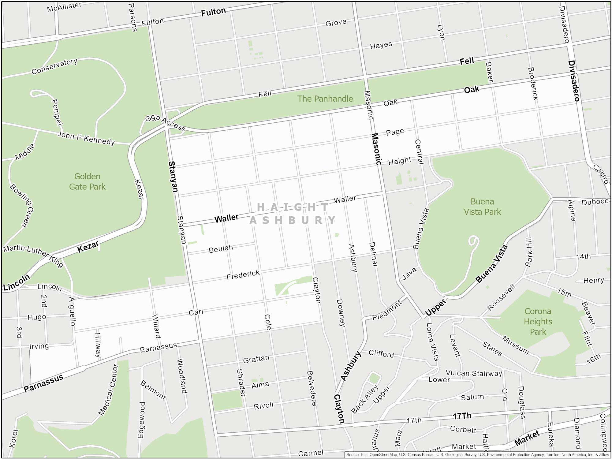
The main streets are Haight Street and Ashbury Street. These two streets intersect in the heart of the neighborhood. Frederick Street bounds the southern extent of this neighborhood. Our boundary extends to Divisadero Street to the east.
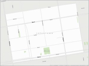
10. Japantown Map
San Francisco’s Japantown main area centers around the Japan Center Mall on Post Street. It features landmarks like the Peace Pagoda and the Japanese Cultural and Community Center. The neighborhood also hosts the annual Cherry Blossom Festival.
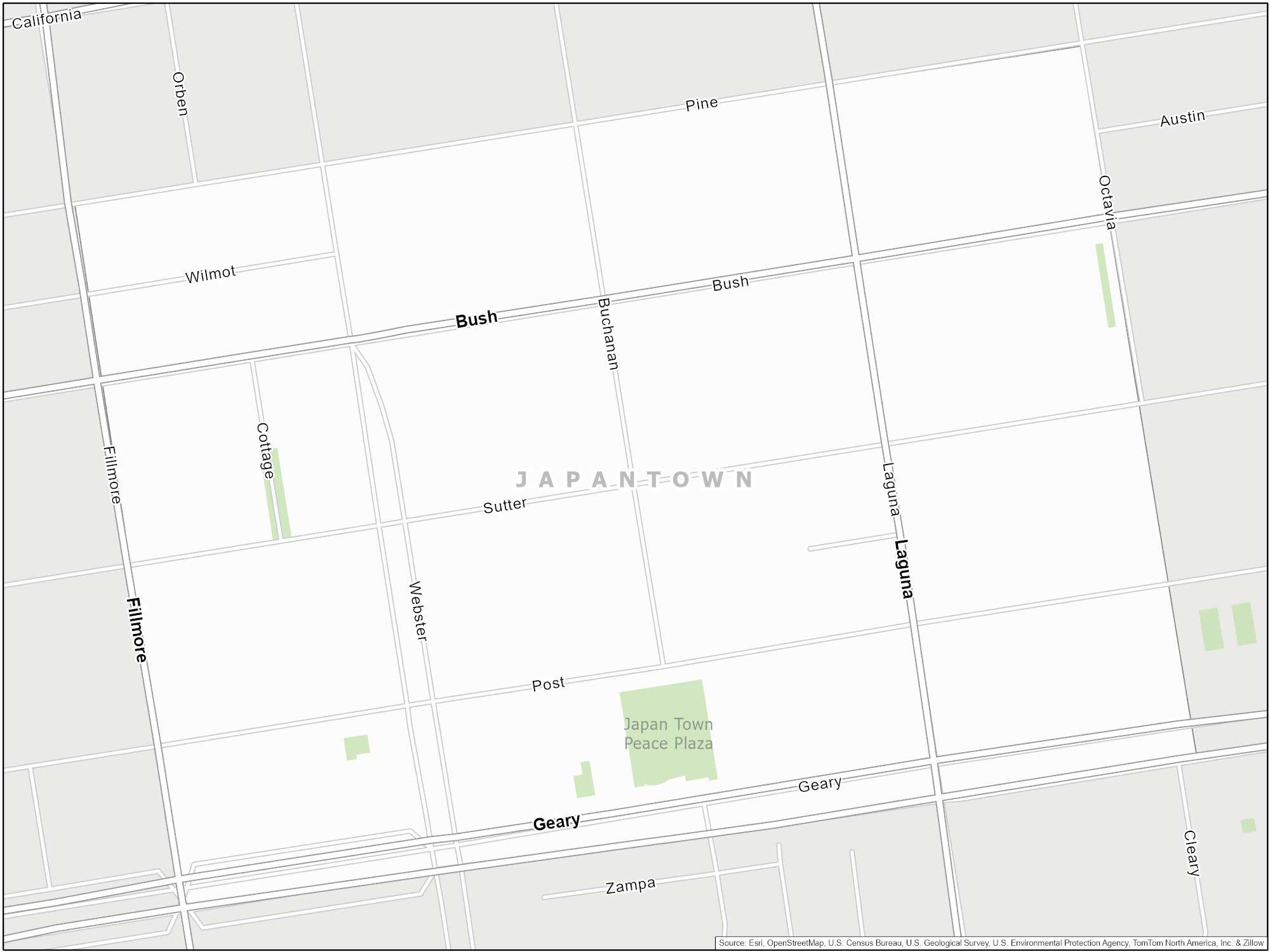
The Fillmore District borders it to the north and the Western Addition borders it to the south. Civic Center meets it to the east, and Lower Pacific Heights borders it to the west. Geary Boulevard marks the southern extent of Japantown.
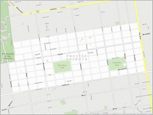
11. Pacific Heights Map
Pacific Heights is mostly an upscale neighborhood known for its views of the Bay. It’s south of Filbert Street, one of the steepest streets in San Francisco (which will give your calves a workout). But remember, it’s not the size of your hill that matters, it’s how you climb it.
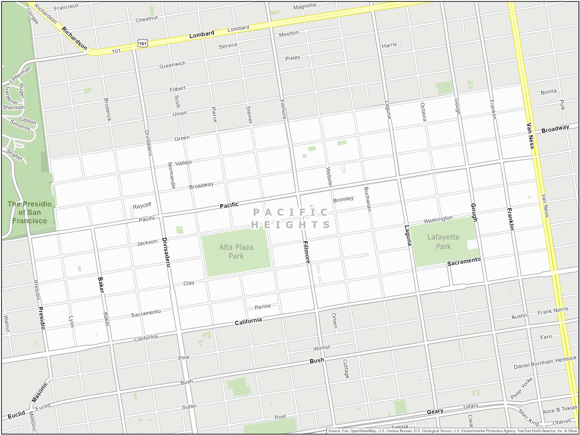
It stretches from Van Ness Avenue to Presidio Avenue. To the north, it meets Cow Hollow and Marina District. To the south, it borders Lower Pacific Heights. Key streets include Fillmore Street, California Street, and Divisadero Street. Lafayette Park and Alta Plaza Park are popular green spaces in this neighborhood.
List of Neighborhoods in San Francisco
Here’s a table that shows the popular neighborhoods and a brief description of each one.
| Neighborhood | Description |
|---|---|
| Pacific Heights | Affluent neighborhood with Victorian and Edwardian homes. |
| Nob Hill | Known for its upscale hotels, historic mansions, and views. |
| Marina District | Trendy area with waterfront views, shops, and restaurants. |
| North Beach | Italian-American neighborhood with cafes and bars. |
| Castro | Historic LGBTQ+ district with a lively and inclusive vibe. |
| Inner Sunset | Residential area with a diverse community and local shops. |
| Mission District | Artsy neighborhood with murals, diverse cuisine, and culture. |
| Haight-Ashbury | Famous for its role in the 1960s counterculture movement. |
| Potrero Hill | Mix of residential and industrial areas with city views. |
| Inner Richmond | Residential area with parks, shops, and diverse eateries. |
| Noe Valley | Quaint residential area with cafes and family-friendly vibe. |
| Outer Sunset | Coastal neighborhood with beaches and a laid-back atmosphere. |
| South of Market (SoMa) | A dynamic area with tech offices, museums, and entertainment. |
| Hayes Valley | Trendy neighborhood with boutiques, cafes, and art galleries. |
| Russian Hill | Scenic neighborhood with iconic crooked Lombard Street. |
| Presidio | The former military base turned park with scenic views. |
| Twin Peaks | An elevated area offering panoramic views of the city. |
| Outer Richmond | Residential area with parks and proximity to the ocean. |
| Chinatown | Historic neighborhood with shops, restaurants, and culture. |
| West of Twin Peaks | Diverse residential area with parks and local businesses. |
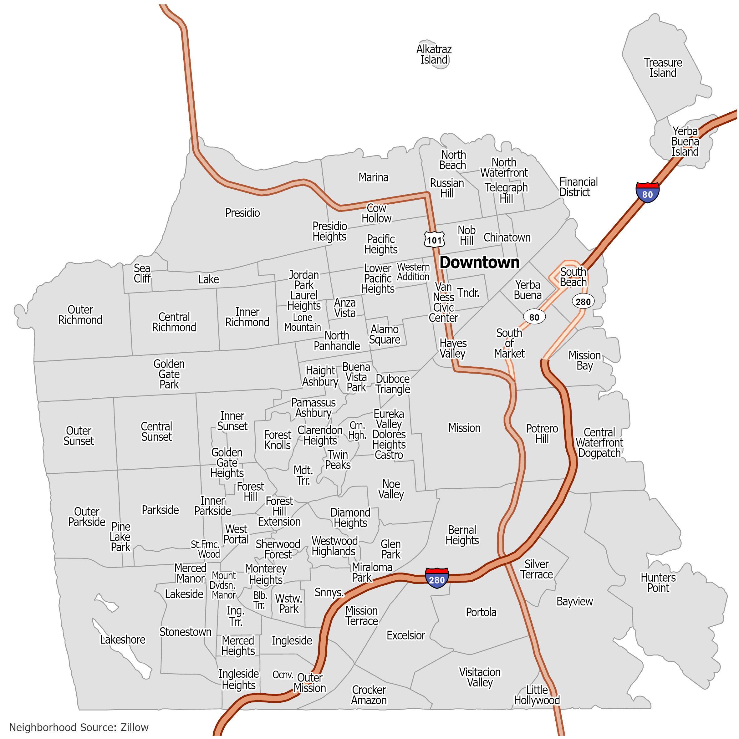
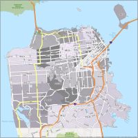
San Francisco Neighborhood Map
Click on the image to see our original neighborhood map of San Francisco with major highways.


The Nob Hill map boarders are not correct. The Nob Hill neighborhood is not a perfect rectangle. The main southern boarder is Pine St not California. Starting at Mason the So. Border shifts down to Bush St. Making Mason a western boarder between Pine and Bush streets. The far west boarder of NH is Larkin between Broadway and Pine. The northern boarder of BH shifts from Broadway to Pacific to Leavenworth. The No. boarder continues to Powell. Then shifts down to Clay as the No. boarder until Stockton. The eastern boarder of NH is Powell until Clay then it becomes Stockton until Bush street.
I would’ve liked a street boundary for the neighborhood edges.
Thanks, Joe for the comment, I really appreciate it. I’ve updated the map so it includes street boundaries for the neighborhood edges.