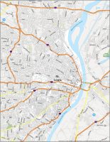
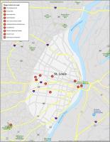
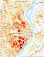
St. Louis Crime Map

St. Louis map collection
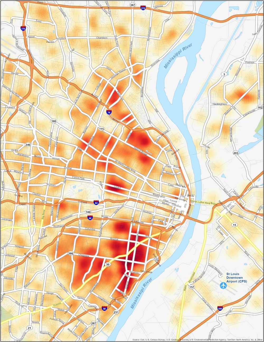
Dangerous Neighborhoods in St. Louis
Visualize the safety landscape with this St. Louis crime map. Using a heat map style visual can help you identify clusters of crime for better safety and awareness in different neighborhoods.
The Ville
The Ville is a neighborhood located in the northern part of St. Louis. It is historically significant as it was once home to many prominent African-American figures. However, over the years, the area has faced economic challenges and higher crime rates. All types of crimes are significantly higher in this neighborhood including theft, assault, and robbery.
Fairground Neighborhood
This neighborhood is located northeast of downtown St. Louis, near Fairground Park. The neighborhood has experienced socioeconomic challenges, which have contributed to crime-related issues over the years. Some of the most common types of crimes in this neighborhood are shootings and it’s not recommended for tourists to visit this neighborhood.
Jeff-Vander-Lou
Situated just northwest of downtown St. Louis, Jeff-Vander-Lou has faced significant socioeconomic struggles, leading to higher crime rates. It is a predominantly residential area with a mix of single-family homes and multi-unit buildings. Various community initiatives have been initiated to improve safety and bring positive changes to the neighborhood.
As with any information regarding crime rates, it’s important to consult up-to-date sources. For instance, this St. Louis crime map can help you get an accurate and up-to-date picture of crime rates in the various neighborhoods of St. Louis.