Lost in Null Island: The Curious Origin of 0,0
Null Island is an inside joke in the world of GIS. It’s actually a place that doesn’t exist in the world today but where data lands in error.
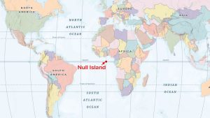
Null Island is an inside joke in the world of GIS. It’s actually a place that doesn’t exist in the world today but where data lands in error.
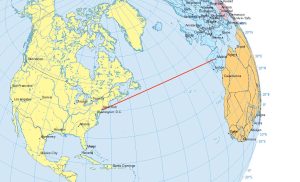
Airplanes travel along the true shortest route in a 3-dimensional space. This curved route is called a geodesic or great circle route.

If you’re in need of a visual reference guide to map projection types, this goldmine of the top 50 global map projections used by cartographers will help.
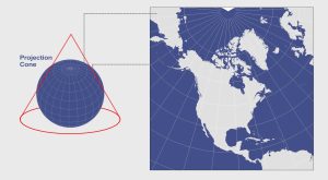
When you place a cone on the Earth and unwrap it, this results in a conic projection. Examples are Albers Equal Area Conic and the Lambert Conformal Conic.
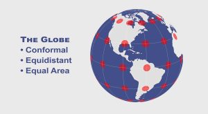
Map distortion is best understood looking at Tissot’s indicatrix. It contains circles and shows how map projections distort shape, size and distances.
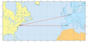
Rhumb lines (or loxodrome) have constant bearings and cross all meridians at the same angle. They are not the shortest distance between 2 points on a sphere
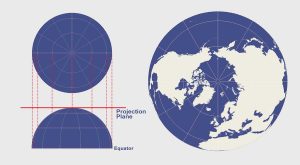
The azimuthal projection plots the surface of Earth using a flat plane. For example, common azimuthal projections are gnomonic, stereographic & orthographic
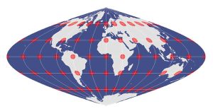
The equal area projection retains the relative size of area throughout a map. So that means at any given region, it keeps the true size and area of features.
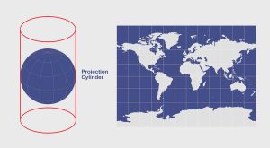
When you place a cylinder around a globe and unravel it, you get the cylindrical projection like the Mercator, Transverse Mercator and Miller projections.

The best way to represent the Earth is with a globe. But map projections can be awfully useful too. Find out why cartographers use map projections in GIS.