50 Map Projections Types: A Visual Guide
50 Map Projections Types
If you’re in need of a visual reference guide to the various map projection types… Then, look no further.
Because we’ve pumped out a goldmine of the top 50 global map projections used by cartographers today.
From Aitoff to Winkel, these map projections are your blueprint for designing cartographic masterpieces.
Because it’s all about the audience… Let’s map with authority and dig right into the BIG LIST of map projections.
A Visual Reference Guide
Scroll down to see all 50 map projection examples. What’s your favorite? Which ones have you used in your maps?
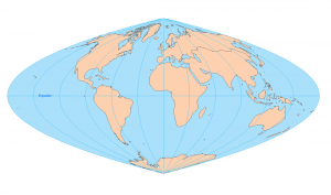
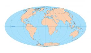
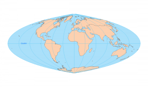
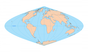
1. Aitoff
Elliptical, compromises area and shape.
2. Azimuthal Equidistant
Preserves distances from center point.
3. Behrmann
Cylindrical, equal-area with standard parallels.
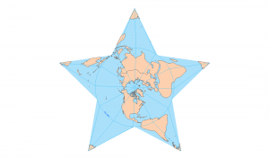
4. Berghaus Star AAG
Star-shaped, minimizes interruptions.
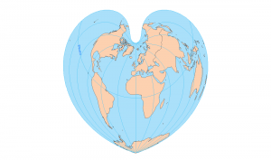
5. Bonne
Heart-shaped, preserves area, distorts shape.
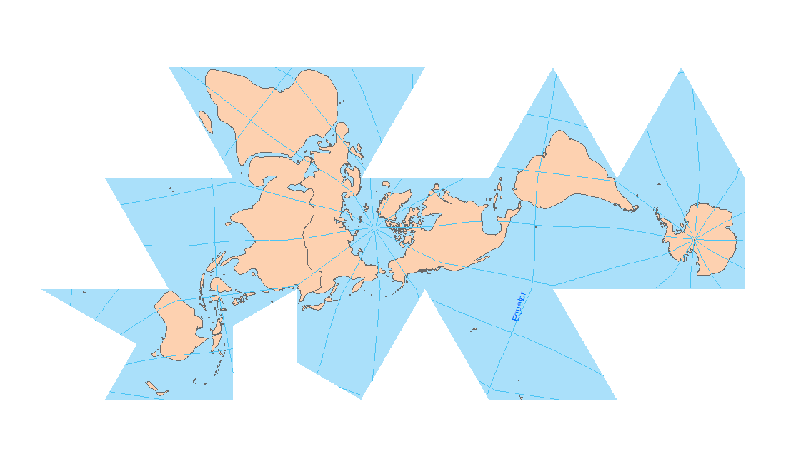
6. Cassini
Cylindrical, good for small regions
7. Compact Miller
Modified Miller, more compact form.
8. Craster Parabolic
Pseudocylindrical, equal-area, parabolic meridians.
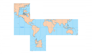
9. Cube
Projects globe onto a cube.
10. Cylindrical Equal Area
Equal-area cylindrical, distorts shape.
11. Eckert-1
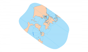
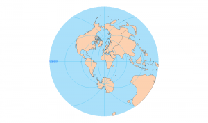
Pseudocylindrical, rounded ends, compromises shape.
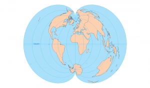
12. Eckert-2
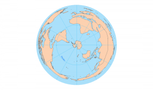
Similar to Eckert-1, flatter poles.
13. Eckert-3
14. Equidistant Conic
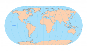
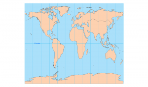
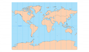
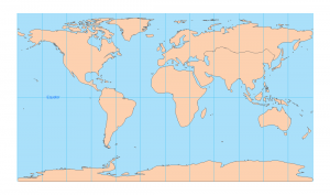
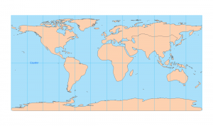
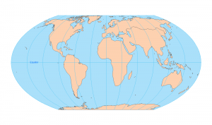
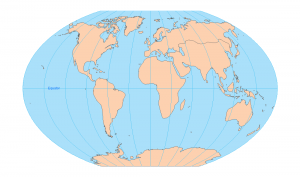
15. Equidistant Cylindrical
Pseudocylindrical, balances area and shape.
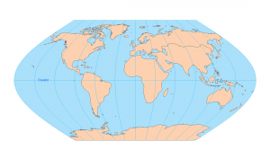
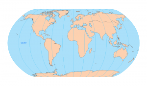
16. Equidistant Cylindrical ARC
Conic, preserves distances along meridians.
17. Flat Polar Quartic
Equal-area, flattened polar regions.
18. Fuller
Polyhedral, minimal distortion, unusual layout.

19. Gall Stereographic
Cylindrical, distorts poles, compromises shape.
20. Goode Homolosine Land
Interrupted, preserves land area proportions.

21. Goode Homolosine Ocean
Interrupted, favors oceans over land.
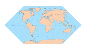
22. Hammer Aitoff
Equal-area, oval shape, less distortion.
23. Hotine
Oblique, for narrow regions or zones.
24. Loximuthal
Keeps loxodromes as straight lines.
25. Mercator
Cylindrical, straight rhumb lines, distorts poles.
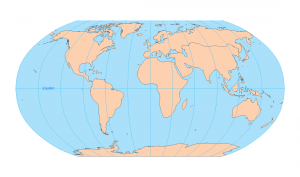
26. Miller Cylindrical
Modified Mercator, reduces polar distortion.
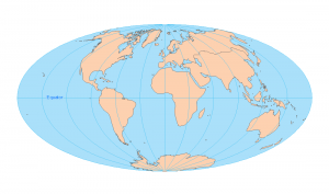
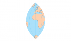
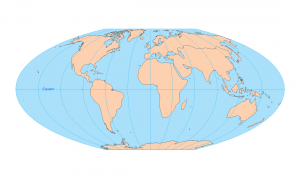
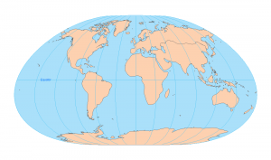
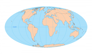
27. Mollweide
Equal-area, elliptical, good for global maps.
28. Natural Earth
Compromise projection, smooth and readable.
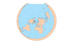
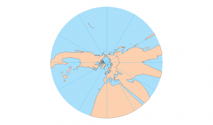
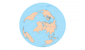
29. North Pole Gnomonic
Straight great circles from pole.
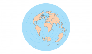
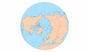
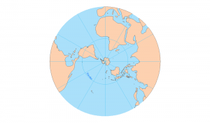
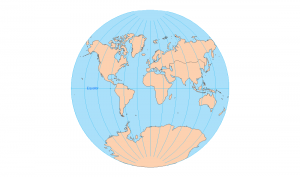
30. North Pole Lambert Azimuthal Equal Area
Equal-area, centered on North Pole.
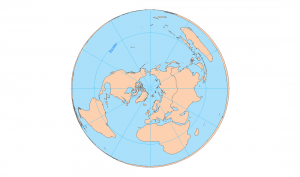
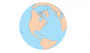
31. North Pole Orthographic
Earth from space, North Pole view.
32. NSIDC EASE Grid Global
Typically for satellite data visualization.
33. Patterson
Compromise projection, smooth with reduced distortion.
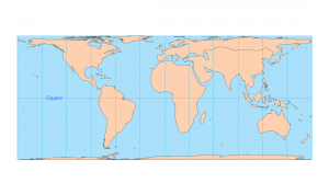
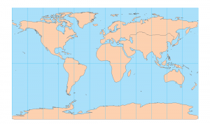
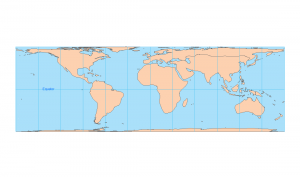
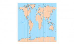
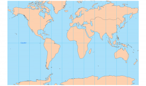
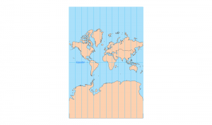
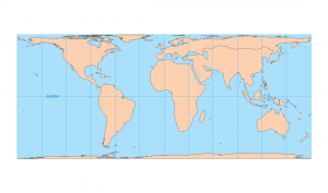
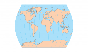
34. Plate Carée
Simple grid, equidistant cylindrical.
35. Polyconic
Multiple cones, good for U.S. maps.
36. Quartic Authalic
Equal-area with curved sides.
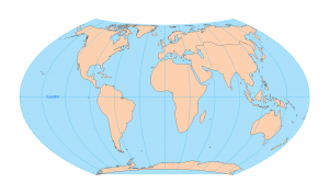
37. Robinson
Compromise, visually pleasing, rounded edges.
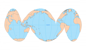
38. Sinusoidal
Equal-area, meridians curve inward.
39. South Pole Azimuthal Equidistant
Preserves distance from South Pole.
40. South Pole Stereographic
Conformal, centered on South Pole.
41. Earth from Space
Orthographic view, realistic Earth appearance.
42. Stereographic
Conformal, circles stay circles.
43. Times
Modified Robinson, visually balanced globe.
44. Two-point Equidistant
Preserves distances from two points.
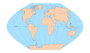
45. Van der Grinten
Circular world, distorts shapes.
46. Vertical Perspective
Like a satellite image view.
47. Wagner
Equal-area, smooth compromise projection.
48. Wagner-2
Variant with slightly altered curvature.
49. Winkel-1
Average of equirectangular and azimuthal.
50. Winkel Tripel
Balanced distortion, popular for world maps.
Types of Map Projections
Now that you have an arsenal of map projections, it’s time to put what you know into action.
Take a fresh approach to your next map…
Because there’s nothing quite like creating a work of art.
So which map projection suits your needs most?
Additional Resources
Here are some more helpful references for map projection types:
- What are Map Projections?
- Map Distortion with Tissot’s Indicatrix
- Cylindrical Projection: Mercator, Transverse Mercator, and Miller
- Conic Projection: Lambert, Albers, and Polyconic
- Azimuthal Projection: Orthographic, Stereographic, and Gnomonic
What’s your favorite map projection and why? Please let us know in the comment section below.


My favorite map projection is the Bonne one. This map projection perfectly preserves size(area) but significantly distorts shape and distance away from its primary lines of reference. The reason I like it because is because its in the shape of a lotus leaf which is cool.
Vertical perspective
I liked the Berghaus star map.
I like space and vertical the most, they look 3d and I like 3d things.
I picked Gall stereographic because it is flat and easier to tell otherwise I would keep having to turn it around so that is why I picked the flat one.
I like the shape of the Compact Miller because it’s basic
Imagine trying to navigate the ocean with the fuller LoL
I would’ve liked a map that flipped the placement of the Americas with the placement of Europe, Asia, and Africa. Otherwise, these were super interetsing.
No Peters Projection?
Great collection! How about Equal Earth and Spillhaus? Makes a round 52, “A map a week keeps the cobwebs away”
Hellooo George, I recognise your virtual cv LOL
For learning, it is never too late. I feel like a child who got a doll to play with. Looking at maps is my favourite hobby, feel that this site information will enhance my interest and knowledge.
Wow! I didn’t know half of those!
This is an interesting collection. I think it adds about 40 to the number of variants that I delt with over 30 years and schools in Alberta, Queensland, West Autralia and university Geography departments in Minnesota and Washington State.
However I was introduced to the one I liked most in 1957. It was a book that displayed great circle portions of the world. It came from WW2 Strategic Bombing planning.
It gave a perspective that gave meaning to the curvature of the earth.