Baltimore Zip Code Map
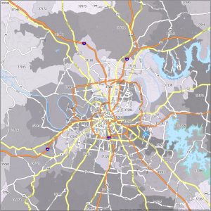
Our map of Baltimore zip codes shows not only zip codes but also overlays them with interstate highways as a top layer.
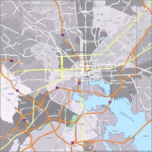
Our map of Baltimore zip codes shows not only zip codes but also overlays them with interstate highways as a top layer.
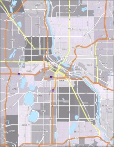
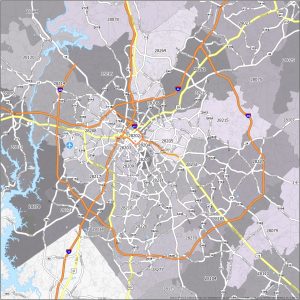
Provided in this article is a Minneapolis zip code map that not only displays various postal regions but also interstate highways in the city.
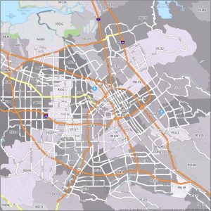
This thematic and color-coded map highlights the interstate highways and distinct postal regions in the city of San Jose, California.
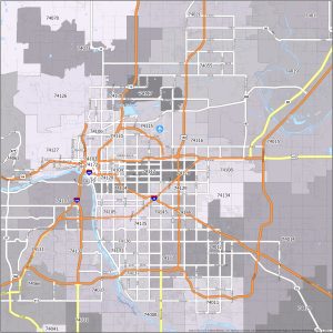
Welcome to our Tulsa zip code map. You’ll find a detailed visual of the interstate highways and postal regions in Tulsa, Oklahoma.
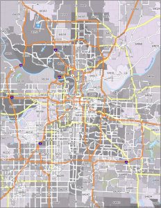
Welcome to our Kansas City zip code map. You will find a visual representation of the city’s postal regions and interstate highways.
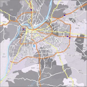
Presented in this article is a color-coded zip code map of Louisville, delineated postal regions, and its network of interstate highways.
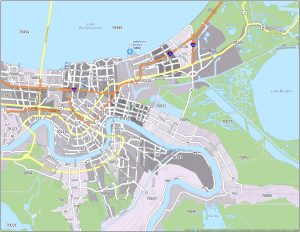
Displayed in this article is a zip code map of New Orleans, which highlights the interstate highways and postal regions within the city.
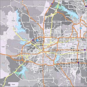
Presented below is a thematic Fort Worth zip code map, containing the interstate highways and postal regions in the area.
Displayed here is a zip code map of Nashville, featuring the interstate highways and postal regions that encompass the city.
Presented here is a thematic map of Charlotte’s zip codes, highlighting both the interstate highways and postal regions within the city.