Fishnets in GIS: An Overview
GIS supports various ways to explore spatial relationships. Among these, fishnets stand out for their utility in spatial analysis.
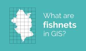
GIS supports various ways to explore spatial relationships. Among these, fishnets stand out for their utility in spatial analysis.
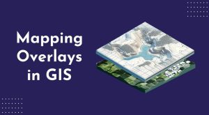
Mapping overlays in GIS work like stacking different layers on top of each other. Each layer represents a different data type.
Finding self-overlaps in GIS involves identifying areas within a single feature geometry where the geometry intersects itself.

The Periodic Table for Spatial Analysis lists 90 tools for quantifying, finding patterns, and predicting outcomes in a geographic context.

There are countless ways you can slice, dice and edit data in GIS. That’s why we’ve created this visual guide with the GIS editing tools.
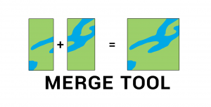
The Merge Tool combines data from multiple sources and puts them into a new data set with the same shape type (points, lines, or polygons).
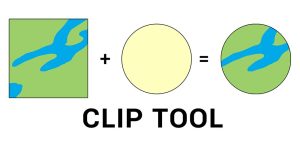
The clip tool cuts out an input layer to a defined feature boundary. Like a cookie-cutter, the output is a new clipped data output and subset.
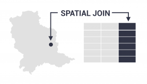
The spatial join tool inserts the columns from one feature table to another based on location or proximity. It can affix one or many fields to the target.
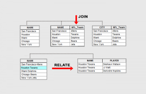
Join appends attributes to a table commonly used for 1-1 table relationships. Relate creates a temporary table for all matching records.
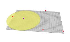
The buffer tool (planar/geodesic) generates a polygon around features at a set distance. Here are ring, geodesic & euclidean buffers.