How To Find Self-Overlaps in GIS
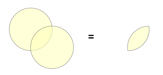
Are you looking to find self-overlaps in GIS? Self-overlaps (self-intersections) are areas where a single feature geometry intersects itself.
One way to do this is by using the Intersect Tool. It’s a bit counterintuitive, as the “Intersect” tool is typically used to find intersections between two or more different layers.
In this article, you’ll learn how to find self-overlaps in ArcGIS Pro.
Self-intersects for topology fixing
When you edit data, if you don’t snap, trace, and follow the edges of other polygons, you can create overlapping polygons.
If you want to check for self-intersects in your data, then you can run the Intersect Tool with just a single layer. The output will be all of the overlapping polygons in your data.
From here, you can automatically see where you can manually fix digitizing errors. Also, you can run topology checks and try fixing them automatically.
Remember that it’s always good practice to check for overlaps before you calculate an area. This is especially true if you create a pivot table to summarize areas because you don’t want to double-count any areas.
How to Find Self-Overlaps in ArcGIS
As already mentioned, you have to use the Intersect Tool to perform self-overlaps.
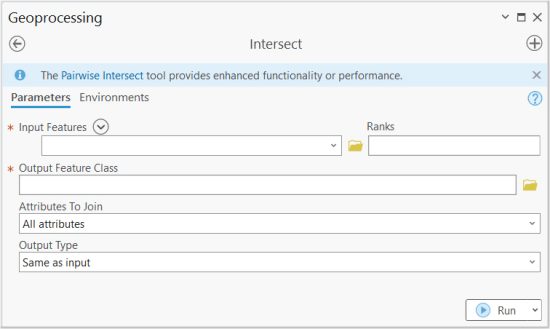
In ArcGIS and ArcGIS Pro, the Intersect Tool is part of the “Analysis Toolbox” and within the “Overlay Toolset”.
It’s a very basic tool in which you add layers that you want to intersect.
You also set the ranks for how attributes will be ordered in the output feature. And of course, you determine the location and name of the output feature class that you want to write.
How to Run an Intersect in QGIS
For QGIS 3, you can find it in the Vector | Geoprocessing Tool | Intersection.
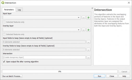
In both GIS software, the main entries are its inputs and output. But in ArcGIS, you can specify the output type as points, lines, and polygons.
In QGIS, you can set if you want to use selected features and if you want to create a temporary output layer.
Summary: Finding Self-Overlaps
Identifying self-overlaps in GIS is an important step to ensure data accuracy.
By detecting overlapping areas, GIS professionals can eliminate errors that might lead to inaccuracies.
The process involves using the “Intersect Tool”, where users can find self-overlapping features.


Many thanks, that was exactly what I was looking for.