RADARSAT Constellation Mission (RCM)
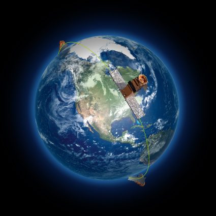
The RADARSAT Constellation Mission consists of three satellites orbiting Earth. Using advanced radar technology, these satellites can see through clouds and darkness. This is crucial for keeping an eye on Canada’s vast territories and coastal areas.
RCM Applications and Uses
The RADARSAT Constellation Mission has many important roles. Here are some key ones:
- Watching over the environment: It checks on forests, lakes, and changes in the land. This helps us keep track of how nature is doing.
- Managing disasters: It monitors natural disasters like floods, earthquakes, or oil spills. If needed, it can improve in rescuing or saving lives.
- Monitoring ice: This is especially important in the Arctic for maritime surveillance. Checking how ice changes helps ships navigate safely.
- Farming insights: It looks at crops and soil moisture. Helps farmers know when to plant and water.
- Guarding the coast: It watches the seas for ships and oil spills. This keeps our oceans safe and clean.
- Mapping changes: It can see how land shifts after earthquakes. Understanding ground movement is useful for planning.
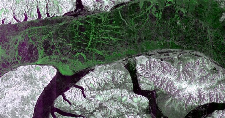
The major advantage of synthetic aperture radar is that it works day and night, even through clouds. This makes RCM a reliable source of satellite data, no matter the conditions.
RCM Instruments and Modes
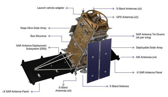
The RADARSAT Constellation Mission satellites are equipped with Synthetic Aperture Radar (SAR). It sends out signals to the ground at an angle. Then, it captures how the reflection bounces back. This is how RCM can create detailed images of Earth’s surface.
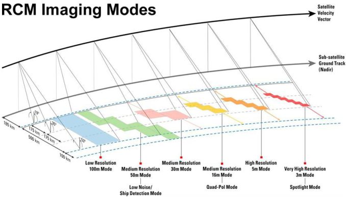
The RCM satellites have several modes. Each is designed for different tasks. Here’s a breakdown:
- Spotlight Mode: This mode gives the highest resolution images of a small area. This is great for detailed looks at specific spots on Earth with a 3m resolution.
- Stripmap Mode: For a balance between resolution and coverage area, this mode is good for mapping medium-sized areas. These options include very high resolution (3m, high resolution (5m) and medium resolution (16m).
- ScanSAR Mode: this mode covers large areas with lower resolution. It’s useful for observing environmental changes over vast regions. For instance, this includes deforestation and ice coverage. The options are medium resolution (50m) and low resolution (100m).
- Maritime Mode: Specially, this mode is designed to monitor marine environments. The main aim is to help detect ships and track oil spills.
Remote sensing analysts choose each mode based on their needs. For example, if we’re looking at icebergs or ships in the ocean, StripMap Mode is perfect. But if you need a detailed view of a specific place, Spotlight Mode is the way to go.
Is RCM Data Available to the Public?
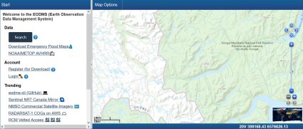
Yes, RADARSAT Constellation Mission (RCM) data is available to the public, but with some conditions. The Canadian Space Agency (CSA) provides access to satellite data for various uses. Sample data is already available on the Earth Observation Data Management System (EODMS).
However, access to this data might require users to go through an application process. This includes research, environmental monitoring, and educational purposes. In some cases, there could be restrictions based on the intended use or the sensitivity of the data.
For researchers, this data is a goldmine for studying climate change, natural disasters, and more. Governments and private entities also use it for planning and monitoring purposes.
What is the difference between RCM and RADARSAT?
The RADARSAT Constellation Mission (RCM) and the original RADARSAT missions (like RADARSAT-1 and RADARSAT-2) are all part of Canada’s efforts to monitor Earth using radar satellites. However, there are key differences between them:
- Number of Satellites: RCM uses a constellation of three satellites. Whereas RADARSAT-1 and RADARSAT-2 were single satellites. This means RCM can cover more area more frequently.
- Technology and Capabilities: RCM satellites are equipped with the latest C-band SAR technology. It offers improvements in data collection as it can collect 250,000 images per year. This is 50 times more than its predecessors.
- Data Collection and Coverage: With three satellites, RCM provides more frequent coverage of the world. It revisits the same spot every 12 days. Plus, they can capture images in multiple modes for a wide range of applications.
- Mission Objectives: While both RADARSAT and RCM focus on Earth observation, RCM’s design allows for enhanced monitoring. This includes marine environments, ice, and weather conditions. In addition, it provides critical data for agriculture (like soil moisture), forestry, and disaster management.
So, while RADARSAT laid the groundwork for Canada’s space-based radar capabilities, RCM builds on that legacy. Its technology is more advanced with broader objectives. Here’s a comparison of RCM vs RADARSAT 1 & 2.
Conclusion
The RADARSAT Constellation Mission (RCM) is a significant leap forward in Earth observation. Equipped with cutting-edge technology, the RCM provides timely information about our planet.
Regardless of weather conditions or time of day, the RCM mission is like having a powerful trio of guardians watching over Earth.
Are you a RADARSAT or RCM user? We’d love to hear from you. Please add your questions and comments below.
The 50 Most Influential Satellites in Remote Sensing
How GPS Receivers Work – Trilateration vs Triangulation
What is NDVI (Normalized Difference Vegetation Index)?
What is Remote Sensing? The Definitive Guide
A Complete Guide to LiDAR: Light Detection and Ranging
100 Earth Shattering Remote Sensing Applications & Uses
OBIA – Object-Based Image Analysis (GEOBIA)
Image Classification Techniques in Remote Sensing [Infographic]