7 Top UFO Sighting Maps
Trying to spot a UFO? Look no further. Our list of 7 UFO sighting maps provides you with a glimpse into the world of unidentified flying objects. Each one brings its own unique cosmic cartography.
1. Esri’s UFO Sightings Map
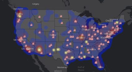
Esri’s UFO sightings map contains 80,000+ observations from 1910 and 2014. But the neat thing is that it’s an actual heat map so you can see hot and cold spots.
The symbology displays the following two types of observations:
It’s also possible to control the map by time frame and find the UFO sightings that are nearest to you. This map taps into the NUFORC UFO sightings dataset published on Kaggle and is limited to the United States.
2. Carto’s UFO Sighting Map
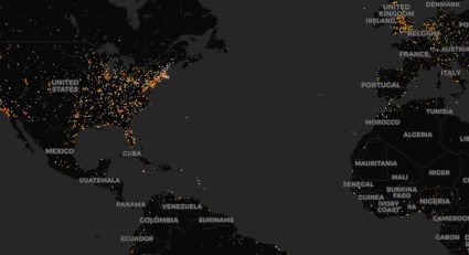
Carto’s UFO sighting map brings together unidentified aerial phenomena in a simplistic way. This global UFO sighting map symbolizes extraterrestrial encounters based on if they are in a populated area or not:
By using this map, you can understand the frequency and distribution of UFO sightings within and outside human settlements.
3. Metrocosm’s Global UFO Sightings Map
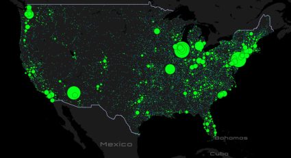
Metrocosm is an oldie but a goodie. In this UFO sightings map, it splits UFO sightings into the number of witnesses:
Based on data from the National UFO Reporting Center, Metrocosm’s UFO sightings display nearly 100,000 from around the globe.
4. History’s UFO Sightings (Taken Seriously)
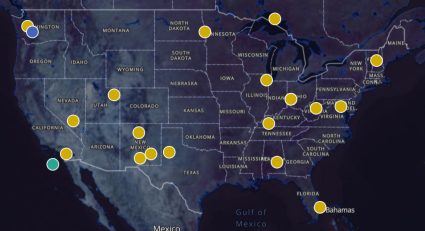
Not all UFO sightings are taken seriously. That’s what this map is here to show you. But the main goal is to determine whether any posed a national security threat. This map divides UFO sightings into the following groups.
- Project Blue Book – A small, top-secret US Air Force team for studying unidentified flying objects from 1952 to 1969
- Unidentified
- Other Sightings
Make sure to click around the map to get a backstory of each observation.
5. YouMap’s UFO Sightings with Videos
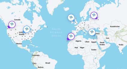
What I like most about this crowdsourced UFO sightings map is how it combines eyewitness videos as evidence for each point. But it’s not for all the points – just those that the public submitted.
YouMap’s UFO sightings map allows you to explore a vast collection of UFO footage from around the globe.
6. CartoVista’s UFO Sighting Map
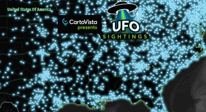
Although CartoVista’s UFO sighting map is a bit hard to control, it’s much more of a statistics-oriented web map.
One of the neatest things about this map is how it classifies each UFO sighting into 5 shapes (circle, fireball, light, sphere, triangle).
You also get information on the length of the encounter, city, description, date, and time. Finally, you can also build some handy charts like pie charts, line graphs, and area charts based on the data you select.
7. Google Maps
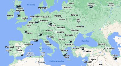
This UFO Google map is a little rough around the edges. The reason I say that is because you don’t have much background information on the data sources for the map.
You only get a map with the listings of the city where the UFO sighting occurs. But overall, it visually documents and maps out reported UFO sightings globally.
List of UFO Sighting Maps
The exploration of extraterrestrial phenomena has always fascinated us. This list of 7 UFO sighting maps has provided us with a glimpse into the world of unidentified flying objects.
These maps have not only showcased the global reach of UFO sightings. But they’ve also revealed hotspots for these mysterious objects in the sky.
Do you have any questions about these UFO sightings maps? We’d love to hear from you. Please get back to us with a question or comment below.


