10 Topographic Maps From Around the World
10 Topographic Maps From Around the World
There’s no “world authority” in topographic maps. Instead, each country sets its own standards and priorities.
Here’s the twist: technology organizations are revolutionizing it all with global topographic maps of their own.
But as landscapes evolve and technology advances, topographers face an uphill battle for accuracy and completeness.
This is one of the major challenges we see all the time in topographic maps.
Nevertheless, these are the top 10 topographic maps from authoritative sources from around the world.
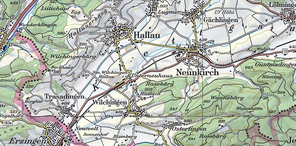
1. OpenTopoMap
OpenTopoMap is the largest crowd-sourced topographic map project in the world. It piggybacks on the open SRTM elevation and OpenStreetMap (OSM) databases.
For those who don’t know, OSM is like the Wikipedia of maps. It’s constantly getting updated by the largest community of mappers in the world capturing our changing planet.
Not only does it produce a classic style topographic map for general use, but it also provides specialty purpose maps. For example, OpenTopoMap has topographic maps for cyclists, hikers, and wheelchair users.
2. Esri World Topography
Esri World Topography is the all-encompassing, all-purpose world topography layer. On top of this, Esri has designed these reference maps keeping the world in mind.
For example, Esri’s World Topographic Map is a mashup of a range of features. It includes everything from water features to landmarks and transportation. All features are overlaid on shaded relief imagery.
As part of Esri’s Living Atlas of the World, the World Topography layer is just one of many. This evolving collection from authoritative sources is ready to use at a range of scales. Also, check out the Topo Map Explorer that’s part of Esri’s Living Atlas of the World.
READ MORE: The Living Atlas of the World by Esri
3. Google Terrain
There’s one remaining source of world topographic maps that we haven’t discussed. And it may be the most powerful and most updated source of all.
Google Maps is the go-to app for navigation and traffic information. Over time, it has become a global leader in location intelligence.
Once you flick the terrain switch to “on”, suddenly global topography comes to life. It becomes obvious how high mountains rise and how steep valleys descend.
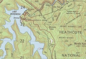
4. United States Geological Survey (USGS)
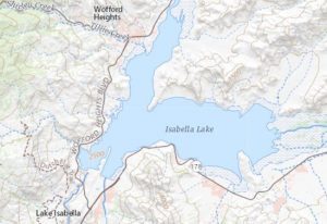
Since 1884, the goal of USGS topo maps has been to display the complex, changing geography of the United States.
These general-use maps include everything from hydrography to place names and contour lines.
You can download current and historical topographic maps from USGS TopoView and the TNM Viewer. In fact, we have a guide to show you how to download free USGS Topo Maps because it’s not always an easy process.
5. Ordnance Survey (OS)
The Ordnance Survey (OS) is Britain’s mapping agency. It maintains the most detailed topographic maps of the United Kingdom.
The default interactive topographic map is the OS map. But there’s more:
For example, OS MasterMap Topography Layer marks out fences, paths and building heights. But these detailed topographic maps come with a cost.
6. German Federal Center for Geoinformation and Geodesy
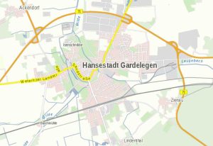
At 1:250,000, 1:500,000 and 1:1 million scales, Digital Topographic Maps (DTK) of Germany are available and suitable for printing.
As part of its open data program, each tile is saved as an image and World File to give them real-world coordinates.
WebAtlasDE is a nationwide interactive topographic map of Germany. In color and grey, it’s updated on an annual basis.
7. Natural Resources Canada (NRCan)
Canada’s National Topographic System (NTS) Maps are set at 1:50,000 and 1:250,000 scales. They display landforms, drainage, forest cover, populated areas, roads, and railways.
Along with a range of geospatial data, these topographic products are available through Canada’s Open Data Portal.
Toporama is a legacy raster product available on the Natural Resources Canada website. If you simply want to view Canada’s Toporama, go to the Atlas of Canada interactive topographic map.
8. Swiss Topo
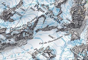
The Swiss Federal Office of Topography (SwissTopo) is world-renowned for its accuracy, quality and artistry. In the SwissTopo portal, you can explore their collections of topographic maps at a range of scales.
For example, their Journey Through Time maps compare Switzerland dating back to 1864. It incorporates the classic hillshade techniques patented by Swiss cartographer, Eduard Imhof.
9. France
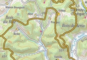
At 1:25,000 and 1:50,000, users can view topographic maps of France built by the Institut Géographique National (IGN). Their Géoportail portal hosts their topographic map series which are all accessible for free online.
For example, you can view their topographic maps with both classical contours as well as in a 3D perspective. Also notable is how you can go back in time back time in their historical interactive map.
10. Geosciences Australia
The National Topographic Map Series (NTMS) is the Australian Government’s national mapping agency. They publish topographic maps available for 1:50,000, 1:100,000, 1:250,000, and 1:1 million scale.
These map products are available for download on the Australian Geosciences government website. Just select a tile to download and view them as a PDF or image file.
The data behind the maps
Elevation is the common theme in every topographic map. In GIS, we use Digital Elevation Models (DEM) to display relief. And the best part about elevation data is the abundance of free data sources. It just depends on the scale you need.
For coarse resolution (30-meter cell spacing), we recommend NASA’s Shuttle Radar Topography Mission (SRTM). For easy access, it’s publically available on the USGS Earth Explorer.
If SRTM is too coarse, then check out our list of the top 6 free LiDAR data sources in the world.
Finally, if you’re looking for ocean bathymetry, GEBCO is your best available source.
Conclusion
Today, we’ve explored 10 topographic maps from authoritative sources around the world.
For all these examples, the process of creating them was time-consuming and complex.
Surveyors, geographers, and subject-matter experts were heavily involved to validate and verify.
What are some of the topographic maps that we missed? Please let us know with a comment below.


https://basemap.de/ recent project Germany.
https://map5topo.nl – Netherlands, using various Dutch Gov. datasets, including 50cm DEM! + OSM (mainly roads).
I wanted to see topographic maps of the world to see climate change, then political, then social aspects of the world. Glad to read your pointing out their changing aspects.
To add to the list: https://www.topotijdreis.nl – it is a real gem as it allows to slide through Dutch topographic maps backward in time.
unfortunately, link not responding
I just checked all the links, and they’re working ok for me
New Zealand also has great topo maps online https://www.topomap.co.nz
Another helpful collation, thank you GISGeography
You missed the Dutch OpenTopo. It may not be spectacular due to lack of mountains in the Netherlands and it shows you exactly why the Dutch are world class in open data and data accessibility – Open Topo NL