GIS Online Certificate: Charting a Course in GIS
Imagine you can earn a GIS online certificate at some of the best institutes in the world without leaving your country… or even the comfort of your own home.
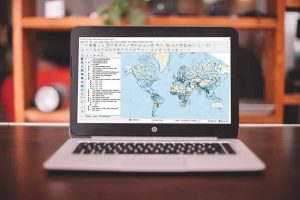
Imagine you can earn a GIS online certificate at some of the best institutes in the world without leaving your country… or even the comfort of your own home.
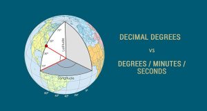
We can find any location on Earth using latitude and longitude coordinates. And we measure those coordinates with decimal degrees or degrees/minutes/seconds
If your letters and words are all uppercase or lowercase in a field, and you want to capitalize the first letter of each word, use this Python code block.
When selective availability was enabled, this added 50 meters of error horizontally and 100 meters vertically to GPS signals.

The Greenwich Meridian (or Prime Meridian) is a zero degrees longitudinal It is the start-point which we measure 180 degrees east and west.

From A to Z, we deliver stunning visualizations and meanings with the GIS Dictionary – Definition Glossary. Sharpen your skills with new GIS terminology.
Dark object subtraction, radiative transfer models and atmospheric modelling are common techniques used to for atmosphere correction in remote sensing.
5 Halloween Maps. Almost all cultures recognize spirits aka the dead. So we bring these 5 maps for the dead to get you in the spirit of Halloween.

The best way to represent the Earth is with a globe. But map projections can be awfully useful too. Find out why cartographers use map projections in GIS.
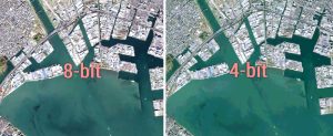
Bit depth is the amount of detail in each pixel expressed in units of bits. 1-bit rasters contain 2 values while 8-bit rasters range from 0-255