What Is Selective Availability in GPS?

What is selective availability?
What is Selective Availability? Selective availability is the intentional degradation of GPS signals.
When selective availability was enabled, this added 50 meters of error horizontally and 100 meters vertically to GPS signals.
Before May 2000, the United States government added this time-varying obfuscated code to all civilian GPS signals.
However, authorized groups like the US military and allies could access the second GPS signal for better accuracy.
Why was selective availability turned on?
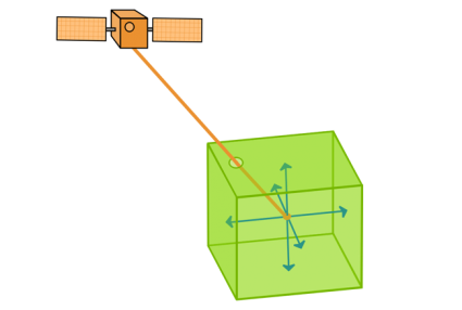
As you may already know, GPS uses trilateration to pinpoint positions on Earth. Ideally, a GPS receiver needs a minimum of 4 signals from GPS satellites orbiting the Earth.
Then, it records GPS positions in latitude and longitude coordinates. Finally, these positions use the World Geodetic System as a reference model.
In 1983, the United States invented the very first Global Positioning System (Navstar GPS). Even though Ronald Reagan promised civilians could use it, he limited its usage with selective availability. And up until May 2000, this assured the US military an advantage.
However, after May 2000, Bill Clinton eliminated selective availability because of the advent of newer technologies. For example, differential GPS was able to correct for more precise positioning. And to this day, the US Department of National Defense maintains the GPS system without selective availability. As a result, this source of GPS error is no longer a concern.
What are other Global Positioning Systems?
Not only does the United States have GPS systems, but India, Russia, and China have also developed their own. But these systems didn’t meet the same level of global coverage as the US until about a decade later.
India just recently finished theirs in 2016 and only covers India and its surrounding area. Russia’s GPS system (GLONASS) has global coverage and is a bit more accurate at about 2.6 meters.
It just goes to show how vital GPS is to the security of some nations. For example, fields like navigation, military, and surveying use GPS routinely every day. For example, here are the top GPS apps for navigation.
But what is truly the best part of GPS?
It’s a fact that every country can access GPS free of charge. And ever since the removal of selective availability, the quality of GPS signals has significantly improved.


“Then, it records GPS position in latitude and longitude coordinates.”
And altitude.
You wrote “In 1983, the United States invented the very first Global Positioning System (Navstar GPS).” Aside from the fact that the system was not “invented” but developed, 1983 is ten years after the system design was completed and five years after the launch of the first GPS satellite. Also, “other global positioning systems,” which are called global navigation satellite systems (GNSS), include the European Galileo and the Chinese BeiDou, which you fail to mention.
Best, Matteo Luccio, Editor-in-Chief, GPS World
Do you recommend the use of handheld GNSS receivers for cadastral surveying?