NAD83 – We’re Not in Kansas Anymore
North American Datum of 1983 (NAD83)
The North American Datum of 1983 (NAD83) uses thousands of survey monuments and triangulation to create a reference frame for Earth.
This reference frame allows surveyors, geodesists, and cartographers to accurately map out locations on Earth with latitude and longitude locations.
The North American Datum of 1983 corrected some of the distortions in the dated NAD27.
On top of that, NAD83 has undergone several updates since 1986 like HARN, HPGN, CSRS, CACS, and CORS. Here’s everything you need to know about the North American Datum of 1983.
A Mammoth Collection of Survey Benchmarks
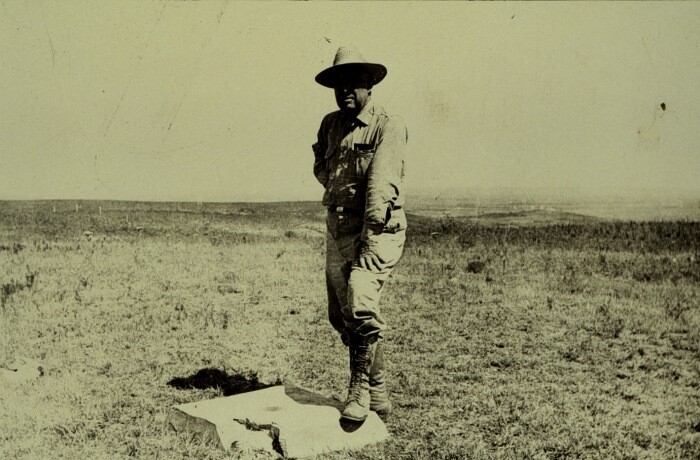
In the late 1800s, a mammoth collection of monument locations (survey benchmarks) began. Surveyors installed precise latitude and longitude brass monuments into the ground
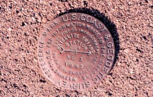
You can see station #4 here:
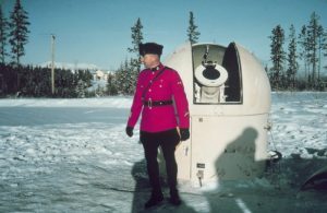
Finally, here’s station #109 in Yukon, Canada:
Mathematicians used triangulation to connect survey monuments which was the basis of the horizontal datum that still exists today.
The result of triangulation from the unified network of survey monuments was the North American Datum of 1927 (NAD27) and later the more accurate NAD83, which is still used today. These horizontal datums provide a frame of reference for latitude and longitude locations on Earth.
We’re Not in Kansas Anymore
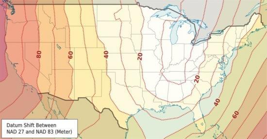
Cartographers created maps using different datums and starting points in the past. For example, the North American Datum of 1927 used Kansas as a starting point. We are continuously improving horizontal datums even today.
NAD27 uses the Clarke Ellipsoid of 1866 with a fixed latitude and longitude at Meade’s Ranch, Kansas (39°13’26.686″ north latitude, 98° 32’30.506″ west longitude).
This means that all points in North America used this fixed point as a reference for measuring direction and distance away.
We can measure all latitudes and longitudes based on the Clarke Ellipsoid of 1866. The North American datum of 1983 (NAD83) changed all of this and became a successor to NAD27.
Geodetic Datums: NAD83 versus NAD27
One of the main differences is that NAD83 is a geocentric datum. Geocentric means that it is referenced to the center of Earth’s mass. This is very different from being referenced to a location on Earth such as Meade’s Ranch.
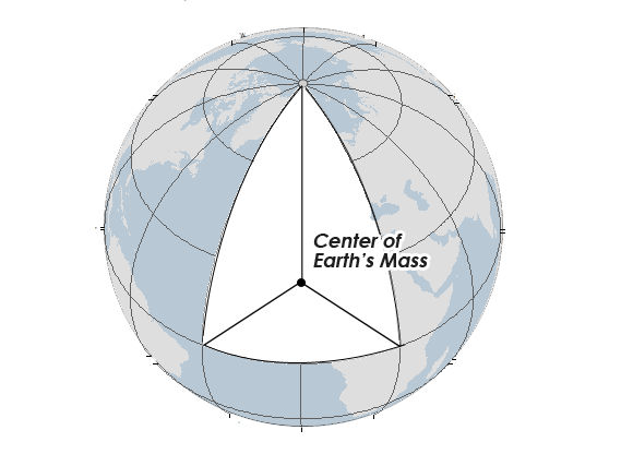
Although it’s a geocentric datum, we still believe it to be offset by about 2 meters. Even today, we are continuously improving datums.
North American Datum of 1983 is based on the reference ellipsoid GRS80 which is physically larger than NAD27’s Clarke ellipsoid.
The GRS80 reference ellipsoid has a semi-major axis of 6,378,137.0 meters and a semi-minor axis of 6,356,752.3 meters. This compares to the Clarke ellipsoid with a semi-major axis of 6,378,206.4 m and a semi-minor axis of 6,356,583.8 meters.
The North American Datum of 1983 (NAD83) is the most current datum in North America. It provides latitude and longitude and some height information using the reference ellipsoid GRS80.
NAD83 corrects some of the distortions from NAD27 over distance by using a more dense set of positions from terrestrial and Doppler satellite data. The National Geodetic Survey relied heavily on the use of the Doppler satellite to locate the Earth’s center of mass.
Surveyors and geodesists used approximately 250,000 stations to develop the NAD83 datum. This compares to only 26,000 used in the NAD27 datum.
One Datum with Many Versions and Abbreviations
NAD83 has undergone several updates since 1986. There are several versions of NAD83. For example, the National Geodetic Survey has adjusted the NAD83 datum four times since the original geodetic datum estimation in 1986:
- NAD83 (1986): This version was intended to be geocentric and used the GRS80 ellipsoid.
- NAD83 (1991, HARN, HPGN): High Accuracy Reference Network (HARN) and High Precision Geodetic Network reworked geodetic datums from 1986 to 1997
- NAD 83 (CORS96): Continually Operating Reference Stations (CORS) consists of permanently operating Global Positioning System (GPS) receivers
- NAD83 (CSRS, CACS): Canadian Spatial Reference System and Canadian Active Control System with GPS processing.
- NAD83 (NSRS 2007, 2011): National Spatial Reference System and current survey standard using multi-year adjusted locations based on GNSS from the CORS.
What’s Next? A New Horizontal Datum in 2022
Surveyors, mappers, and anyone in the geography profession use NAD27, NAD83, and WGS84 as geodetic datums in North America.
Surveyors now rely almost exclusively on the Global Positioning System (GPS) to identify locations on the Earth and incorporate them into existing geodetic datums.
The National Geodetic Survey has already indicated that it will be replacing NAVD88 and NAD83 in 2022 – because it is non-geocentric by about 2.2 meters.
The new reference frames (geometric and geopotential) will rely on primarily Global Navigation Satellite Systems (GNSS) such as the Global Positioning System (GPS) as well as an updated and time-tracked geoid model.
References
Image Credit: National Geodetic Survey Explorer


hello .. found us coast and Geodetic Survey mark …. did 1933 … MID. NO 3 …. where is it from … tnx
Rockin Greg
Cool information to read
Excellent summary, Thanks!