5 Live Satellite Maps to See Earth in Real-Time
From near real-time satellite views to live feeds, this article aims at showing you how to view a live satellite map of the world.
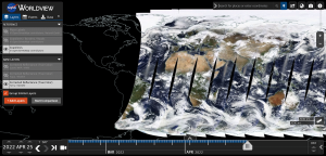
From near real-time satellite views to live feeds, this article aims at showing you how to view a live satellite map of the world.
Whether you want to improve cartography, database administration, or develop location apps, there are tons of free GIS training resources.

If you’re new to HERE WeGo Maps, this guide will help you get started with the app, API, and other ways that you can use HERE WeGo Maps.
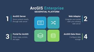
ArcGIS Enterprise is a back-end software that allows you to control how to implement web GIS and serve spatial data across an organization.
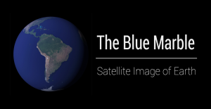
This article explains the 5 versions of the Blue Marble (Apollo 17 was the first) and how you can download each NASA satellite image of Earth.
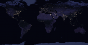
By stitching 400+ images from space, NASA’s Black Marble (Earth at Night) map the most comprehensive night view using Suomi NPP imagery.

Esri Certification is a new type of exam qualification which is meant to validate your proficiency with Esri-related software applications.

GISP Certification is a recognized credential that sets the benchmark for skills in the geographic information systems technology field.
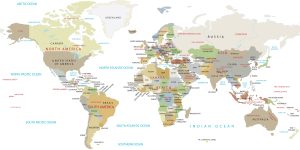
This is a world map showing the various countries, continents, and other locations around the world – meant to serve as a reference guide.
ArcGIS Drone2Map allows you to streamline your data collection with drones by providing a robust set of tools and automated workflows.