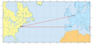
Why Are Rhumb Lines (Loxodromes) a Constant Track Direction?
Rhumb lines (or loxodrome) have constant bearings and cross all meridians at the same angle. They are not the shortest distance between 2 points on a sphere
Rhumb lines (or loxodrome) have constant bearings and cross all meridians at the same angle. They are not the shortest distance between 2 points on a sphere

Remote sensing is the science of obtaining information without physically being there. The 3 most common methods of capture is airplane, satellite & drones.

In the case of a semi-variogram, closer things have less variability and are similar. While things farther away are less predictable and are less related.
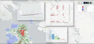
While not necessarily your prototype GIS package, GeoDa carries exciting analytical & visualization tools in industries like economics, health & real estate
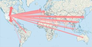
Cartographers use lines to show the movement of phenomenon in flow maps. To show the magnitude, they change the width of flow lines.
Rasterization converts vectors into rasters. While vectorization transforms rasters in vectors. We explain how to go from one data model to the other.
TerraPop delivers internationally comparable environment and demographic data at a global scale – this includes raster, area-level and micro-data.
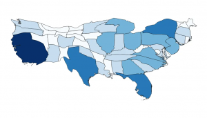
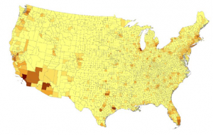
Cartogram maps distorts reality to convey information. It accomplishes this by resizing and exaggerating any variable using a polygons geometry.
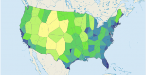
In a Voronoi Diagram, when you take a point in any given Thiessen polygon, it indicates that it’s closer to that generating point than to any other.
Lossless compression (like JPEG) retains values and lowers file size. However, lossy compression (like LZ77) reduces file size by eliminating redundancy.