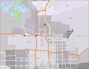
Austin Texas Zip Code Map
Here is our Austin, Texas zip code map. This map highlights the distinct zip codes that define each area for postal receiving and delivery.
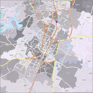
Here is our Austin, Texas zip code map. This map highlights the distinct zip codes that define each area for postal receiving and delivery.
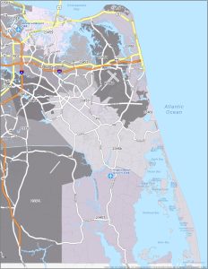
This article provides a color-coded, thematic Virginia Beach zip code map. This map contains the unique zip codes that define the city.
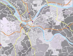
Our Pittsburgh zip code map is your essential guide to the diverse postal regions of the “Steel City”, including its transportation network.
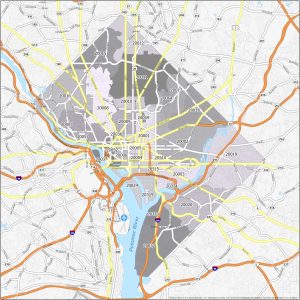
This article provides a Washington DC zip code map, which is a valuable tool for anyone in the nation’s capital looking for postal regions.
Are you in search of a Salt Lake City zip code map? You can download our Salt Lake City zip code map for free download (for personal use).
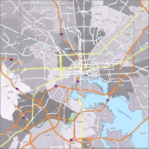
Our map of Baltimore zip codes shows not only zip codes but also overlays them with interstate highways as a top layer.
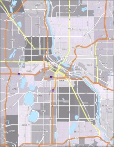
Provided in this article is a Minneapolis zip code map that not only displays various postal regions but also interstate highways in the city.
This thematic and color-coded map highlights the interstate highways and distinct postal regions in the city of San Jose, California.
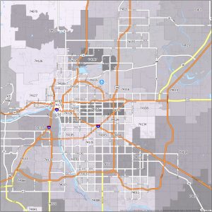
Welcome to our Tulsa zip code map. You’ll find a detailed visual of the interstate highways and postal regions in Tulsa, Oklahoma.
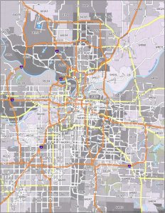
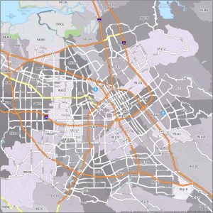
Welcome to our Kansas City zip code map. You will find a visual representation of the city’s postal regions and interstate highways.