Canberra Map, Australia
Canberra Map
Use this map of Canberra to start your adventure in the capital city of Australia.
Our map collection includes a road map, a neighborhood map, and a list of things to do.
Download and print our free map of Canberra (including the Queanbeyan part) so you can get the most out of your trip.
Jump To: Interactive Map | Printable Road Map | 10 Things to Do | Reference Map
Canberra map collection
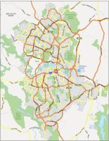
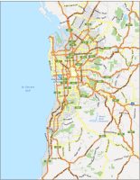
Interactive Map of Canberra
Find all the latest information using this interactive map. You’ll be able to see Canberra’s surrounding nature and mountains. Also, check out its culturally significant attractions which include the Australian War Museum and the Royal Australian Mint.
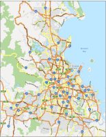
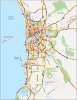
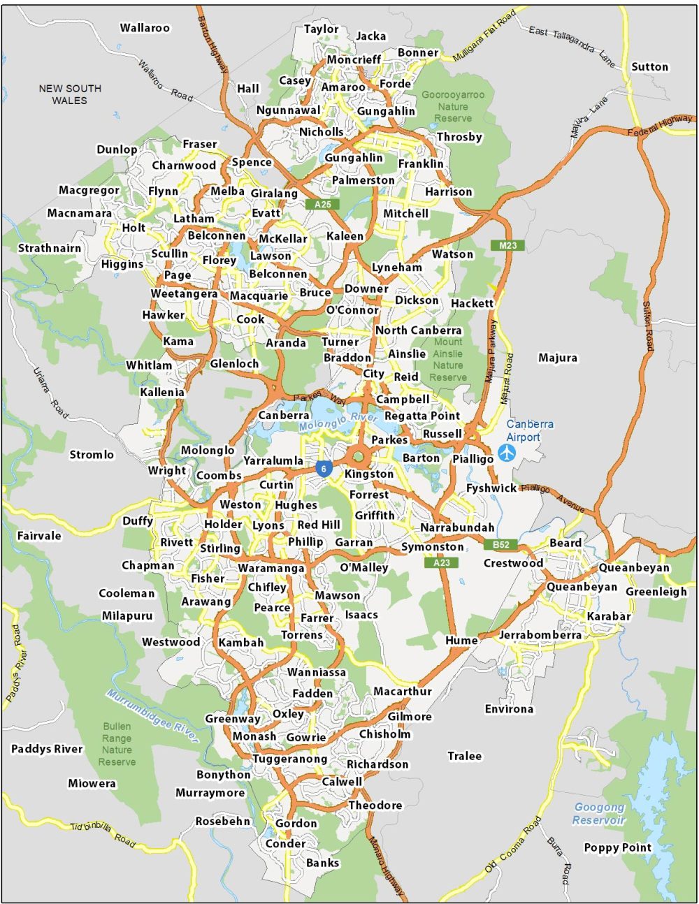
Canberra Road Map
Thinking about traveling to Canberra? This at-a-glance map can help you locate anywhere you want in the city. It displays highway numbers and major street names so you can better navigate around the city. Download this free road map today.
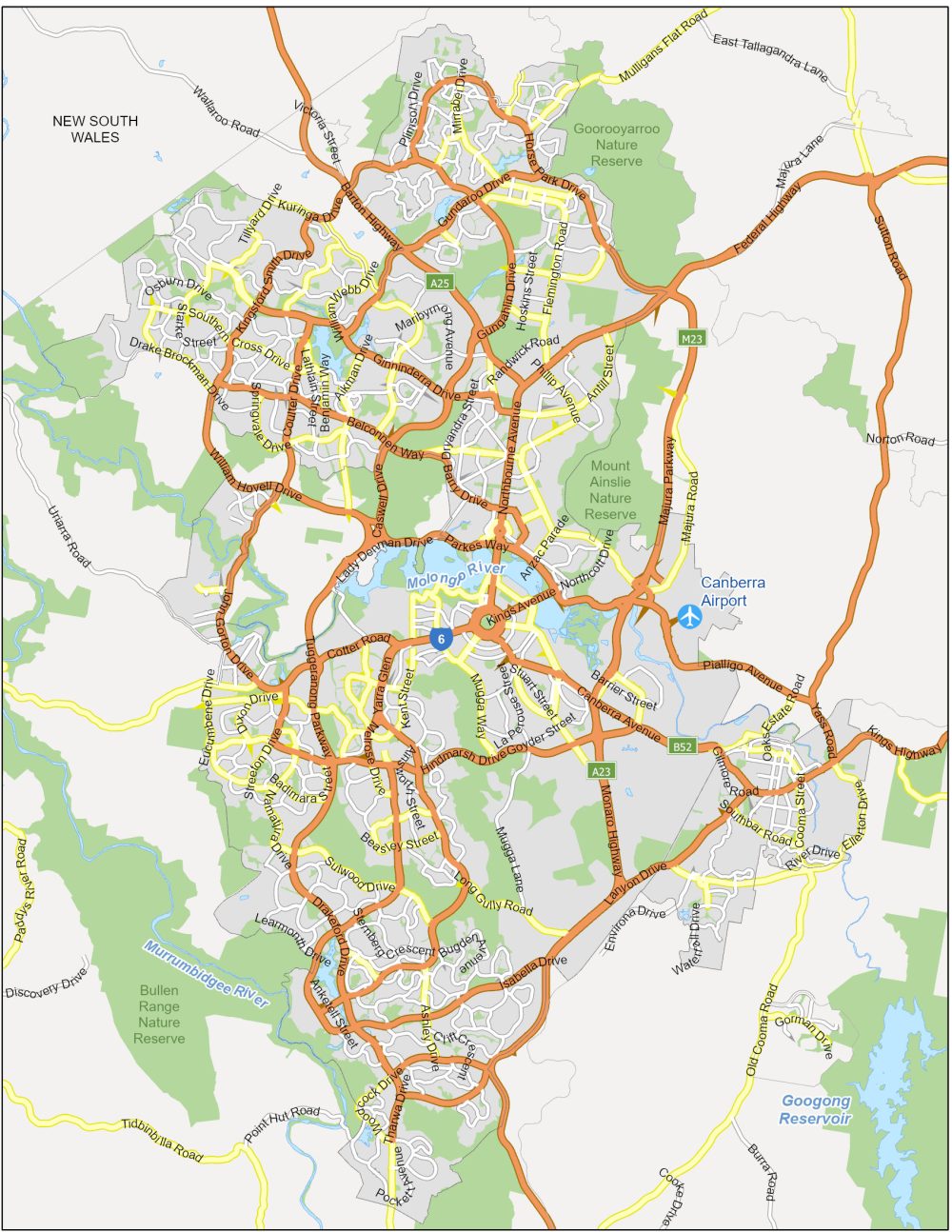
Highways: 6, A23, A25, B52, M23, Monaro Highway, Kings Highway
Parkways: Tuggeranong Parkway, Majura Parkway
Major Roads: Hindmarsh Drive, Gungahlin Drive, Horse Park Drive, Ginninderra Drive, Gundaroo Drive, Canberra Avenue, Belconnen Way, Yamba Drive, Kingsford Smith Drive, Lanyon Drive, Parkes Way, Isabella Drive, Cotter Road, Erindale Drive, Tharwa Drive, Coulter Drive, Pialligo Avenue, John Gorton Drive, Barry Drive, Adelaide Avenue, Yarra Glen, Morshead Drive, Johnson Drive, Kings Avenue, State Circle
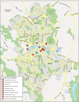
10 Things To Do in Canberra
Looking for something to do in Canberra? That’s easy. We’ve put together a list of the top 10 attractions to visit. Canberra has a mix of cultural monuments and galleries with parkland to relax and unwind. From the National Museum of Australia to the Old Parliament House, the city is packed with goodies to explore.
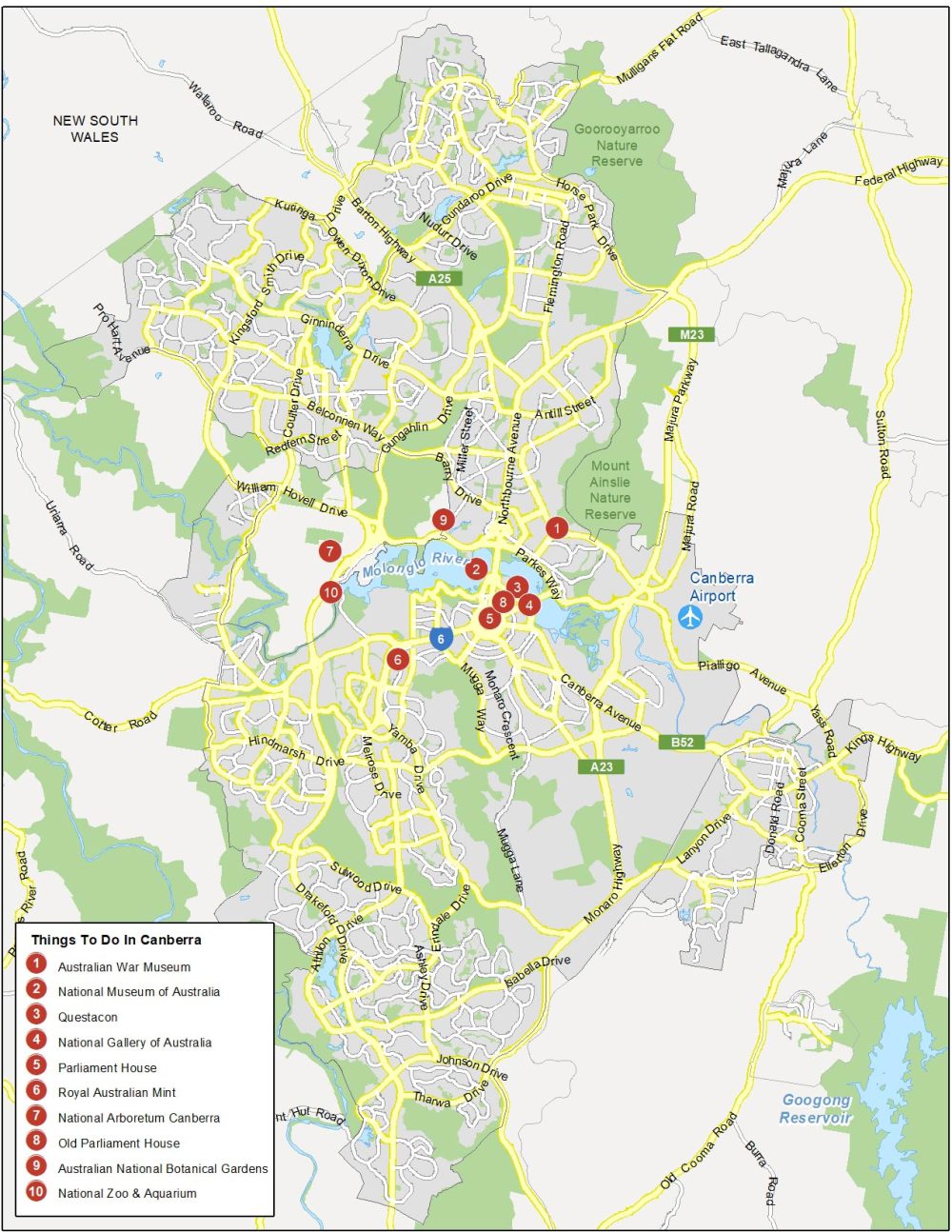
Canberra is the capital city of Australia and is the seventh most populous city. Here’s a list of the top 10 things to do in Canberra.
- Australian War Museum
- National Museum of Australia
- Questacon
- National Gallery of Australia
- Parliament House
- Royal Australian Mint
- National Arboretum Canberra
- Old Parliament House
- Australian National Botanical Gardens
- National Zoo & Aquarium
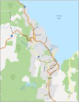
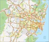
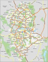
Canberra Reference Map
This neighborhood map displays populated places and areas of interest in Canberra and Queanbeyan. It also includes its international airport, conveniently located about 10 kilometers to the east of Capital Hill.
Airports: Canberra Airport
Water Features: Molonglo River, Murrumbidgee River. Googong Reservoir
Communities: Tuggeranong, Queanbeyan, Woden, Weston Creek, Calwell, Greenway, Conder, Kambah, Phillip, Weston, Fyshwick, Dickson, Belconnen, Holt, Mitchell, Harrison, Gungahlin, Jerrabomberra