What Is Central Place Theory?
Central Place Theory is a way to understand why cities and towns are where they are. Walter Christaller developed this theory in the 1930s.

Central Place Theory is a way to understand why cities and towns are where they are. Walter Christaller developed this theory in the 1930s.

BIM, or Building Information Modeling, is a smart way to design buildings. It creates virtual 3D models about the its materials and systems.

GIS supports various ways to explore spatial relationships. Among these, fishnets stand out for their utility in spatial analysis.

Mapping overlays in GIS work like stacking different layers on top of each other. Each layer represents a different data type.
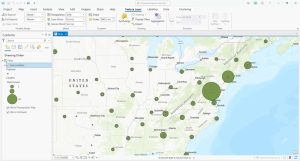
Point clustering groups nearby points into clusters so you can interpret a high density of points. Learn how to use clustering in ArcGIS Pro.

Spatial analysis focuses on finding spatial patterns and trends. Spatial analytics enables predictions by using AI and machine learning.
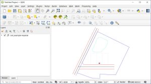
There are free tools online that convert DWG to SHP. But we recommended using QGIS, which is an open source GIS software option.
Spatial patterns show us how things are connected in the world. With GIS technology, we can visualize and analyze spatial patterns.

Imagine if your GIS was not just a know-it-all but also a learn-it-all, constantly figuring out the world. Welcome to the world of GeoAI.

We explain the differences between hexagon binning and rectangular binning, as well as provide examples of both with tessellation.