The State Plane Coordinate System (SPCS)
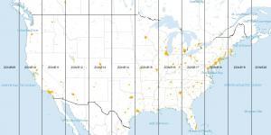
The State Plane Coordinate System divides the United States into 124 zones to locate any point with a high level of accuracy (one part in 10,000).
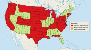
The State Plane Coordinate System divides the United States into 124 zones to locate any point with a high level of accuracy (one part in 10,000).

Map distortion is best understood looking at Tissot’s indicatrix. It contains circles and shows how map projections distort shape, size and distances.
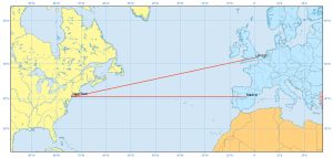
Rhumb lines (or loxodrome) have constant bearings and cross all meridians at the same angle. They are not the shortest distance between 2 points on a sphere
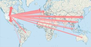
Cartographers use lines to show the movement of phenomenon in flow maps. To show the magnitude, they change the width of flow lines.
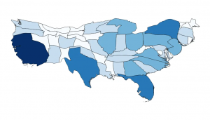
Cartogram maps distorts reality to convey information. It accomplishes this by resizing and exaggerating any variable using a polygons geometry.
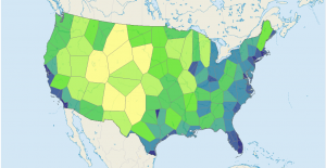
In a Voronoi Diagram, when you take a point in any given Thiessen polygon, it indicates that it’s closer to that generating point than to any other.
Equal intervals, quantile, natural breaks, pretty breaks- data classification methods generate different choropleth maps. We explain the types of maps here.
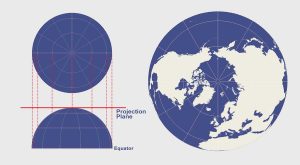
The azimuthal projection plots the surface of Earth using a flat plane. For example, common azimuthal projections are gnomonic, stereographic & orthographic
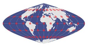
The equal area projection retains the relative size of area throughout a map. So that means at any given region, it keeps the true size and area of features.
Universal Transverse Mercator (UTM) segments the Earth into 60 zones (each UTM zone is 6°) and projects each zone with an upright cylinder of its own.