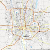
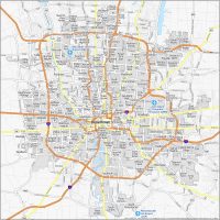
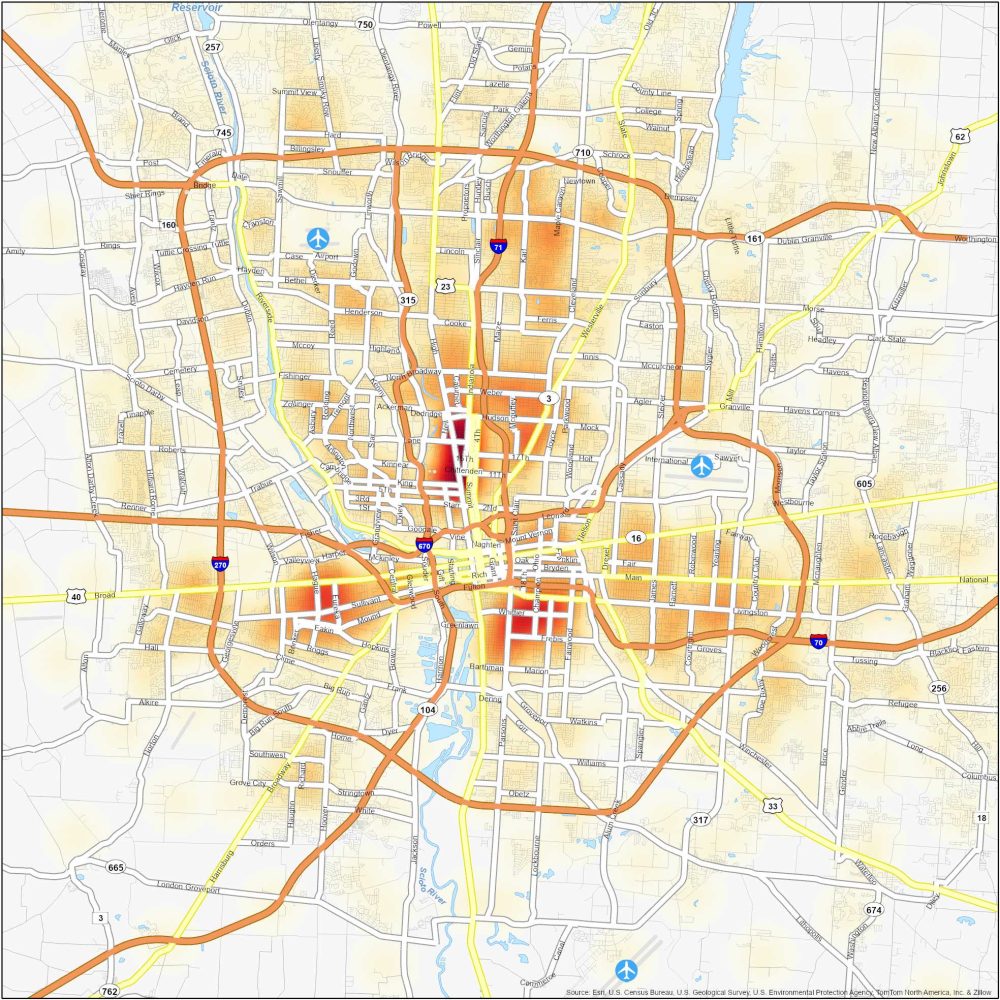
Columbus Crime Map (Ohio)
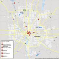
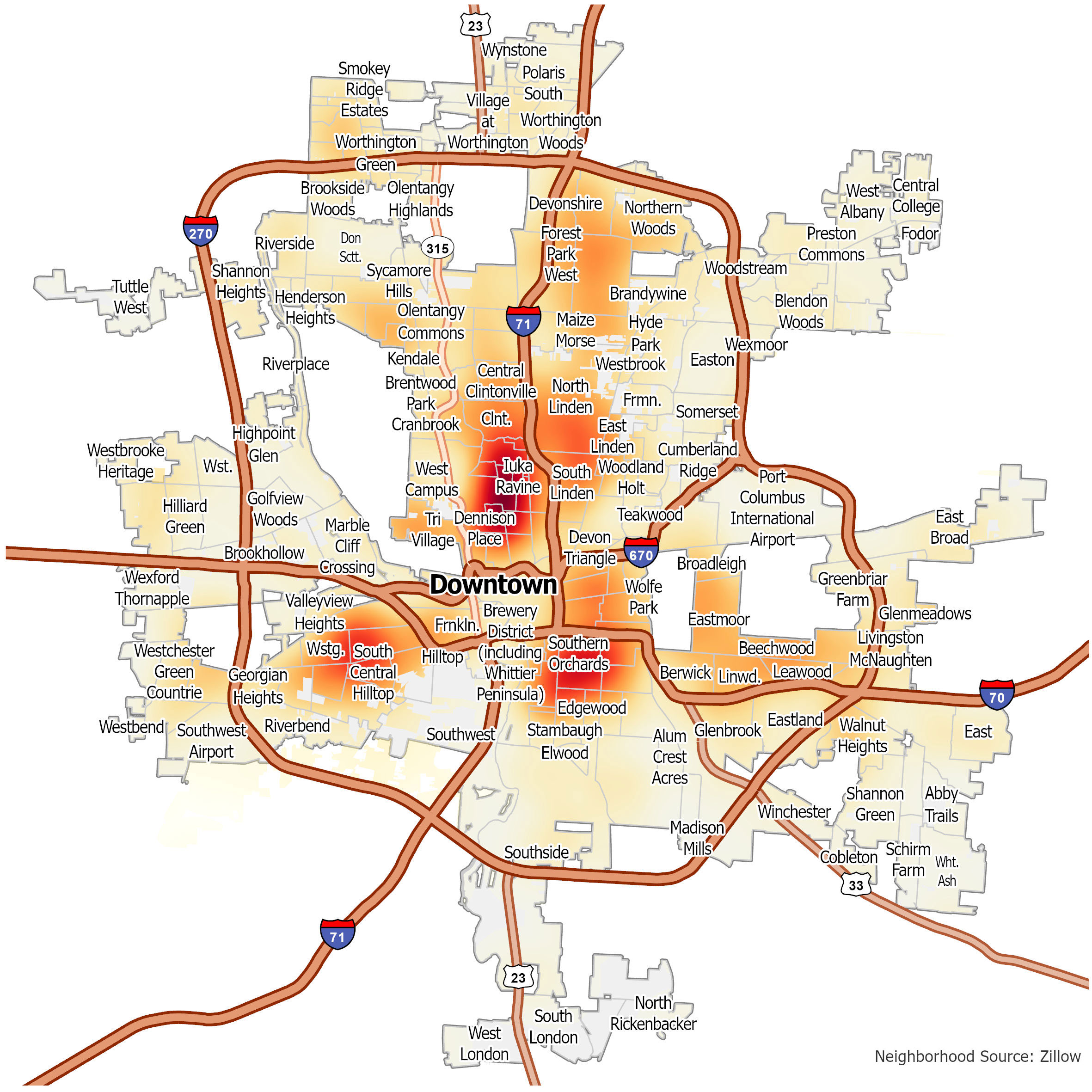
Dangerous Neighborhoods in Columbus
In general, crime rates are higher adjacent to Downtown Columbus along I-71 and I-70. Our map highlights hot and cold spots of crime. Here are some of the most dangerous neighborhoods in Columbus.
| Neighborhood | Location | Types of Crime |
|---|---|---|
| Linden | Northeast Columbus, residential area | Homicides, violent crimes and property crimes. |
| Near East Side | East of Downtown, historic neighborhoods | Thefts, vandalism, burglaries, and some violence. |
| Hilltop | West Columbus with a residential community | High rates of theft, burglary, and some violence. |
| South Linden | North of Downtown, primarily residential | Property crimes and occasional violence. |
| Franklinton | West of Downtown, industrial and residential mix | Drug-related offenses and property crimes. |
| University District | North of Downtown, near Ohio State University | Frequent thefts, vandalism, and occasional assaults. |
Columbus Crime Map
Click on the image to see our original crime map of Columbus with interstate highways.