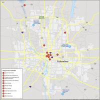
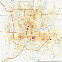
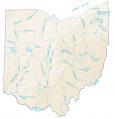
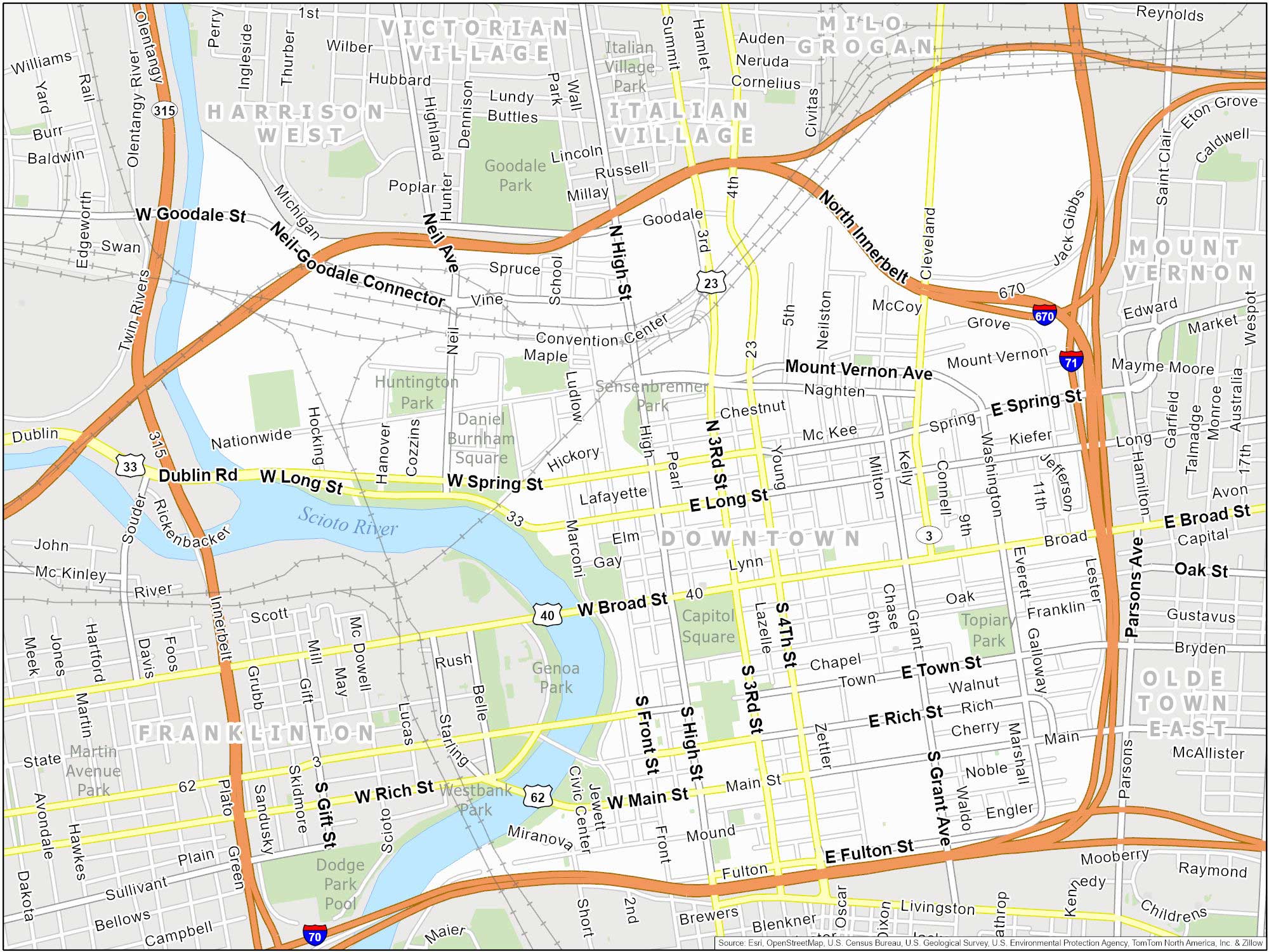
Columbus Neighborhood Map (Ohio)
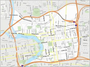
Downtown Columbus
Columbus is the capital city of Ohio. The downtown area is the urban core. It bordered the Scioto River, I-670, I-70 and I-71. We recommend taking a stroll along the Scioto Mile, which is a beautiful park along the river.
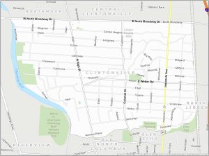
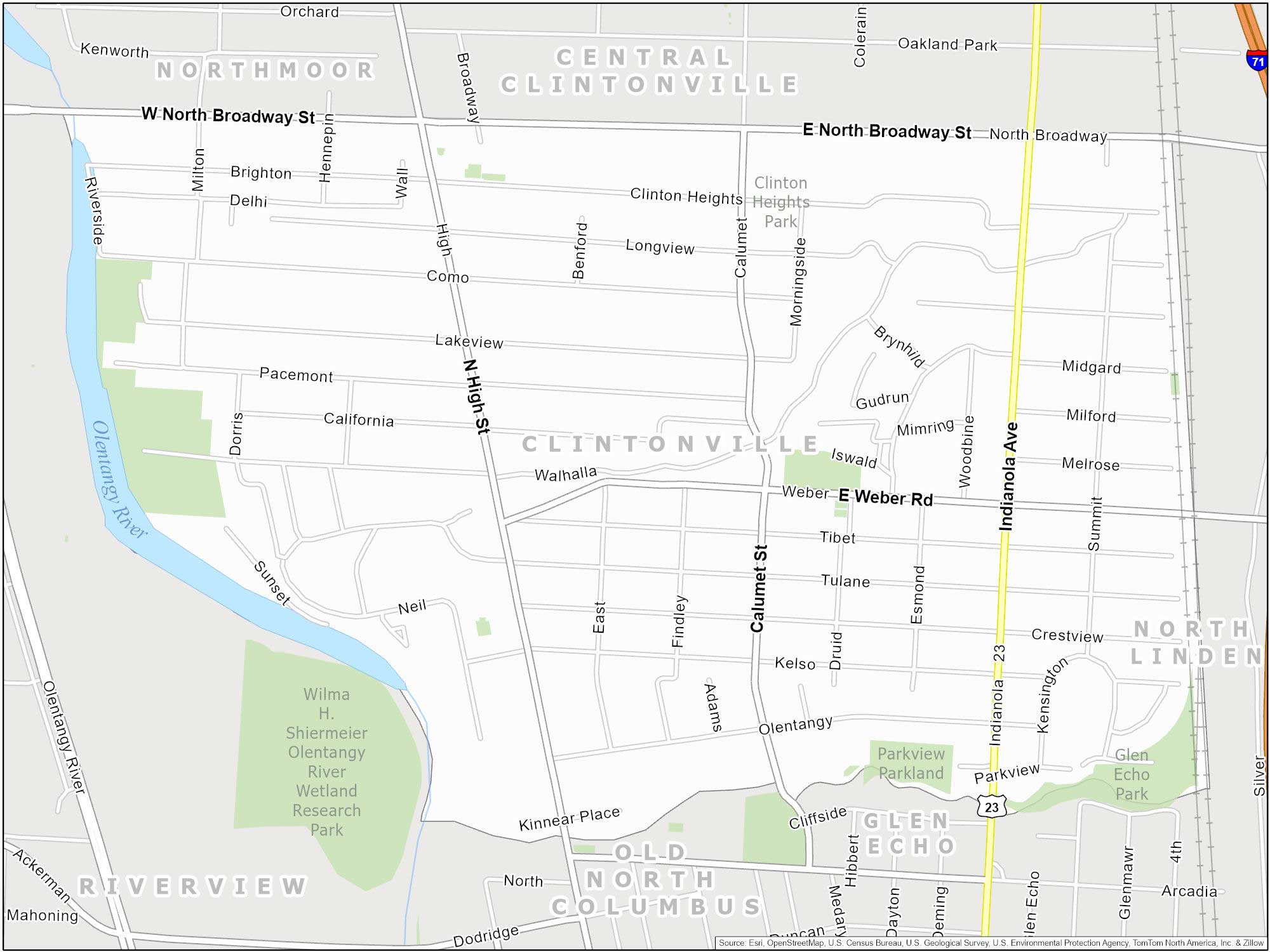
Clintonville
Clintonville is located just north of Downtown Columbus. Geographically, Clintonville has varied terrain. The Olentangy River forms its western boundary, with the Olentangy Trail as a highlight for enjoying nature.
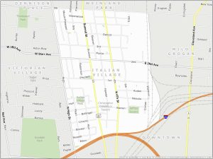
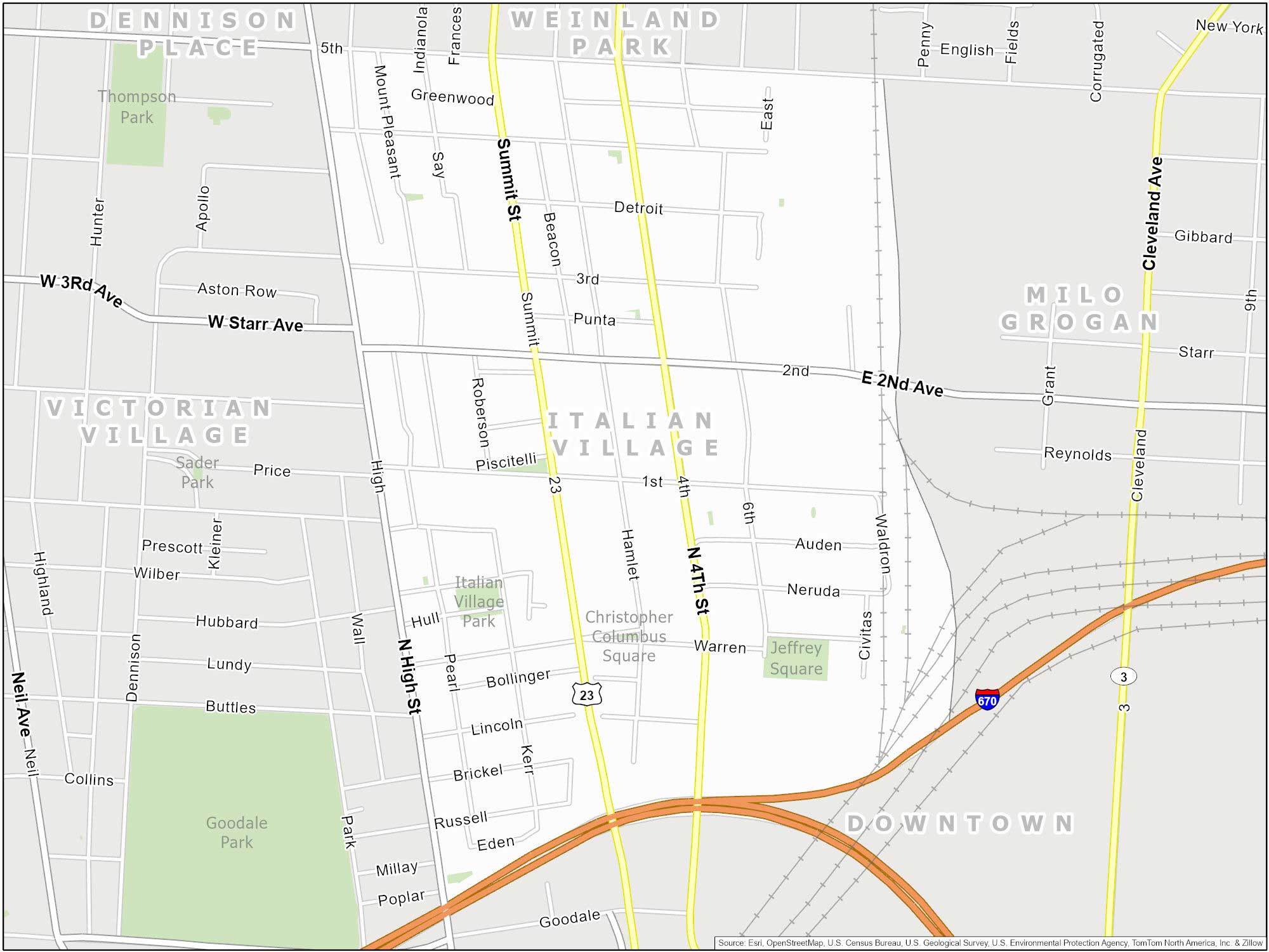
Italian Village
Italian Village is northeast of Downtown Columbus. It borders I-670 to the south and Fifth Avenue to the north. Plus, it’s adjacent to the Short North Arts District to the west. It is also home to the historic Columbus Italian Festival, celebrating the neighborhood’s Italian heritage.
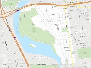
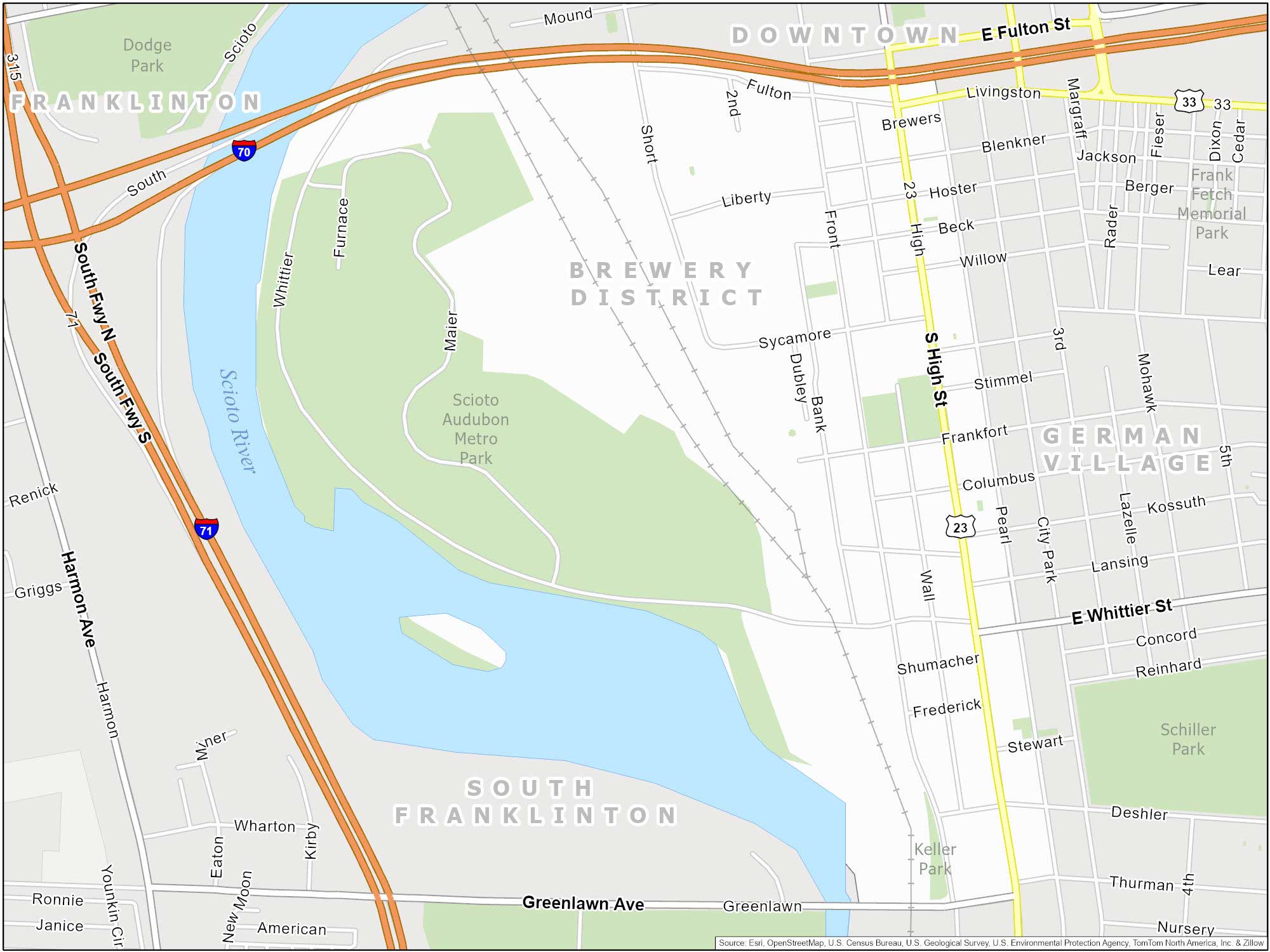
Brewery District
True to its name, the Brewery District hosts several breweries that celebrate its brewing heritage. This neighborhood is south of Downtown Columbus. It’s next to the Scioto River and German Village.
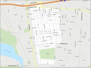
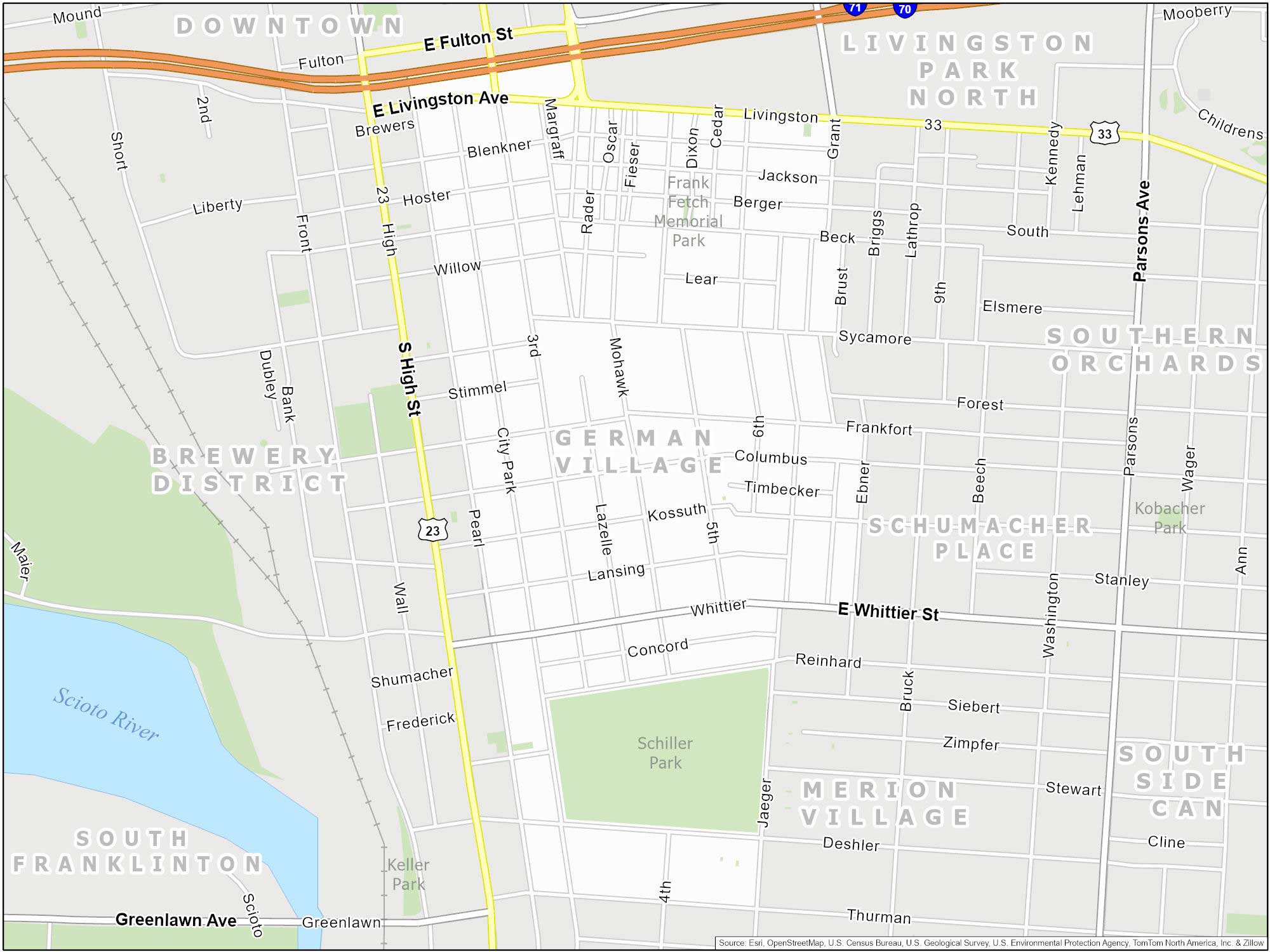
German Village
German Village is one of Columbus’s most historically rich neighborhoods. You can find this neighborhood just south of Downtown. This area’s architecture reflects its deep-rooted German heritage.
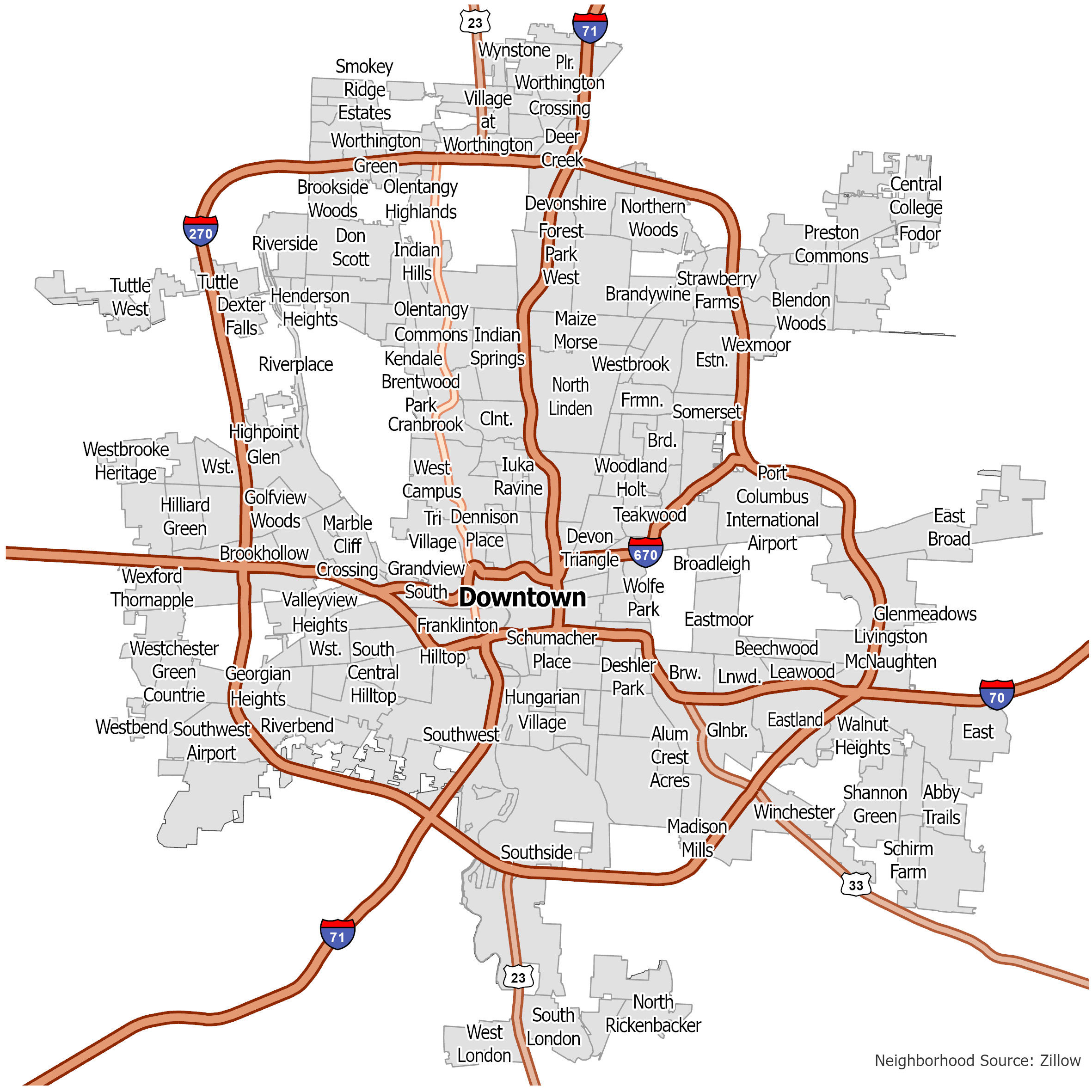
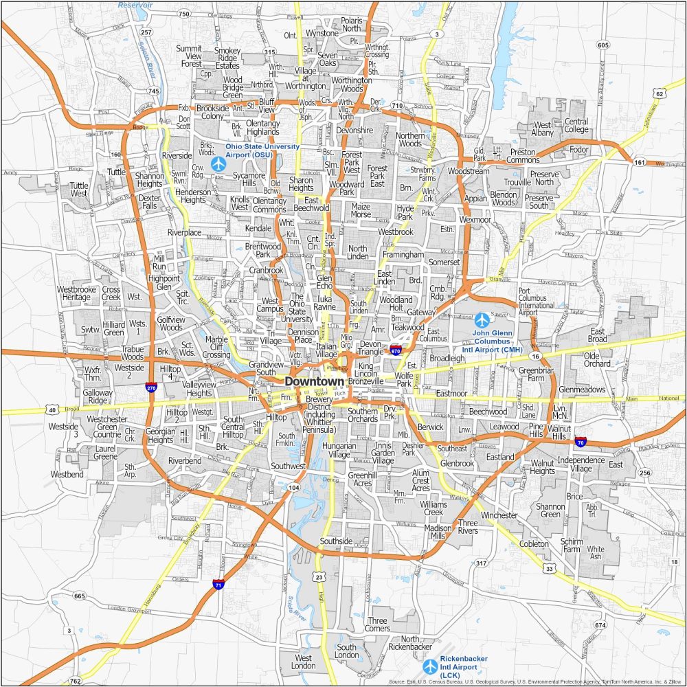
Columbus Neighborhoods Map
Click on the image to see our original map of neighborhoods with interstate highways.