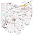
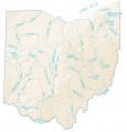
Map of Ohio – Cities and Roads

About the map
This Ohio map contains cities, towns, roads, rivers, and lakes. For example, Columbus, Cleveland, and Cincinnati are major cities shown on this map of Ohio.
A lot of people picture Ohio as your plain Jane American experience. For example, picture eating corn dogs, fireflies in the summer with fireworks, and carnivals. Also notable, Ohio has the largest Amish population in the United States.
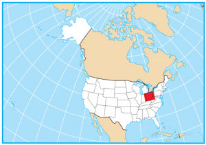
Ohio is located in the midwestern region of the United States. It borders Michigan, Indiana, Kentucky, West Virginia, Pennsylvania, and Lake Erie in the north. Ohio is a very diverse state, and it’s easy to see why it is chosen as one of the top destinations for travelers in the United States.
Ohio map collection

You are free to use our map of Ohio for educational and commercial uses. Attribution is required. How to attribute?
State capital
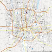
Columbus
Major cities and towns
Columbus
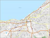
Cleveland
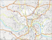
Cincinnati
Dayton
Toledo
Akron
Barberton
Beavercreek
Bowling Green
Canton
Cuyahoga Falls
Elyria
Euclid
Fairfield
Findlay
Hamilton
Kent
Kettering Lancaster
Lima
Lorain
Mansfield
Marion
Massillon
Middletown
Newark
Parma
Sandusky
Springfield
Warren
Westerville
Youngstown
Zanesville
Upper Arlington
Strongsville
Gahanna
Alliance
Ashtabula
Athens
Bellefontaine
Bucyrus
Cambridge
Chillicothe
Circleville
Coshocton
Defiance
East Liverpool
Fostoria
Gallipolis
Greenville
Hillsboro
Ironton
Marietta
New Philadelphia
Portsmouth
Sidney
Steubenville
Van Wert
Washington Court House
Wooster
Fremont
Norwalk
Ashland
Mt Vernon
Jackson
I like the stae of Ohio but also this map
A great help with state projects
How can I get the geocoding for the congressional districts of Ohio
The ArcGIS open data hub is good for this type of data – 10 Free GIS Data Sources: Best Global Raster and Vector Datasets