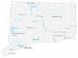
Connecticut Lakes and Rivers Map
About the map
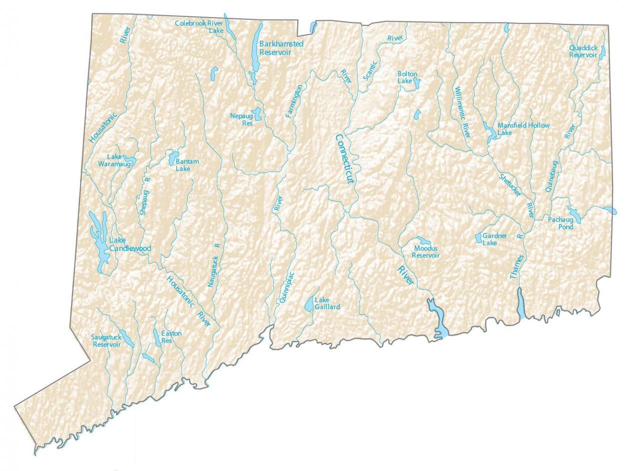
In general, rivers in Connecticut flow into the Atlantic Ocean. In this map, you will find major rivers, reservoirs, lakes, and water features in the state of Connecticut.
By far, Candlewood Lake is the largest lake in Connecticut at 5,420 acres. It more than triples the size of the next largest Lake Lillinonah.
One of the major rivers is the Connecticut River, cutting through the cities of Essex, Hartford, and Middletown. Some of the other major rivers that flow through Connecticut are the Housatonic River and the Thames River. In the south, it’s the Long Island Sound that determines the border of the state.
Connecticut map collection
You are free to use our lakes and rivers map of Connecticut for educational and commercial uses. Attribution is required. How to attribute?
Connecticut lakes, reservoirs and rivers
Connecticut lakes
Candlewood Lake
Mansfield Hollow Lake
Lake Gaillard
Lake Waramaug
Bantam Lake
Bolton Lake
Gardner Lake
Rivers in Connecticut
Connecticut River
Housatonic River
Thames River
Quinebaug River
Shetucket River
Willimantic River
Farmington River
Colebrook River
Housatonic River
Naugatuck River
Shepaug River
Quinnipiac River
Scantic River
Connecticut reservoirs
Barkhamsted Reservoir
Saugatuck Reservoir
Easton Reservoir
Nepaug Reservoir
Quaddick Reservoir
Moodus Reservoir
Sounds
Long Island Sound
Ponds
Pachaug Pond