Earthquake Maps for Disaster Response
Today, we’re going to provide you with a list of earthquake maps to help improve disaster response and recovery.
Whether you’re just an observer or a concerned citizen, these interactive earthquake maps can help you understand the locations of seismic events around the world.
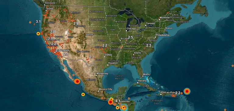
1. USGS Earthquakes
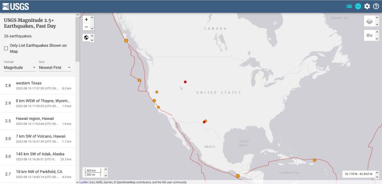
The USGS Earthquakes Map is your real-time gateway to seismic activity across the globe. Use this map to explore the ever-changing world of tectonic shifts with up-to-the-minute earthquakes.
Here are some of its biggest features:
How does it work? The USGS retrieves seismic data from observatories throughout the world. This earthquake map doesn’t show all small earthquakes. But it can still help people understand tectonic activity and our planet’s forces.
2. Esri Earthquake Public Information Map
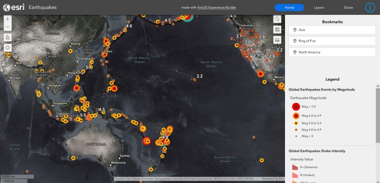
Esri’s Earthquake Public Information Map helps emergency responders, government agencies, and the public know where and how severe a disaster is.
Some of its notable features include:
The Earthquake map uses live data from the USGS PAGER alerts program. Another nice feature is that you also have the capability to update the basemap to imagery, topography, terrain, and many more.
3. European-Mediterranean Seismological Centre (EMSC)
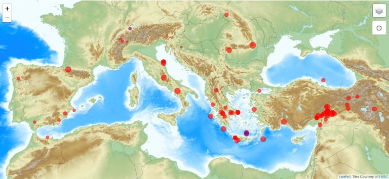
The European-Mediterranean Seismological Centre (EMSC) provides an interactive Earthquake map. This one offers real-time information about seismic activities in the European and Mediterranean regions.
Here are some of the advantages of using the EMSC earthquake map.
The EMSC’s Earthquake Map contributes to raising awareness and understanding of seismic activities. Although this organization has a focus on Europe and the Mediterranean regions, it also shows seismic events for the entire world.
Summary: Earthquake Maps
Earthquake maps have many benefits. They help with situational awareness, resource planning, and risk assessment.
From USGS to Esri and EMSC, these 3 online earthquake maps are updated in near real-time with the latest tremors.
But because you can integrate it with data from various sources, it provides the latest information to responders and the public.
Did we miss any earthquake maps? We’d love to hear from you in the comment section. Please feel free to add your input below.


