Your GIS Workstation – What to Upgrade?

What’s your GIS workstation like? Is it as slow as a mule or incredibly fast as the Flash?
If you’ve worked in the field of GIS, you’ll have an idea of the demands of GIS software like Esri ArcGIS and QGIS.
It’s your CPU, RAM, graphics card, and hard disk drives that, well, make it all work.
You need a powerful GIS workstation to meet the ever-increasing demand of processing big data… and that’s exactly what we examine today.
GIS Workstation Typical Hardware

As a GIS analyst, you work with A LOT OF data. And almost all of it is geospatial in nature.
You do everything with data. You display, capture, edit, share, visualize, manage, and delete GIS data.
If you’re in the market to buy or build a GIS workstation from scratch… You’re essentially investing in your career.
Here is what you should look for in an ideal GIS workstation.
1. Dual Monitors – Seeing Double
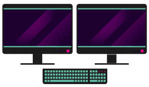
Every GIS analyst likes working with dual monitors. I haven’t found one who doesn’t.
The efficient GIS analyst uses dual monitors instead of a single large monitor. With the heavy amount of multitasking you’ll be doing in GIS, you need two screens for optimal vision and task organization.
When you edit GIS data, analysts separate their GIS visuals and attributes on separate screens. Hands down. Two screens beat a single large monitor.
2. Central Processing Unit (CPU) – Your Workhorse
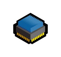
GIS is CPU-heavy. The central processing unit (CPU) is your workhorse. The CPU is like your headquarters for processing data. When you run an intensive GIS process, the system gets maxed out. Overclocking is common in the world of GIS and CPU performance reduces the lag.
Modern computers have multi-core processing so they can perform more than one task at the same time. Multiple cores split tasks into separate pieces. As long as the software program is written to take advantage of multiple cores, this can increase overall speed.
3. Random Access Memory (RAM) – Temporary Memory
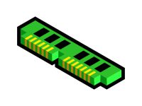
Computers process data really quickly. But hard drives are really slow in comparison. If you read and write all your processed data directly from your hard drive, computers would be too slow because the hard drive couldn’t keep up with the processor speed.
RAM is where data is temporarily stored that is fast to read and write. RAM is extremely fast and is the best place to store frequently used data. When GIS software programs are active for in-memory workspaces, the data is stored in the system’s internal memory (RAM).
4. Hard Disk Drives (HDD) – Permanent Storage
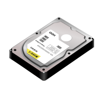
Hard disk drives generally store data in spinning magnetic disks as secondary storage. Disk drives are used to transfer large blocks of data and stay in memory until it’s needed. This depends on rotations per minute. Hard drives are much cheaper because it doesn’t have to move data quickly like RAM.
Solid-state drives are a newer type of hard drive and are much faster. The technology they use is like flash drives without any moving parts like spinning disks. It depends on how much data it can read/write per second. If you work with LiDAR and other large data sets, your HDD will fill up pretty quickly.
5. Graphics Processing Unit – Visualize Smoother
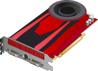
The GPU works for GIS display and graphics such as zooming and panning in a map. A good graphics processing unit renders multi-layered maps and symbology smoothly. It helps display 3D data with ease.
Although a lot of attention is placed on the CPU, your GPU ultimately powers layers to draw on your high-resolution monitor. When working with large data sets like LiDAR and parcel fabric, a good GPU really starts to shine for redrawing, zooming, and panning data.
6. Flash Drives – Quick External Storage
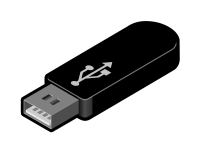
Flash drives store data in solid-state memory. You simply insert your USB memory stick and transfer files like a breeze.
They don’t have any moving parts and don’t require power to retain data. Flash drives are easy to transfer back and forth, they are very portable and are becoming an inexpensive option to store data.
7. CD-ROM, DVD and Blu-Ray – Permanent External Storage
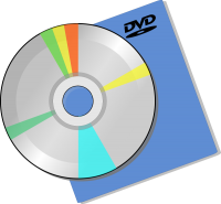
CD-ROMs may be obsolete but DVDs and Blu-Ray disks are still going strong (as far as I know). Generally, CD-ROMs, DVDs, and Blu-ray disks are used to store permanent data. Burn data on a disk, and that disk will probably be unchanged forever.
They are removable storage devices. Unlike flash drives, these devices use spinning disks to store data. They are inexpensive options for data storage but are much slower than flash drives and hard disk drives.
GIS Personal Computers Options
Even though you don’t need to understand all the details of computer hardware, you should have some understanding of what happens behind the scenes.
Computers have become inexpensive. They are just about everywhere.
Most often, the device you’ll work on in GIS is an ordinary desktop or laptop computer. The term Personal Computer (PC) encompasses devices such as desktops and laptops.
Here are the common types of computers that exist today.
1. Desktops

A desktop computer is designed to be non-portable and sit beside one’s desk. They don’t have batteries and usually have external keyboards.
Towers enclose the major components of a computer excluding the monitor, keyboard, and mouse. Workstations are powerful desktops with extra features such as disk space and graphic cards.
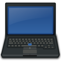
2. Laptops
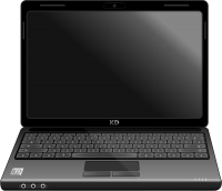
Laptops are portable computers often running on batteries. They can be used almost anywhere because they have integrated screens and keyboards.
Laptops often run on batteries. In front of the keyboard, laptops usually have a touchpad or trackball that can be used as a mouse.
3. Notebooks
Notebooks were scaled-down versions of laptops. They were Lightweight, portable, smaller screens without CD-ROM or DVD drives. They compromised performance for portability.
Now, the terms laptops and notebooks have almost become synonymous with very little separation between the two types of computers.
4. Tablets
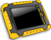
Tablets are ultra-portable computers. They are generally more expensive and can have the same processing, memory, and hard drive as laptop computers.
They are usually equipped with an on-screen keyboard or stylus making them ideal for specific environments. Tablets can recognize handwriting and have virtual keyboards.
5. Mainframes
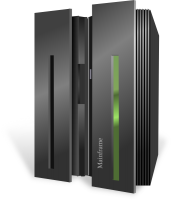
Mainframes are centralized computers that support numerous workstations. Large organizations use mainframes with each user connecting to a dumb terminal.
Hundreds of users can have software updates from the central server. Cloud computing involves users connecting remotely through a browser. Applications and data storage are maintained on a central server.
6. Servers
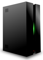
Servers are computers that support multiple users accessing client applications simultaneously. It runs an instance of the software and accepts clients’ requests.
Mainframes, cloud servers, and minis are examples of servers. Users can access these servers and information is held centrally where users can share and access data collaboratively.
How Central Processing Units Work
The central processing unit (CPU) takes instructions from the operating system (OS). The CPU takes this instruction set and goes through a repeating cycle
FETCH INSTRUCTIONS: Executable files are binary files with instructions for the CPU. The OS copies the program into RAM and then begins feeding the CPU instructions.
DECODING: Each instruction is in binary numbers – (1 = on and 0 = off). The CPU decodes the strings of binary code.
EXECUTION: The CPU performs the actual operation. This is done by the Arithmetic Logic Unit.
This cycle repeats starting at the fetching of instructions.
Moore’s Law in GIS
In the 1960s, the size of computers compared to baby elephants. They were bulky without the ability to just move them in your suitcase.
A fellow by the name of Gordon Moore observed that the same size chip will double in speed every 18 months.
Like clockwork, this prediction had been true and coined the term ‘Moore’s Law’.
What does the future hold? Quantum computing? Virtual reality in GIS?
Conclusion: Your GIS Workstation
We’ve reviewed some of the essential GIS hardware components:
CPUs, dual monitors, RAM, HDD, and GPUs…
All play a key role in how well your choice of GIS software will run.
Let us know where GIS users should spend their money on computer hardware below.


What a lazy article this one!! Useless!!
Pretty vague and general. I found nothing specific that would help me figure out what to look for in buying a new computer.
Hello, thanks for the article. I have a question, in your opinion, what is the optimal screen size.
I like dual monitors, both 24 inches. Apparently, over time it strains your eyes if dual monitors are different screen sizes
Please update/correct your page, as your statement,”Burn data on a disk, and that disk will probably be unchanged forever” is not entirely accurate. CDs and DVDs deteriorate and thus you may not be able to access your Saved data.
This article is pretty useless. One GIS software will take advantage of hardware (or fail to take advantage) very differently. To even mention the use of hard drives is a joke.
Hi! Would you say a graphics card is still necessary for smooth panning and zooming if I buy a laptop with 16GB RAM and the latest 8th gen i7 processor? Thanks!
I am thinking to buy a laptop which processor should I prefer?
Regard
Avantika