35 Differences Between ArcGIS Pro and QGIS 3
ArcGIS Pro vs QGIS 3
Six years ago, we compared ArcGIS vs QGIS. The response was incredible and we thank you for that.
But since then, the game has changed. Yet, the players are still the same.
The Omen of Open Source GIS is back with QGIS 3. It’s up against the Pioneer of Proprietary GIS, ArcGIS Pro.
Buckle up.
Because today, you’re going to witness a head-to-head battle between the juggernauts of GIS software.
Pick your poison.
Table of Contents
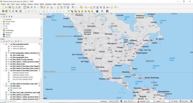
2. Interface
3. Coordinate Systems
4. Catalog
5. Editing
6. Vector Analysis
7. Remote Sensing
8. Speed
9. Tables
10. Statistics
11. Raster Analysis
12. Networks
14. Scripting
15. Labeling
16. Map Automation
17. Animation
18. Map Types
19. Topology
20. Interoperability
21. Geocoding
22. Symbology
23. LiDAR
24. Map Elements
26. Database
27. Web Maps
28. Errors
29. Cost
30. Extras
31. Imagery
32. File Structure
33. Community
34. Emerging Tech
35. Documentation
1. 3D – How far can it bend?
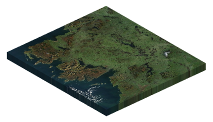
Both QGIS 3 and ArcGIS Pro bend data in 3D. When testing, we wanted to see just how far they both could bend.
QGIS 3 fuses 3D natively without plugins. Likewise, ArcGIS Pro renders 3D data in local and global scenes.
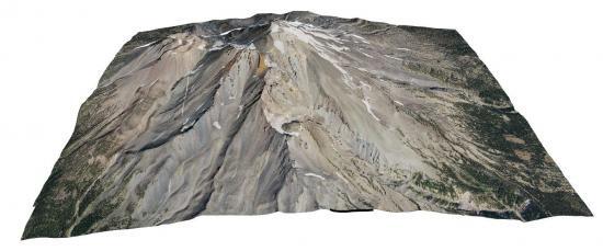
We found QGIS 3 handles raster DEMs smoothly like this 3D display of Mount Shasta.
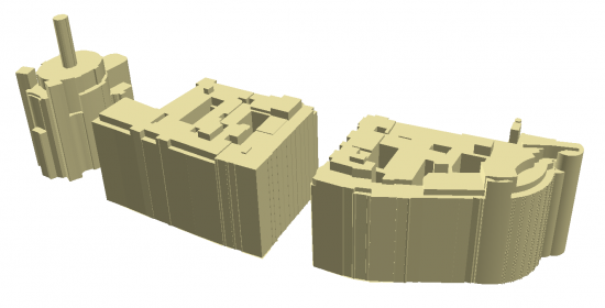
Another highlight is the 3D measuring and 2.5D renderers in QGIS 3. This is how you get building heights with shadows.
But when it comes to 3D editing and analysis, ArcGIS Pro can do more. The visibility analysis tools are interactive and intuitive. It’s fun to explore the 3D analysis tools in GIS like – line of sight, shadow, and skyline.
QGIS 3 only has viewsheds through GRASS GIS. In comparison, it falls short of the 3D tools in ArcGIS.
As 3D data expands in a big way, ArcGIS Pro outshines QGIS 3. If it’s editing, analysis, or displaying 3D multipatches you want to do, ArcGIS Pro wins by quite a large margin.
2. UI – GIS Interface Wars
I think it was Shakespeare who once said, “To ribbon, or not to ribbon, that is the question.” As it turns out, QGIS 3 and ArcGIS Pro have different opinions on ribbons in the user interface.
ArcGIS Pro is like GIS meets Microsoft Office. The tab interface keeps all your tools organized. When clicked, it only suggests relevant tools.
The start page has more of a dashboard feel. For instance, you can pin all your favorite projects. The undo/redo stack has a larger history in ArcGIS Pro.
QGIS keeps it familiar. It’s as straightforward as it was before. The buttons feel refined and cleanly put together. But I can’t help it looks a bit untidy and unorganized when you compare it to ArcGIS Pro.
Docking feels overly sensitive. I noticed that QGIS 3 loves to dock windows! Dropping layers into the map is a lifesaver.
Although it’s a matter of preference, contextual ribbons are a refreshing departure from the same old UI. That’s why ArcGIS Pro gains a bit of an edge for the user interface.
3. Coordinate Systems – Flatten the Earth
Even though 7000+ coordinate referencing systems (CRS) exist today, both QGIS and ArcGIS are seasoned veterans in handling them.
But listen carefully.
The new interface in QGIS 3 kills two birds with one stone. Not only does it preview the geographic bounds, But it also shows only relevant coordinate systems. This clever idea puts a nice twist to coordinate systems.
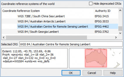
ArcGIS Pro avoids a total facelift. Instead, it gives you a more complete arsenal. It has some of the rarest tribal projections.
On-the-fly projections are the industry standard and both are MVPs. Tried, tested, and true. QGIS 3 edges out ArcGIS Pro for its intuitive projections.
4. Catalog – A library of GIS data
QGIS Browser. Gone.
ArcCatalog. RIP. Laid to rest in Redlands, California. Next to their coverage files, ArcView 3.0, ArcScene, ArcGlobe, Flex, and Avenue. Remember those?
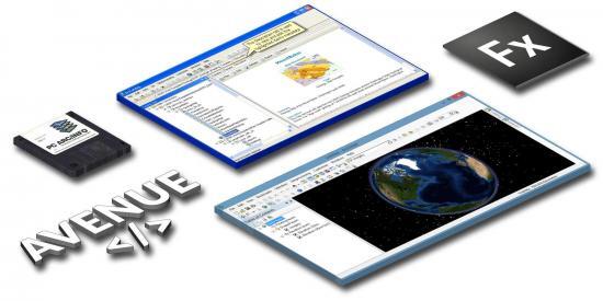
Once entirely stand-alone applications, now they’re just unwanted overhead. Instead, QGIS 3 and ArcGIS Pro natively integrate them within its core application. Not surprisingly, both are solid in each and every aspect. Like a library, they still have it all.
Previewing, organizing, and of course metadata creation. Despite these major tweaks, no recycling bin can be found to undo any accidental deletes. Heartbroken, I wait for this feature in a future release.
A big complaint is because of the departure of the stand-alone ArcCatalog. Sometimes you just want to search around directories to find GIS data. Without ArcCatalog, you have to create a project (or start without a template), and then go searching for the data. Why the hassle?
5. Editing – Slice, dice, fillet, divide, and explode!
Both QGIS 3 and ArcGIS Pro ramp up GIS editing with new inventive and improvised tools. Each one enables you to MacGyver your data in unique ways.
Fortunately, QGIS 3 adds better vertex handling. Its snapping tools closely mimic a CAD user experience. While tools like tracing with an offset are useful for roads, closing features at 90° are good for digitizing buildings.
ArcGIS Pro adds a slick contextual editing interface. Instead of the default point-and-click, the default options are very different.
Reference grids help you align to features in the map so you can better digitize features in 2D and 3D. Editing steals the show in a big way. Both have more venom than ever before.
6. Vector Analysis – Licensed to geoprocess
In GIS, there’s nothing more important than having the right tools available for you. Because if your only tool is a hammer, the whole world is a nail. So which software gives the most versatility?
ArcGIS Pro has a goldmine of 1500+ geoprocessing tools in 35 toolboxes. All are neatly organized in the analysis ribbon and geoprocessing pane.
But it’s the licensing that kills. It leaves you “licensed to geoprocess” like a bad James Bond movie.
QGIS 3 keeps its tradition alive with 900+ vector geoprocessing tools. As part of this assortment of tools, you can leverage GDAL, GRASS, and SAGA GIS.
But you can also tap into 600+ plugins to lay a solid foundation of additional geoprocessing tools. It’s a bit untidy with tons of overlap but workable.
Oddly enough, a core tool like Erase still needs an advanced license in ArcGIS Pro. Ready-to-use tools cost money. But when it comes to geoprocessing, the sheer volume of tools is greater in ArcGIS Pro compared to QGIS 3.
| Criteria | ArcGIS Pro | QGIS 3 |
|---|---|---|
| Geoprocessing Tools | 1500+ geoprocessing tools | 201 tools (QGIS 3) 50 tools (GDAL) 298 tools (GRASS GIS) 361 tools (SAGA GIS) 900+ tools in total |
| Toolsets | 35 toolboxes | 25 toolboxes |
7. Remote Sensing – See the unseen
There’s no magic bullet in either software package as a complete remote sensing solution. ArcGIS Pro takes a step in the right direction. But in QGIS 3, it’s just an afterthought.
QGIS 3 relies on the semi-automatic classification plugin for remote sensing. Although it’s a bit of a hit-and-miss, its strength is in coarse resolution imagery extraction and classification.
In search of an untapped plugin for segmentation or object detection, you’ll be left empty-handed.
Whereas ArcGIS Pro provides “mean segment shift”. It’s rough and objects are not always meaningful. But hey, at least it’s something to work with.
Overall, ArcGIS Pro has made large strides forward in remote sensing. One of the biggest improvements in ArcGIS Pro is “interactivity“. What I mean by this is its image classification wizard.
It’s an underrated addition that gives you a sneak preview and allows you to tweak parameters before you fully commit. Likewise, Esri adds AI and a deep learning framework so you can train neural network models.
8. Speed – The quickest software in the west
ArcGIS Pro is multi-threaded, meaning you can run processes and it’s still responsive. The 64-bit parallel processing in ArcGIS Pro is for performance. As you pan through your maps, imagery loads responsively.
For example, AGOL base maps are especially fast-loading. Even opening projects, you’ll notice it feels quicker.
Despite all these major improvements, QGIS 3 still outperformed in the majority of the speed tests we ran. But how could this be?
Developers built QGIS 3 from the ground up. Don’t forget that there’s no license to connect to either in open source.
Quickest software in the west.
QGIS 3 is fast. QGIS 3 makes fast GIS software look not fast. Overall, you’ll be floored by the quickness of QGIS 3.
Here are some of the speed tests we ran:
| Operation | ArcGIS Pro | QGIS 3 |
|---|---|---|
| Buffer 16,000 points | 3.35 seconds | 1.40 seconds |
| Run Composite Bands | 1 minute, 38 seconds | 34 seconds (GDAL) |
| Inverse Distance Weighted Interpolation | 1 minute, 24 seconds | 1 minute, 12 seconds |
9. Tables – Editing, querying, and joins
QGIS 3 brings new interactive table editing tools. For example, date fields have calendars and booleans have checkboxes. Just in case you fat-finger anything on your keyboard, auto-filling remembers previously stored values.
Joins and relates have always been standard in QGIS. But now you can use composite foreign keys. This means you can create relationships that are linked with more than one attribute.
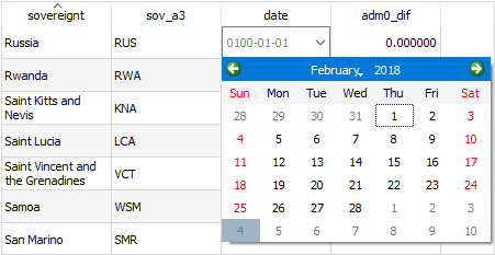
“Extent filtering” in ArcGIS Pro is an undervalued feature that filters only the rows by your current extent. Instead of long definition queries with several operators, you can stack up definition queries on top of each other. And similar to QGIS 3, popup calendars also come standard.
Otherwise, ArcGIS Pro introduces contingent values, which is sort of like IFTTT logic where one value is dependent on another. Incremental values are also much easier to perform in ArcGIS Pro.
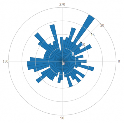
10. Statistics – You can’t manage what you can’t measure
How to lie with maps stats. Where does GIS come into play in statistics? I’ll put it another way. Where doesn’t GIS come into using statistics?
Think of the potential: geostatistics, zonal stats, regression, and any type of chart or graph on a map.
In QGIS, you can build basic charts with the “plots toolbox”. For example, histograms, box, bar, and polar plots like this beauty below. Although kriging is available through SAGA GIS, it just doesn’t feel as polished as ArcGIS Pro.
In ArcGIS Pro, it’s the interactivity that steals the show. For instance, you click a point and see it on the scatter plot. New chart types like data clocks, temporal charts, and calendar heat maps make your stats stand out.
The geostatistical tools in ArcGIS Pro make you feel more immersed. Let me premise this by saying, we hate the idea of “wizards” of any kind. But the geostatistical wizard actually educates you on how to perform kriging properly. So once you build your model, you feel more confident in the output.
11. Raster Analysis – Master the raster
Despite an impressive 1500+ geoprocessing tool count, ArcGIS Pro will lock you out for the majority of them without a license. For example, zonal statistics, raster reclassification, and even map algebra require a Spatial Analyst license.
Several geoscientific and terrain analysis tools like ruggedness aren’t standard in ArcGIS Pro. Instead, it’s part of ArcHydro. Just open up in QGIS 3 and you can find them in GDAL and SAGA toolboxes like Least Cost Path.
When it comes to raster analysis, nothing is outstanding enough to lure you into using ArcGIS Pro. Meanwhile, QGIS 3 had the convenience that’s worth its weight in gold. Because with reinforcements like GDAL, GRASS, and SAGA to back you up, QGIS 3 only outshines ArcGIS Pro.
12. Network Analysis – The connectivity enabler
It takes a while for a business to fully understand this… But every business is spatial in nature. Where are our customers? Where are our sales? And how can we better serve them? To answer any of these types of questions, it’s best to use network analysis.
For any straightforward drive-time analysis, QGIS 3 can tackle this problem. By finding “service areas” with the OpenRouteService (ORS), you can learn about the “accessibility” of locations.
Although QGIS 3 has removed the Road Graph plugin, you can still access its tools from the network analysis toolbox. For example, some of the most popular are – the fastest route, service areas, and multiple shortest paths.
But there’s really much more you can do in the polished set of network analysis tools in ArcGIS Pro. For instance, you can run location-allocation, OD cost matrix, and vehicle routing problems. Not only can you set travel modes like driving, walking, or truck, but you can also optimize any type of fleet for delivery, repair, or transit.
13. ETL – GIS on autopilot
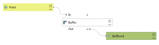
Both ArcGIS Pro ModelBuilder and QGIS 3 Graphical Modeler get a fresh coat of paint. Extract, transform, and load (ETL). That’s the name of the game.
Silently, one of the biggest upgrades in QGIS 3 is the graphical modeler, which allows you to string together inputs, algorithms, and outputs to automate almost anything. The feature filter algorithm is great for sending features to different ports, giving it an FME type of vibe.
ModelBuilder gets a lot of attention too in ArcGIS Pro, allowing you to group, lock, label, expand, and collapse model groups. Besides this, you get logical tools to branch models and schedule them at different times.
Whereas Tasks in ArcGIS Pro Tasks involve preset steps for a repeated business operation. Typically, they rely on the amount of user input for semi-automation.
14. Scripting – Put it in cruise control
Python libraries are code someone else has written to make life easier for the rest of us. We tap into those libraries, then suddenly gain functionality for almost everything like machine learning, reporting, and graphing.
ArcGIS Pro gets a big facelift with Python 3+Conda. On startup, you install, run, and update packages and their dependencies in the package manager. By default, third-party libraries like SciPy and Pandas are pre-installed.
ArcGIS Notebooks are built on top of Jupyter notebooks with the intention for data scientists to interactively code, edit, visualize, and share. There’s also new functionality to add the ArcGIS API for Python to a Jupyter Notebook. It’s possible to use Jupyter Notebook for PyQGIS, but it’s a bit tricky.
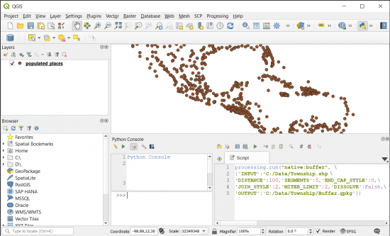
PyQGIS is the Python environment inside QGIS 3. When you export any graphical model as a PyQGIS script, it’s like the equivalent of using a cheat code. Alternatively, just steal the Python code from the processing history and run it in the Python console. It’s good to get something started.
Finally, QT Creator comes installed with QGIS 3. It’s a separate application for building an interface for a plugin of your very own.
READ MORE: Free GIS Programming Tutorials: Learn How to Code
15. Labeling – A Master Class in labeling
QGIS 3 is teaching a Master Class for labeling because it’s all about the details. For example, callouts with Manhattan lines are looking ultra-polished.
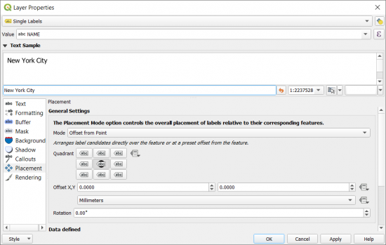
When you have overlapping labels, the traditional ArcGIS approach is to either try and fail using the Maplex Label Engine or convert to annotations altogether. Whereas their manual label placement in QGIS 3 is beneficial for keeping any map tidy.
Not to be confused with some of the functionality with labeling in ArcGIS Pro. The text and shape markers, map notes, and dictionaries for labeling are new features. But once you start working in QGIS 3, it better handles a lot of labeling issues than ArcGIS Pro.
16. Map Automation – The paper map printing press
Map automation is about turning your GIS software into a paper map-pumping machine. First, build a strip map for each extent in your mapbook. Then, pump out maps with the right rotation and scale.
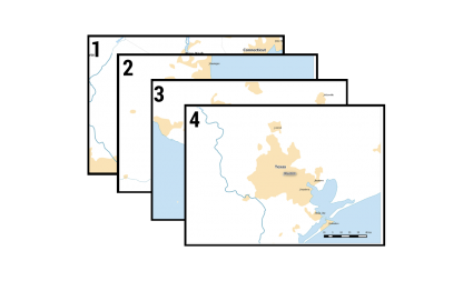
ArcGIS Pro rebrands Data Driven Pages as just Map Series. It meets its match with QGIS 3 Atlas. When we tested the two, they both did their jobs equally well.
It’s just more of a workaround to build your strip map in QGIS 3 because you have to download the Polystrip plugin. It deserves to be a tool natively in the Cartography toolbox.
17. Animation – Tick of the clock
It’s through temporal data that maps can come alive. Glue viewers to their screens in awe and inspiration with map animations. As it turns out, you don’t need much skill and practice to create a cinematic experience in either one.
We like the whole ArcGIS Pro experience better for animation. You can dig deep into each keyframe in the animation timeline pane. The hyper-realistic animated water fill symbol and shininess with a response to light gives a feeling of awe.
The new Temporal Controller is how you become an armchair animator in QGIS 3. Similar to ArcGIS Pro, you can go through each slice of time. A neat feature is accumulating data over time. This feature is now part of the core and performs relatively smoothly in QGIS 3.
18. Map Types
If you’re tired of the same old maps and want to spice things up a bit, which GIS software should you pick?
Because there’s no such thing as information overload in maps, it’s only bad design and selecting the right map type for the job.
A while back, we estimated there are about 25 types of maps in the industry. We cut the list down to 20. While ArcGIS Pro can satisfy 19/20 map types, QGIS 3 also tackled 19/20.
| Map Type | ArcGIS Pro | QGIS 3 |
|---|---|---|
| Animation | O | O |
| Cartograms (Density-Equalizing) | X | O |
| Choropleth | O | O |
| Contour | O | O |
| Dasymetric | O | O |
| Dot Map | O | O |
| Firefly | O | O |
| Graduated Symbol | O | O |
| Heat Map | O | O |
| Hexbin | O | O |
| Isochrone | O | O |
| Map Series (Atlas) | O | O |
| Radial Flow | O | O |
| Schematics | O | O |
| Space-time Cubes | O | X |
| Statistics | O | O |
| Surface | O | O |
| Vector Direction | O | O |
| Voronoi | O | O |
19. Topology – Become a Jedi editor
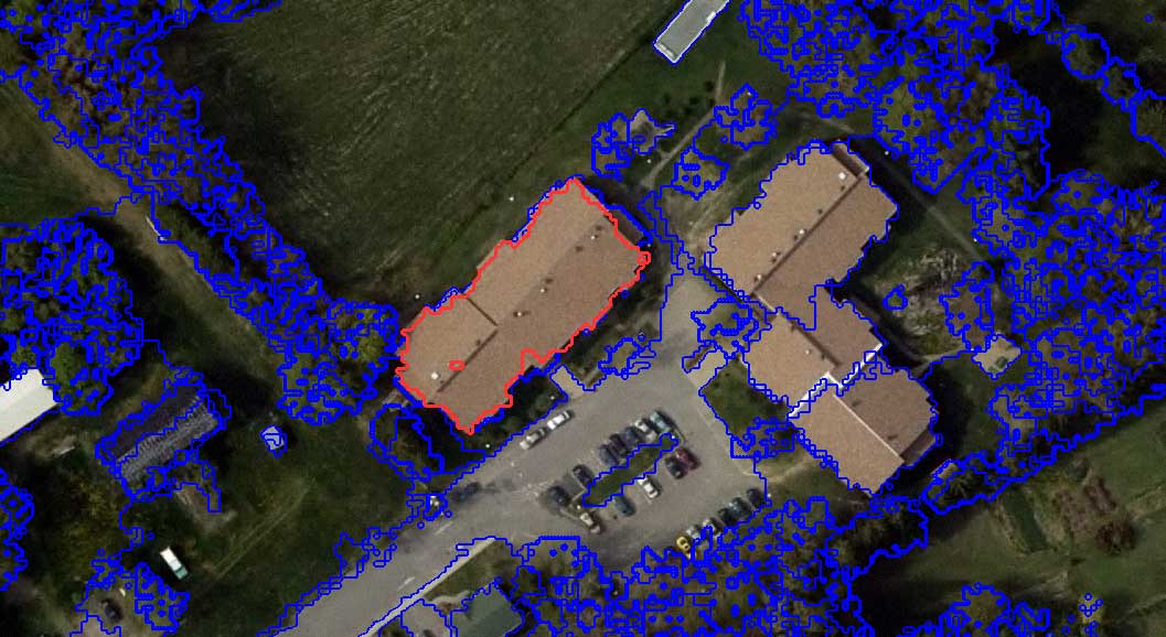
Even the most talented Jedi data editors can introduce digitizing errors like undershoots, dangles, and overlaps in their geometry. When it comes to topology errors, should you turn to ArcGIS Pro or QGIS 3? Your path, you must decide.
The Geometry Checker in QGIS 3 is a core plugin for validating geometry errors. As a top-notch topology tool, it has all the functionality you need like finding gaps, self-intersections, and slivers to keep data integrity.
Whereas ArcGIS Pro sticks to its same winning formula. But it adds the Data Reviewer, which is like having a topology checker on steroids. This system automates data quality control for high-quality data and error management.
20. Interoperability – It’s in your DNA
Regardless of what they say about interoperability in GIS. There’s nothing new. But there’s always something different in formats and file types. So GIS software has to keep up with all technology and be interoperable.
Interoperability is in the DNA of QGIS 3. It’s genetically tailored to consume almost all GIS formats through geospatial natural selection.

FGDB, CAD, NetCDF, GPX, KMZ, and now QGIS have added mesh layer support, useful for scientific modeling. Even though you can still import MXDs, you can convert Esri “style files” to QGIS format.
ArcGIS Pro ramps up interoperability by adding native support for KML/KMZ directly in the map viewer. The same goes for CAD file formats like DGN, DWG, and DXF file formats. As Geopackage becomes the new standard in QGIS 3, ArcGIS Pro is playing catch-up to support GPKG.
21. Geocoding – The great geocoding heist
In QGIS 3, geocoding is all open source using the OSM Place Search plugin. OSM Place Search adds a panel with a search box. After you search for a location, it zooms to that address. Everything returned is OpenStreetMap (OSM) from the Open Database License.
If you want to geocode or reverse geocode an address in ArcGIS Pro, Esri charges 40 credits per 1,000 addresses based on the service you use. We said it before, but any credit system should come with a bottle of antacid.

The major selling point of ArcGIS Pro is that you can securely use it behind your firewall. If you want to take a different approach to geocode in ArcGIS Pro, LocateXT creates coordinates based on written text.
For any recreational user, QGIS 3 should suffice. There are just so many geocoder services available today that you should explore your options before you pay.
22. Symbology – Adding a fresh coat of paint
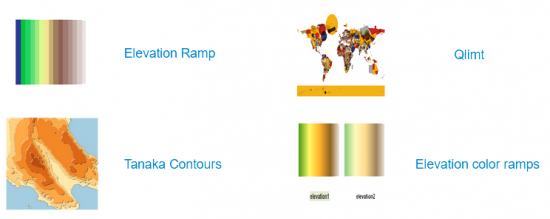
Cartography has always been a strength for QGIS and it still remains the case. For instance, it has improved color ramps, point clustering, and the option to save your favorite symbol. You can also override symbol patches in the legend through the style manager.
But when it comes to pure choice, ArcGIS Pro delivers a world-class set of symbols and color schemes.
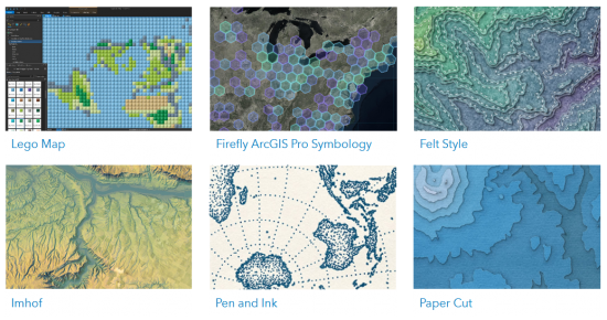
When you run a STYLX search in Portal, the style options are endless like watercolor, Lego, pirate, paper cut, felt, and pen ink. Of course, the necessary styles are here too like geology, public safety, and transportation.
Despite the new QGIS 3 style-sharing platform, it still can’t match what ArcGIS Pro starts you off with. Users just want to be able to select from pre-existing symbology without getting into building their own.
But if you’re into building your own set of symbology, QGIS 3 is a supreme platform to do so. Once the style-sharing platform grows (because it’s still in its infancy), this can help fill the void.
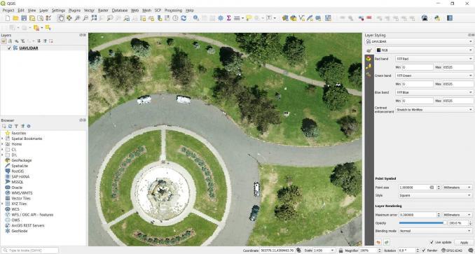
23. LiDAR – Let there be light detection and ranging
Introducing: LiDAR in QGIS 3. The point cloud development we’ve been waiting for quite some time.
Albeit, the LASTools plugin is still solid but it comes with a hefty price tag. So it’s a nice departure to have a true open source option.
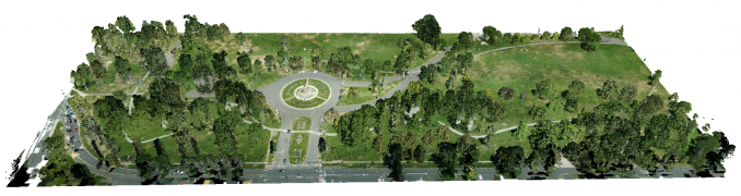
First, we like that you can drag and drop LAS and LAZ files. Unlike ArcGIS Pro, there’s no need to transform to an intermediate format like LASD.
As it’s still in development, it still crashes a ton. For now, at least. The point cloud visuals are impressive but it doesn’t have much for LiDAR analysis just yet.
Another day, another proprietary format for Esri with LASD. But what can we say? The display is lightning-fast. It doesn’t crash.
And you can draw as a point cloud, contours, or a surface. The contextual tabs come in handy with capabilities for visibility, area, volume, height, and classification.
READ MORE: Top 6 Free LiDAR Data Sources
24. Map Elements – A cookbook of elements
Put your chef hat on. North arrows, scale bars, legends, keymaps, and neat lines… These are the ingredients you need for an impactful cartographic design. As it turns out, both ArcGIS Pro and QGIS 3 are master chefs in culinary mapping.
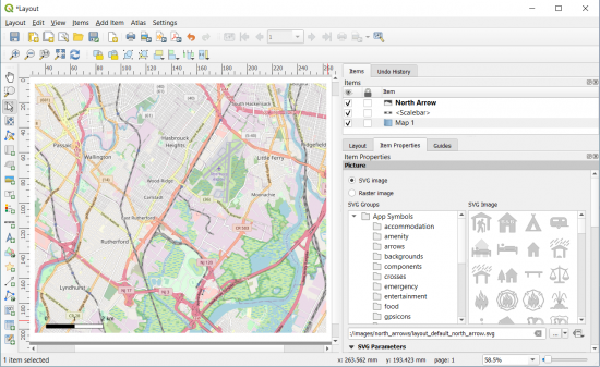
While QGIS 3 adds a brand new layout engine replacing print composer, ArcGIS Pro gives you a much-deserved spell checker and map template previews. Both offer refreshingly varied sets of designs that offer a mix of classic and modern styled map elements.
But there still seems to be a curious disconnect between map layouts (PAGX and QPT) or lack of them. Other than the few available on GitHub or Portal, a lot of users just have to build their own without much to work with.
25. Metadata – Hot off the press
I know some people who have more fun moving cinder blocks than writing metadata. But you know what they say for metadata – “hindsight is 20/20“. Whether it’s the lineage, use limitations or date of creation, metadata can save you some serious headaches.
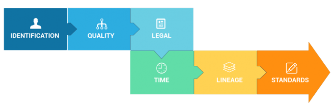
In ArcGIS Pro, you edit metadata in the Catalog View (not the Pane). You’ll notice a brand new, handy spell-checking, and all typos have squiggly lines. Before you start editing metadata, you can set your styles such as FGDC, ISO, or just the default item description.
Overall, metadata gets a big overhaul with an internal formalized metadata schema. But QGIS 3 takes a bit of a different approach, in which it saves metadata in the project file. Depending on the file type, you can also be saved in a QML or SQLite. But catering to the different metadata styles had taken a bit of a backseat.
26. Database – Good things come in GeoPackages
QGIS 3 introduces the OGC GeoPackage (GPKG), which becomes the default file type. It’s built on top of an SQLite container with a set of conventions for vectors, rasters, tiles, attributes, extensions, and imagery. When you work with a GeoPackage it’s like the map is a database and the database is a map.
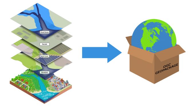
The file geodatabase (FGDB) format is still the backbone for ArcGIS Pro. It’s a big storage container for everything like vectors, rasters, tables, and relationship classes. For stitching images, raster catalog and mosaic datasets are standard formats.
Both databases in QGIS 3 and ArcGIS Pro are transactional and have views and SQL support. But the FGDB is a proprietary format and it’s difficult to write to. This is why the GeoPackage format has become a widely used open source standard in use today.
27. Web maps – Jaws in a web map
If you want to build a web map, perform field collection, or download authoritative data, Esri’s cloud-based platform ArcGIS Online (AGOL) is for you. It’s hard to compare QGIS 3 to Esri because AGOL is such a massive online platform.
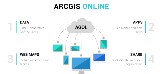
If QGIS 3 is a big fish, then AGOL is like Jaws in the world of web mapping. You can do everything in ArcGIS Pro and so much more…
We love the open source movement. We are even bigger fans of the underdog story. But Esri is light years ahead in the world of online mapping. You can’t compare the two.
READ MORE: 5 Best Web Mapping Platforms – The Battle of Web GIS
| Web Map Types | ArcGIS Pro | QGIS 3 |
|---|---|---|
| Field Collection | Collector/Survey123 – Instead of just collecting data in the field, you can deploy and manage field staff in real-time using ArcGIS Workforce. | QField – Mobile data collection field app for Android with a 4.6-star rating. Input.io – QGIS in your pocket. Simplify site visits by capturing field data on your mobile or tablet. |
| Web Mapping | LiDAR Web Maps – While LiDAR is just rolling out in the core QGIS 3 desktop application, Esri’s building LiDAR point cloud web maps with customized geoprocessing widgets. | QGIS2Web – Create a web map using OpenLayers or Leaflet from your QGIS project. QGIS Cloud – Publish your maps from QGIS Desktop without the need of owning your own server. |
28. The reigning monarch of 999999
If ArcGIS Pro is the reigning monarch of 999999 errors, then QGIS 3 is the czar of crash reports. When testing, they both crashed a lot. :( QGIS Crashed. We are the bug finders and there’s lots of them.
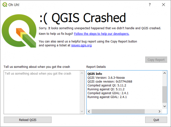
We saw it all… white screens of death, unresponsive geoprocessing, and the dreaded 999999 error. GIS isn’t for the faint of heart.
Here are some errors we experienced:
| Errors | ArcGIS Pro | QGIS 3 |
|---|---|---|
| Types | • It froze when adding a legend • 999999 error with the GeoAnalytics Desktop Tools | ▪ It crashed when zooming out using the “World from Space” projection ▪ Constant crash reports for the new LiDAR display |
I’m shocked. Shocked! Well… Not that shocked.
You’re going to have equal bottlenecks with both. While QGIS seems a bit more responsive for your ordinary panning and zooming, ArcGIS Pro has fewer bottlenecks for LiDAR and data processing.
29. Cost – The price for GIS
Open source for Esri is like what garlic is for vampires. See what others can’t. Pay what others don’t. We said it before, and we’ll say it again. “Licensed to geoprocess” sounds like a really bad movie. ArcGIS is the villain.
But open source skeptics say you’ll pay a cost in time for what you can’t do in open source. While this is partially true, QGIS 3 has tons of functionality. Frankly, some of it is equal to or better than what you can do in ArcGIS Pro like geoprocessing, cartography, and data management.
Let me get this straight: This is not a post on the evils of proprietary software versus the virtues of open source. Where do your “GIS needs” match the desired GIS software functionality? At this point of intersection is where only you, as a GIS professional, should decide.
READ MORE: 13 Free GIS Software Options: Map the World in Open Source
30. Extras – Plugins and extensions
GIS is the only technology that integrates different subjects with geography as a common framework. Think about hydrology, aviation, transportation, climate change, and smart cities. For any GIS application, Geography is always a common link.
ArcGIS Pro is versatile with everything from stereo models, oblique imagery, photogrammetry tools, full-motion video, space-time cubes, and real-time sensors. From aviation to maritime tools (air and sea)… If you can’t dream it, you can’t do it.
The innovation of QGIS 3 is why it succeeds in a big way. Something is satisfying about looking at the creativity in its 1000+ plugins.
Just a random plugin like Go2StreetView brings up a Google Street View of any location you click on a map. Smart, practical, and effective. Something you rarely see.
QuickMapServices find base maps for any location you zoom in and out. At the very least, you can get OpenStreetMap wherever you are in the world.
31. Imagery – Mosaics, georeferencing, and band combinations
Imagery gets a dedicated ribbon in ArcGIS Pro mostly to set and enhance its appearance. Whereas QGIS 3 handles imagery display in the layer properties as usual.
Both are equal for setting band combinations, resampling type, and stretch type. You can also change everything from blending modes to contrast enhancement.
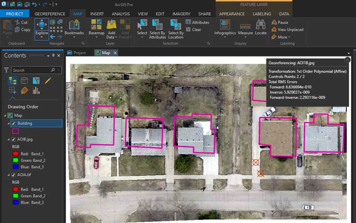
In ArcGIS Pro, auto georeferencing still doesn’t work as intended (as shown below). So, hold the front door.
But the individual pixel editor is long overdue. Imagery mosaics, georeferencing, and contour production are basically equal in both.
32. File Structure – APRX vs QGZ
QGZ is the upgraded extension for QGIS 3 projects. Whereas APRX is for ArcGIS Pro projects, which contains maps, toolboxes, databases, folders, and even styles. Currently, it’s not compatible with QGIS 3. But you can still convert MXDs from ArcGIS Desktop through MXD2QGS.
When you convert an MXD to APRX in ArcGIS Pro, it doesn’t produce an exact carbon copy either. Unfortunately, it misses some neat lines and other objects. Keep in mind you can’t go in reverse from APRX to MXD.

Connecting to root folders is easier and you can set all of your favorites. But the downside is that you still cannot connect to a root directory. By default, you have to connect to a sub-root directory.
A welcomed addition to ArcGIS Pro is the dark theme. It’s nice for working in rooms with low ambient light and less battery consumption.
33. Community – Stay connected
As Steve Jobs said: you have to start with the customer experience and work backward to the technology. Steve Jobs understood that when you try to reverse-engineer the customer’s need for the product, it’s too easy to lose touch with reality.
How well do QGIS 3 and ArcGIS Pro understand the needs of their customers?
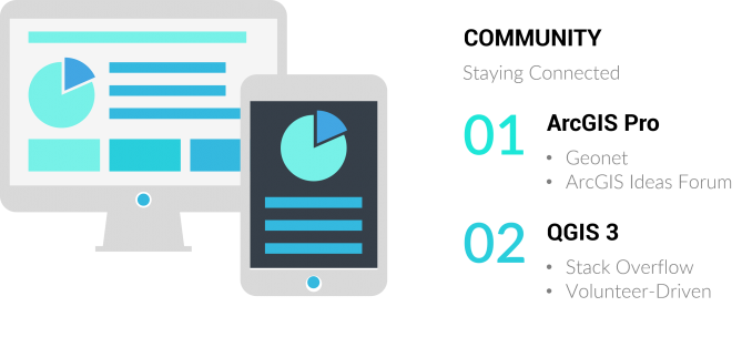
In ArcGIS Pro, you can suggest your ideas by posting them on the forum for Geonet ArcGIS Ideas. As the community votes it up or down, eventually, some features in the user wish list can become part of the product plan. Esri keeps track of the top-voted ideas and it’s how they stay connected to the community.
QGIS is completely volunteer-driven and managed by a project steering committee (PSC). The development follows a road map and everything is documented in the visual changelog. Also, GIS Stack Exchange is the central community hub for QGIS users.
Check out its bug reports and QGIS idea space to get involved. Feedback and funding come from the community. This is why we always recommend supporting the world’s largest and most ambitious open source GIS project. Make a donation today or get involved!
34. Emerging Technology – Being Future Proof
They say that once a new technology rolls over you… if you’re not part of the steamroller, you’re part of the road. In the world of GIS, who’s the steamroller, and who’s part of the road?
Here are just some of the areas that could be the next big thing.
- Machine Learning
- Spatial Data Science
- IoT
- Augmented/Virtual Reality
- Big Data
- Indoor Mapping
The future is for those who take it. These are some of the tools that ArcGIS Pro uses to stay current with emerging technology… Deep Learning Toolset, ArcGIS Velocity, AR Toolkit, ArcGIS Indoors, and GeoAnalytics Desktop Tools…
So far, it’s a bit late in the game so QGIS 3 scores a big donut being future-proof in most categories. But who knows? Development moves at the speed of light in the world of GIS.
35. Documentation – Solve the puzzle
Think of GIS as a puzzle. You can’t complete a puzzle without having all the pieces. Otherwise, it can feel like walking a mile with a shoe on the other foot.

The QGIS 3 user manual gets enhanced help documentation for each tool. But don’t forget that QGIS 3 is not just its own toolbox. It also consists of GDAL, SAGA GIS, and GRASS GIS. One of the consequences is sparse documentation, especially for SAGA GIS.
Whereas in ArcGIS Pro, the help documentation is thorough. Because a lot of students start with Esri in school, it’s like riding a bike. Once learned Esri, never forgotten.
Plus, Esri has always been big on training (free or paid). Just check out one of any Esri MOOCs and you’ll see why.
Let’s wrap this up
Two battling giants. Head-to-head in a GIS showdown. Some features are just a tightrope walk between the two.
50+ years strong. Esri employs 4,000 staff globally. It’s so big that people confuse it with the whole field of GIS. But it’s not about the power of money. Because Esri understands the connection between people and the planet. Esri is about making the world a better place to live.
For QGIS’s 20+ yards of development, some said the journey was impossible. Yet here it stands. A classic underdog story that is driven by volunteers dedicated to building what many consider the top open source GIS software. QGIS 3 is an impressive release. But still, it has work to do.
We hoped that we could shine a bit of light.
Now, we want to turn it over to you. Who’s in your corner? Is it the unsung hero of open source (QGIS 3)? Or do you take comfort in Esri ArcGIS Pro?
Maybe, you’ve just forgotten it all and stay with the good ol’ trusted ArcGIS Desktop and QGIS 2. Please let us know by leaving a quick comment below. We’d love to hear from you!


I use QIS a lot, but in some projects, for example, when I need spatial statistical analysis tools like Moran or geographic regression, or when I want to orthorectification an aerial photo, there are not many tools for this task and I am forced to use other software.
QGIS also works on MacOS; ArcGISPro does not. You’d have thought that as MSOffice works both on Windows and MacOS that ESRI would have been able to develop a version for Mac users. I wonder why not?
User of both QGIS and ArcGIS Pro.
Since the author brought up web maps, community and emerging technologies. We’d be amiss to discount some of the other functionality that is included with ArcGIS Pro outside of the purely desktop software. That includes Story Maps, Web Apps, Field Maps, Dashboards, Experience builder. Much of the purpose of these new products is not so much to create more GIS professionals as enable more GIS aware end users. That really is the end game. Even if we develop the most sophisticated geo-analysis, if we cannot share or present in an effective or convincing manner, what’s the point?
ESRI has developed an entire GIS ecosystem suited for emerging / mature organizations which use GIS regularly as both creators and consumers. As most of the comments here have pointed out the value to cost for desktop solution is undeniable. The true value comes from being able to enable our end users and put the power of maps, geography and science in their grasp in a simple, non-technical, intuitive interface.
Don’t get me wrong, we can use leaflet and Python and a host of other solutions to share and distribute content. But now we’re asking our GIS professionals to also be a programmer and a web developer. If we factor in the cost of expertise and abilities and compare (ArcGIS Pro user that can simply publish a map to ArcGIS Online for immediate consumptions vs a dedicated programmer to create code) the calculus changes.
I like them both but I like QGIS more when compared to ArcGIS Pro. Switching from ArcMap to QGIS was easy as the tools in QGIS are intuitively easy to find. As a seasoned GIS users I see how file use and maintenance is easier with ArcGIS Pro but I have learned now to avoid the ESRI proprietary models to avoid those issues.
ArcGIS Pro has buried things behind a TARDIS of click-walls. I need to search the internet for the simplest of tasks and that take time away from meeting work demands quickly. ArcGIS Pro is slow and clucky. v3.1 is getting closer to being stable but my job is not to debug ESRI’s software so I have been a hesitant adopter. Simple tasks spin for some unknown reason like opening tables, popup, exporting, and geoprocessing tasks…things that took milliseconds in Map and still take milliseconds in QGIS. It is actually shocking that ESRI is still fixed on the shapefile as a default type and not geodatabases.
ArcGIS Pro does shine with the universal application of geoprocessing environments. Setting analysis for the window extent and snap rasters is pure gold for reducing file sizes to project areas and file sizes.
Ok, it’s time to enter into the fray. For me, it’s all about day-to-day use. The biggest thing, I think, is that QGIS has a certain transparency: I always like to know things without having to go digging. QGIS supports that view. This—and many other qualities of QGIS that make it a joy to use—weren’t mentioned. These are the hidden gems that make QGIS shine, and many are among the features I use constantly as I develop a map. And, I want to promote QGIS.
Here are some of the features I like:
* Feature counts: Right click on a layer in the table of contents and select “Show feature count” to show the count of features in that layer. If you have a category- or rules-based symbology, the count is shown for each, all right there in the table of contents.
* Filtering (i.e. turning off and on) the display of features with classed symbologies: Both rule- and category-based symbologies allow (with checkboxes) clicking off/on symbologies in either the table of contents or on the symbology pane.
* Selecting features by classification: You can select features from a class with a right click on the class in the table of contents; you can then zoom to those features, export them, or do whatever you need with the selection.
* Easy access to layer filtering (the attribute query in Esri-speak): Right click on the layer in the table of contents and “Filter” is one of the choices. Once a query is created, a funnel icon shows up on that layer in the table of contents; click it to open the query window. When you mouse over the icon, a popup appears with the query text.
* Layer locking: You can lock layers to prevent them from accidentally being removed from a project file. When locked, a lock icon is displayed with the layer name in the table of contents.
* Layer notes: You can add notes to any layer. Layers with notes display a notepad icon in the table of contents; click it to open the notes window. Hovering the mouse over the icon displays a popup showing the notes.
* Layer edit mode: When a layer in QGIS is in edit mode, a pencil displays to the left of the layer name.
* Layer information: When hovering over a layer in the table of contents, a popup appears with the CRS and data path of the layer.
* Raster symbology: So many options are available here. I often use Google Maps for my imagery layer for the sake of display speed. I can alter the display of the imagery (Google or any other) for contrast, brightness, saturation, and gamma. If I’m working with a DEM, I can render it with up to 255 breaks. By altering the color ramp (a very simple process), you can closely examine the elevation changes in a fairly level area.
* Complex symbology: QGIS has a feature called the “Geometry generator” (it’s worth a web search!). Using formulas accessing features’ data or geometry, symbologies can be created that would otherwise require running geoprocessing to create feature sets whose only function is to create some desired symbology. And that’s just the tip of the iceberg of what’s possible.
* Rules-based symbologies: You can symbolize any aspect of a layer’s features and turn these on and off as needed, and even group them, using “rules” (essentially queries, but with many more options). If you leave the rule empty, it will display for the entire layer. This way, one layer can have several symbologies for different purposes, so you don’t need to duplicate a layer for every symbology you need or to create a complex symbology. If you create a categorized symbology, you can convert it to a rules-based symbology by changing the symbology type from “categorized” to “rules-based.”
* Merged symbologies: A good example of this is symbolizing land-use categories in a municipality. If you simply symbolize these categories, there will be outlines around each parcel. If you don’t want to see all those borders you can use a merged symbology, where adjacent parcels of the same category will become one symbol in the output (this can be verified by opening an exported PDF in a vector-editing program; all contiguous parcels of the same category will be a single entity). If you want an outline, the outline will be around groups of contiguous parcels.
* Calculated fields: Often in a project I will use data that I don’t want to modify (such as regional data used by others) but I want a modified value that can be derived from the data. Calculated fields to the rescue! Whether it’s geography-related (e.g. calculating the area of intersection of a feature with a feature from another layer), a mathematical calculation, or text manipulations (simple concatenation or more complex manipulations using regular expressions), there’s much that can be done. I’ll often use a calculated field for creating specialized labeling.
* Calculated summaries: This builds on the previous item. I have some dummy shapefiles with one feature. I’ll use this layer and add calculated fields that summarize data in other layers. If I make a modification in one of the referenced layers, it will automatically be updated in the summaries. You can even base these calculations on the categories you might use for a rules-based symbology. It’s easy to modify formulas, and as far as documentation goes (knowing what formulas were used where), the documentation is in the formulas! Lock the layers that you use in the summary calculations!
* Easy customization of keyboard shortcuts: if you use other graphics programs very much, you may want to use similar shortcuts. Some examples of what I use all the time:
-Select a layer in the table of contents: type 0 [zero] to zoom to that layer’s extents; – Select some features on a layer: use [ctrl]+J to zoom to those features – Zoom previous: backspace – Zoom next: space
You can even (as of a recent update) set keyboard shortcuts for the layout view.
* Saved layer sets/groups: QGIS calls these “themes.” I use them all the time when working in a map, depending on what I’m currently doing. You can base map layouts on themes so you never need to remember what layers are on for what layout, so even if you have different layers displaying on the map, layouts will always display their assigned layers. If you have only some categorized- or rules-based-symbologies on for a layer, that will be saved with the theme. And of course, themes can be updated as needed.
* Complex annotations: All the basic types that apply to symbologies (rules-based, etc.) are available for annotations. Annotations can be moved while maintaining a connection with the data. A recent update brought us “Annotation layers,” which can include text and graphics that will remain positioned geographically.
* XML file format: That’s right, I can open a map project file and edit the text directly. This is a great time-saver when I need to make a lot of changes that can be more easily and quickly accomplished with a find-and-replace rather than clicking through the QGIS interface several times.
* Easily copy styling from one layer to another: It’s easy and quick to copy all the styles from one layer to another, and even faster if you assign keyboard shortcuts to the tasks.
* Transparency applied to symbology is maintained in PDF output: There’s no need to increase the DPI of the output if linear elements have transparency because QGIS maintains vectors as vectors, even if transparency is set. Also, transparency can be set on either the outline or the fill, independently.
* Layer actions: Layer actions are specialized actions that can be performed on a feature from the attribute table. I have created three that I use often: Zoom to feature, Pan to feature, and Flash feature, and I created icons for these that show in a column in the attribute table. Instead having to right click and choose “Zoom to feature,” I only need to click on the magnifying-glass icon to zoom to that feature, and if I am doing a lot of that sort of zooming when I have the attribute table open, it’s a big time-saver, and it’s just plain easier than repeatedly doing the right-click-zoom-to-feature thing.
There’s more, but this is quite enough for now.
A word about the ribbon: I have yet to become comfortable with the ribbon, despite using Word and Excel frequently in my work. It requires too many clicks to get to what I want to do. I am a fan of the palettes and properties panes familiar to users of Adobe products; QGIS uses this model.
After learning GIS on ArcMap about 15 years ago I switched to QGIS just out of college because it was free and I was working for an incredibly small forest consulting business that just couldn’t stomach the cost of any extra ESRI licenses than necessary. Fifteen years of joy with QGIS and I just recently found myself in a new job that requires me to use ArcGIS Pro, and I absolutely abhor it.
I hate the command ribbon that is constantly shifting in an effort to show me what it *thinks* I want to see when what I really want is just a nice simple toolbar that is always where I expect it to be (yes, I know there are ways to customize the ribbon and favorites bar, but they are convoluted settings buried in annoying places and more work than I want to mess with).
It’s so slow it borders on the obscene. It takes a ludicrous amount of time to export a single feature from a feature class and geoprocessing tools like creating a grid take full minutes when they execute in milliseconds in QGIS. I literally went from nothing in QGIS, through geoprocessing slope calculations on half a dozen areas to be cable yarded for a logging operation, to exporting finished maps for them in less time than it took ArcGIS Pro to calculate the histogram on the already existing slope raster so that I could use the classified symbology.
Geoprocessing tools in Q happily kick results to a memory layer by default without having to manually specify memory as a location so I can burn through several intermittent steps to a final dataset faster.
I find the expressions used by QGIS vastly easier to comprehend with limited programming knowledge than ESRI’s options, plus QGIS offers far better support for how functions work directly within the expression builder dialog.
I can see where there may be some advantages if you need to do some serious geospatial heavy lifting or absolutely if you’re all about easily sharing team web maps that one advanced user has created (though I still don’t think the option is as off the table with QGIS as this article makes it sound), but in an industry where a significant number of my clients don’t even have an email address yet and what I’m regularly dealing with is well shy of landscape scale modeling/analysis type tasks I’m just REALLY struggling to see the benefit of shelling out the $$$ for something that works better for me for free.
ArcPro is hot garbage. Everything must be in a geodatabase for the tools to work or for you to edit attribute tables. ArcPro is not cross platform which makes it a nightmare for teaching purposes. Sorry but not sorry. QGIS is preferable.
I appreciate your candor.
I’m a technical writer and editor dedicated to producing useful environmental documentation. I volunteer my technical editing services to any group involved in environmental protection, green energy or climate change mitigation projects.
Since my last three projects consisted of editing/copyediting/proofreading and document design analysis of habitat conservation studies, I’ve decided to learn as much as I can about GIS, and possibly become “bilingual” in ArcPro and QGIS, at least at the novice level. I need to know the basics of GIS mapping for the biological sciences, because the maps and images in these scientific papers are part and parcel of the knowledge being given to readers.
But for me, the only obstacle to learning ArcPro is cost. As a volunteer editor, how can I afford ArcPro? Or should I be going back to my alma mater (the Evergreen State College) so see if they’ll give me a student license? What is the current cost of ArcPro for an individual license, anyway?
The cost of ArcGIS Pro at the time of writing this is (non-commercial use) is $100 USD. This also gives you ArcGIS Online. But the cost goes up in the thousands range for commercial and business use
You can have Rstat in QGIS, so saying ArcGIS is better in statistic analyses seems strange… or you didn’t know how to use QGIS as well as you know ArcGIS!!!
The vast majority of my GIS work is done using using Spatialite, a tiny, fast, lightweight, free spatial SQL processing engine. It has over 800 spatial functions that can handle everything I need to do. Many of these functions are only included in the advanced license on Arc Pro, which I don’t have because it is very expensive. The vast majority of web maps I make are produced with the Leaflet, free javascript library. ArcPro is used along with ArcGIS Online to share ESRI feature themes over the web. Exporting, importing and converting spatial data is automated with the free GDAL command line tool, ogr2ogr. I use for QGIS is to view generated or processed data layers. I also use QGIS DB Manager to work with PostGIS using spatial SQL I automate a lot of these processes using Python.
I believe that in most cases that open source software is more secure than closed source. I have a GIS adminstrator that believes QGIS is inferior on the basis of security. I am interested if anyone can point me to any security issues with either software.
Our college dropped the ESRI license during COVID and switched to QGIS. I teach a GIS intro class and find the learning curve for QGIS to be not nearly as steep as it is for ArcGIS. I am thrilled with QGIS. Students do not have the hassle of licenses, cloud password access issues, and expiration after losing student status. Also, students seem to grasp the QGIS interface much more readily than the ArcGIS interface. One comment, it was sad to say goodbye to the geostatistics functionality of ArcGIS. We are using QGIS 3.26, which we love, but the SAGA plugin doesn’t come close to the geostatistics capabilities of ArcGIS.
Please I need more tutorials on ArcGIS.
Undoubtedly, ArcGIS Pro has many capabilities compared to QGIS. For example, in the field of spatial statistics analysis, geostatistics, photogrammetry and artificial intelligence, etc. QGIS is not so capable. ArcGIS Pro also has a much more user-friendly and compact environment. But I find it interesting that it is open source and plug-in, and that anyone from anywhere in the world can contribute to its development. And also the world of open source systems is growing rapidly so we can hope …
Thank you so much for everything
Good analysis, although aimed at a user above my skill level. But I may not be alone in my perplexity. I’m a mostly self-taught ArcMaps user, volunteer on a small town Planning Board. I want to train a few other volunteers, so I won’t be the only person in my small town (at 76 years old!) who knows enough GIS to meet our town’s pretty basic needs. I have to learn either ArcPRO (sooner or later) or QGIS at the same functionality I have now in ArcMaps. No point in learning both! Then I need to teach it to others who may not have $100 per year, plus town employees who would have to get a budget for a lot more than that. Obviously, I’m choosing QGIS.
If you’re interested, I’d be willing to learn QGIS with your other volunteers, and contribute to making data products for your town. It would be good for me to learn the basics, because I’m a retired technical writer volunteering my time editing habitat conservation studies (and anything else related to environmental protection, green energy, or climate change mitigation.
Even if I’m not a good match for your volunteer needs, I’d at least like to talk to you in real time, on the phone or Zoom, to get more background on how you use QGIS for your town. Thanks for replying! — J.C. (John Clifford) Armbruster, Olympia, Washington
I’d like to suggest to you a couple of options:
Hope this helps!
Hi! Just a quick design consideration about your image on top: Instead of using the old ArcToolbox logo, you could use the real ArcGIS Pro logo ;)
It can be easily downloaded here: https://www.esri.com/content/dam/esrisites/en-us/common/icons/product-logos/ArcGIS-Pro.png
The blue logo color is #006fde
I appreciate your comparison. I’ve been using ESRI products for 30 years now, but have recently taken a peek at QGIS. Why? $$$. I needed to do a simple geoprocessing function that needed an ArcGIS Advanced license which I didn’t have. Which brings up a point you missed – ESRI is throwing the little guy under the bus: much of their focus is on WEB which is expensive. Got a network engineer and a Database Administrator just sitting around doing nothing? Fine. But small organizations have to do what they can with a GIS Analyst. Witness the disappearance of free database from ArcGIS Pro, the Access geodatabase and SQL Express. Postgres is not free if you need to buy an ArcGIS Server License to use it. And the File geodatabase is proprietary, doesn’t have an ODBC or openDB driver, and can’t do SQL beyond simple stuff like “Select finger from hand where ID=3”.
One point in ArcGIS’ favor though are API’s. QGIS has C++ which is only suitable for fulltime programmers, and Python which is quite coarse grained and thus limited. ArcGIS (still) has .NET.
For support, while GeoNet has a LOT of content, it’s very difficult to find anything in there as it’s internal search engine is dismal, and the content is hidden from external ones like Google. Likewise, the Technical Support that you pay quite a bit for in the “maintenance fees” has really gone downhill since it was outsourced to India…
Thank you for explaining this so well. I have used ArcGIS for a long time and still do occasionally for certain aspects but QGIS is so much easier to onboard new team members and scale. It is definitely now my tool of choice for small teams, interns and conducting training workshops.
Great article, though I do somewhat agree with Paraboliq’s comment in respect to the desktop bias of this comparison. If it were just about desktop then given the increasingly marginal differences between the two platforms, how many would really choose to pay the significant licensing to ESRI for the privilege of achieving the same task. It wouldn’t be so bad if some of the relatively basic geometry and editing operations weren’t locked behind the eye wateringly expensive advanced license level.
But GIS is no longer about just desktop, and the ‘online’ and mobile element in this article is contained behind a single topic (No. 27) as if it were as equally important as any of the others, when in fact it is vastly more important than many if not all the others. To score ArcGIS as 100% and QGIS as 70% does not at all reflect the article’s text which states that ArcGIS is indeed ‘light years ahead’. In this respect a single star for QGIS would have been more accurate (and still generous!).
Not knocking QGIS though – I use it most days and the changes over Version 3 have vastly improved its capabilities compared to two or three years back. I do have reservations about QGIS’s future though, how much longer can a star burn this bright? – just look at the major development partners, can these continue to contribute so much indefinitely?
I’ve been developing in Python using ArcGIS Pro for the last 2 years or so. Basically building a process to create maps from excel data and publish to ArcGIS Enterprise (Portal). It has been a bit of a nightmare in some respects as:
1. Things just don’t do what they say on the box.
2. Things just aren’t available in ArcPy (like formatting numbers)
3. There is very little real support on Geonet (about 5 users)
The big question ESRI has to ask is why if Pro is so good so many users just haven’t switched from ArcMap?
We are switching from Mapinfo so you would expect we are coming off a low base, but there are just things that are able to be done in Mapinfo (and I’m pretty sure I could do in QGIS) which can’t be automated in ArcPy.
And the cost. As expected (we are a big government organisation outside the USA), we had a very nice licencing deal at the start to get everyone across. Now the Chickens are coming home to roost, the $$ signs are getting pretty large and the billing is being pushed down to the individual departments which means that Managers are starting to talk about limiting licences etc.
Luckily I think our organisation always knew this might happen and has a QGIS/Web option set up to switch to.
A really good and in-depth analysis article here. It was well worth the read, thank you! I did a quick calculation to get an empirical result (which is a bit unfair, as what you prefer usually comes down to what you like. I, for example, really dislike Ribbon GUI’s, and would’ve likely switched the GUI scores around), but in terms of scores, ArcGIS Pro is the winner, at 150/175 possible stars, and an average of 4.29 stars. QGIS 3 doesn’t do too badly, at 138/175, at an average of 3.94 stars.
QGIS 3 is still my choice, as what you get in this Open Source package vs the vast amount of licenses required for ArcGIS Pro just cannot be beaten. QGIS 3 also gets my vote, as I am an avid believer in Team Toolbar. Perhaps someday, but not today.
A final drawback, for me, is ArcGIS Pro’s GPU-intensive requirements (4GB+ recommended), especially in today’s silicon-drought, where such requirements require a very costly upgrade. QGIS 3 has given me no such problem. In the words of Todd Howard: “It just works.”
And in another parallel, QGIS 3 probably crashes just as often as a Bethesda game.
I have loved using QGIS for a long time, but my customers don’t care too much about that. My bigger customers want access to the amazing web applications that I can provide in minutes with the Enterprise ArcGIS platform. ArcGIS Pro is great, and I wish it wasn’t so expensive to use because a lot of my customer are churches or small municipalities that can’t afford a big price tag. Many of them have to put up with longer delivery and less functionality for the same problem.
I use both depending on who I’m serving. If I was a millionaire I would give everyone the same great products that Esri enterprise provides.
I’m a volunteer editor working with habitat conservation groups. Could I chat with you over the phone or Zoom about your work? I’ve realized that since ALL of my documents have maps, and many of those maps are GIS-generated, I should really get some initial training in QGIS, and possibly Arc Pro or its predecessor. I’d like to know more about your customer base — I’m not interested in poaching, I just want to get a feel for what small organizations want in GIS products.
I echo the comment about bias in the article. Plus the comment about users not wanting to roll their own symbology is just wrong, I work for a GIS consulting company and we make maps for a variety of clients and none of them want stock symbology, they all have their peculiar likes and dislikes for how things should look, so in my opinion, QGIS shines brighter there.
Cost of license is also a massive factor in our office and none of us have ever figured out how the ESRI credits system works. This article should point out more when a higher level of license is required for some of the things ESRI does ‘better’, as too often we find there is a geoprocess for a task, but we don’t have another $1000+ to buy a new license add-on, etc. Meanwhile, QGIS offers a LOT of the functionality of things like Spatial Analyst for free right out of the box.
At my work, we’re an ESRI house because they’re the 800lb gorilla of the industry, but we all use QGIS a lot, and often prefer to do much of our work there, then jump over to ESRI to make the final deliverable.
And I believe there is now a way to import an MXD into QGIS, albeit a paid solution from a 3rd party.
I switched to QGIS perhaps ten years ago. In terms of support, there is nothing we search that we cannot find on the internet about QGIS. There is no point to buy a racing car if you are limited by the speed on the road. I respect Esri for all that they have done and still doing now. Their products are good and very expensive at the same time. Opensource QGIS and other packages such as PostGIS and Geoserver have come a long way. There is no limit in the number of QGIS licenses I can install at the office. Unfortunately, in my opinion, there is still a gap in QGIS for what concerns 3D and Web Mapping. The day we will be able to open a qgs or qgz file without a painful installation as a web map, I will say that QGIS has conquered the industry.
The majority of users of GIS systems are not big companies able to spend thousands of bucks on GIS software. For sure, Esri is providing a state of the art software and it’s the least we want from a company of 4000 employees. But QGIS and its community provide an incredible solution that can be deployed so easily!!! Efficient and no cost!!! There is space for the two but for me, QGIS keep the first rank because of the community and simplicity ;) For the web thing, use the Lizmap plug-in and all I solved :)
Nate has correctly pointed out that unlike ArcGIS, QGIS also runs on Mac operating system. But, there is more to it. QGIS also runs very well on different flavours of Linux, BSD and android operating systems.
You forgot the biggest difference of the all: you can use QGIS on a Mac!
Is there a little bit of bias in this article? I’ve worked with both packages in a production environment and can happily say that QGIS (when paired with the other FOSS packages like Postgres+PostGIS, GeoServer, mapstore2) easily blows the ESRI packages away when it comes to community, documentation, capabilities, etc. The ESRI stuff is super convenient when all you want is a choropleth map but gets difficult when you start with custom widgets, non-ESRI DB’s, etc.
This is like comparing Mac to Linux. The one is easy to use while the other gives you all the options but also asks that you know what you’re doing.
Nobody cares about Desktop comparison: Esri has not developed anything in this area for years, because it is mature
Esri is a full system with (yes) Desktop, but also Servers, cloud (ArcGIS Online), field apps, training, support, etc…
You are comparing 2 costumes focusing only on the shape of the buttons
And believe my daily experience: the price of licenses is a negligible detail in a GIS project. This is what most companies in the world understand
QGIS, through GRASS GIS , has a temporal cube analysis option , https://grass.osgeo.org/grass79/manuals/temporalintro.html
You also may want to check out this machine learning in QGIS though OTB video from 2018, https://www.youtube.com/watch?v=emoGMibsgv0
Great article! It’s almost like a travel dictionary. After eight years in the industry, I have always had both installed, although I mainly use ArcGIS.
The only category that I would add to the analysis is web GIS support (GeoServer/Openlayers vs ArcGIS Online). The skills barrier to creating simple geo apps and sharing them securely is far lower for ArcGIS.
Bottom line , opensource solution is better than a close system.
You must look into the future and yes even to consider cost.
If QGIS was 2 years old , I would say: Wait for the product to be mature.
QGIS is a large toolbox for future development of GIS matters.
Eli
On the point of Remote Sensing, QGIS features Orfeo Toolbox (a powerful and comprehensive image processing software) in its arsenal… I think you missed that. Considering that (with GRASS and SAGA), I think QGIS supersede ArcGis Pro in terms of the depth of tools available, but perhaps not very well organized.