What is GIScience (Geographic Information Science)?

DEFINITION:
GIScience (Geographic Information Science) is the science behind how we collect, use, and understand location-based data.
What is GIScience (Geographic Information Science)?
While Geographic Information Systems answers “what” and “where”, Geographic Information Science (GIScience) is concerned with the “how” and its development.
In short, GIS is the analysis, storage, visualization, and management of geographic data.
But there is another “S” when it comes to GIS. This “S” stands for Geographic Information Science or simply GIScience.
Today, let’s take a look at GIScience and some of its applications.
How is GIScience Different From Geographic Information Systems?
We all know that Geographic Information Systems looks at the “what” and “where”.
For example, an electric company would store its assets in a GIS system as points, lines, and polygons. The “where” is their physical geography on a map.
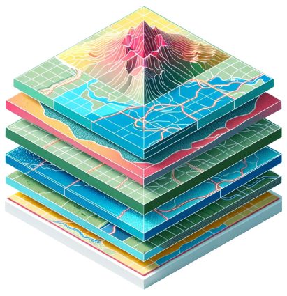
- Points may be towers as XY locations.
- Lines may be wires that are connected to each tower.
- Polygons may be the areas each line services.
All of these have attributes tied to them. The “what” is information about their feature.
- Towers can be made of steel, wood, and other types of material.
- Wires can be overhead or underground.
- Service areas can have the population and demographics they service.
The focal point of Geographic Information Science is the technical implementation of Geographic Information Systems. In other words, it involves conceptual ideas for how to implement GIS.
As you know, there is unlimited potential to apply GIS in our everyday lives including these 1000 GIS applications.
GIScience Builds Better Geographic Information Systems
While Geographic Information Systems answers the “what” and “where”, Geographic Information Science is concerned with the “how”.
For example, GIScience conceptualizes how to store spatial information, collect data, and analyze it. It encompasses all aspects of GIS such as remote sensing, surveying, mathematics, programming, and geography.
Geographic Information Systems relies on the developments in GIScience for future developments. In other words, GIScience is the building block and foundation for all uses of a Geographic Information System.
If you want to get involved, participants from around the world get together at the GIScience flagship conference. This is where they discuss and advance the state-of-the-art in geographic information science. Since 2000, their annual conferences have discussed the role of geographic information in geography, computer science, engineering, mathematics, cognitive science, psychology, social science, and geostatistics.
Conclusion
GIS analysts and technicians use Geographic Information Systems as a software tool in everyday work.
But how did these tools become available?
It came from GIScience which studies data structures and computational techniques.
As you know, this is the backbone of GIS systems that we use every day.


Very nice explanation is given here with good and easy examples, Thanks for this..