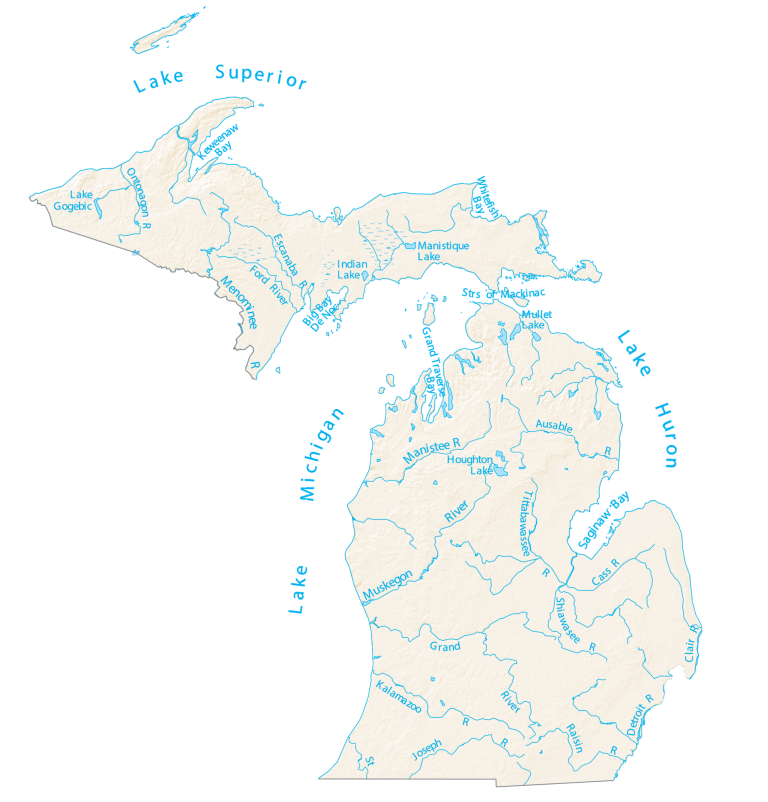
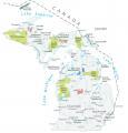
Michigan Lakes and Rivers Map
About the map
In this map, you will find major rivers, reservoirs, and lakes. It’s a clear, easy-to-read map that highlights Michigan’s natural water features.
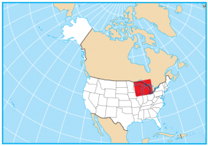
Michigan is actually divided into two pieces, split apart by Lake Michigan and Lake Huron. So, everywhere you look at the boundary of Michigan, more than 50% is the Great Lakes.
Lake Michigan boasts some of the best freshwater beaches in the state. Sleeping Bear Dunes is one of the most popular ones. But it’s quite the hike. All worth it with views of the National Lakeshore.
Michigan map collection


You are free to use our lakes and rivers map of Michigan for educational and commercial uses. Attribution is required. How to attribute?
Michigan lakes, rivers and reservoirs
Lakes and reservoirs
Lake Michigan
Lake Huron
Lake Superior
Lake Erie
Lake St Clair
Saginaw Bay
Houghton Lake
Lake Gogebic
Keweenaw Bay
Big Bay De Noc
Indian Lake
Manistique Lake
Whitefish Bay
Grand Traverse Bay
Mullet Lake
Rivers and streams
Menominee River
Manistee River
Muskegon River
Kalamazoo River
Grand River
St Joseph River
Cass River
Tittabawassee River
Raisin River
Ausable River
Escanaba River
Ontonagon River
Ford River
Shiawassee River
St Clair River
Detroit River