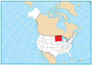
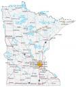
Minnesota State Map – Places and Landmarks
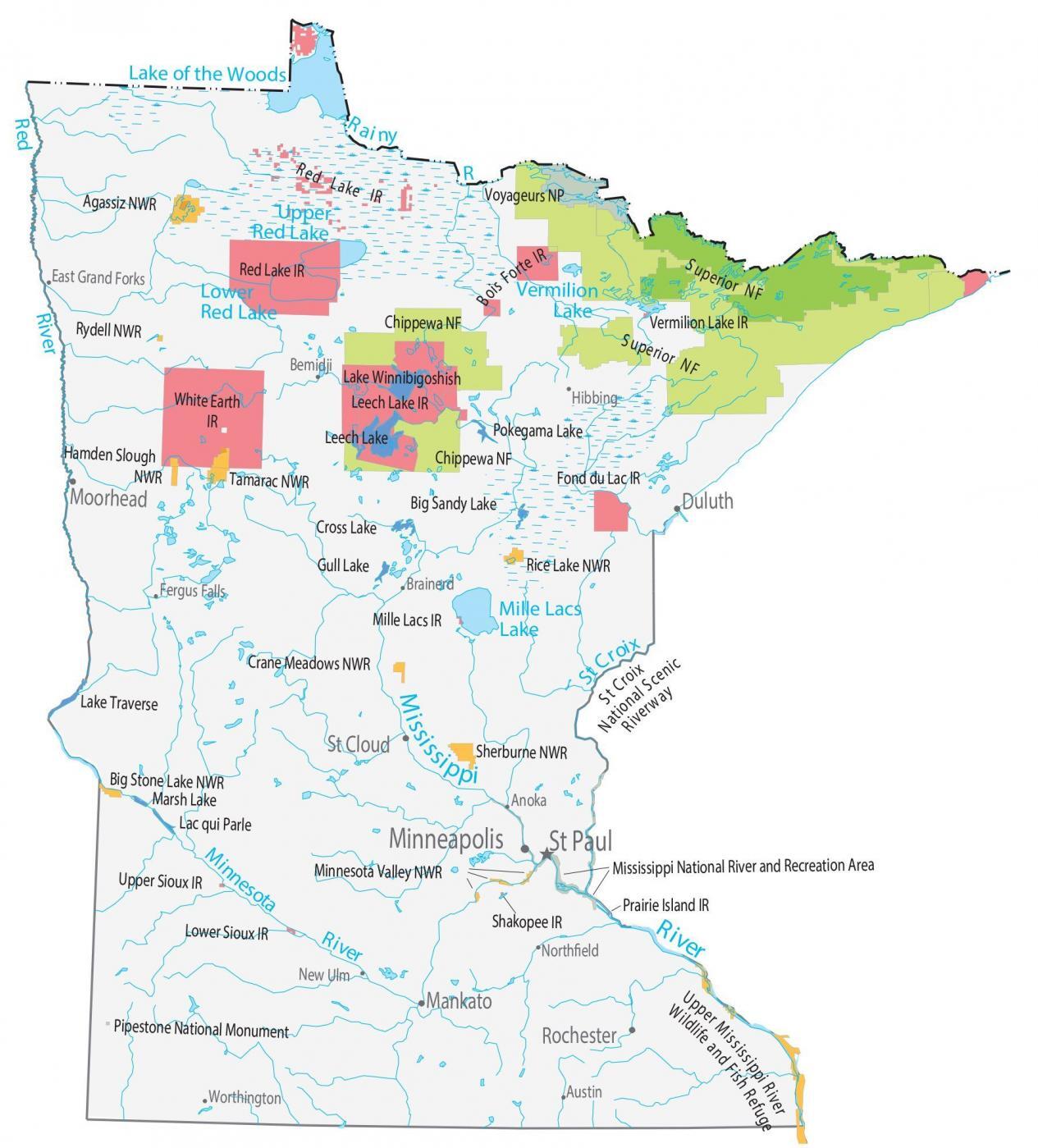
About the map
Our Minnesota State Map shows major landmarks and places. For example, it features national forests, parks, wildlife refuges, major lakes, and other federal lands in the land of 10,000 lakes.
If you ever go to the northeast of Minnesota, we highly suggest checking out Voyageurs National Park. It’s the only national park in Minnesota and it’s described as a maze of interconnected water highways.
Next, Pipestone National Monument is a sacred area for American Indians. This is mainly because how they have quarried the red pipestone for pipe smoking. Finally, Saint Croix National Scenic Riverway offers 200 miles of paddling adventure at the St. Croix and Namekagon rivers.
Minnesota map collection

You are free to use our map of Minnesota for educational and commercial uses. Attribution is required. How to attribute?
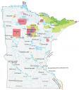
Federal lands
National Park (NP)
Voyageurs NP
National Forests (NF)
Chippewa NF
Superior NF
National Wildlife Refuge (NWR)
Agassiz NWR
Hamden Slough NWR
Tamarac NWR
Rydell NWR
Rice Lake NWR
Crane Meadows NWR
Sherburne NWR
Lake Traverse
Big Stone Lake NWR
Minnesota Valley NWR
Other Landmarks
Upper Mississippi River Wildlife and Fish Refuge
Mississippi National River and Recreation Area
Pipestone National Monument
Saint Croix National Scenic Riverway
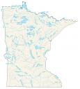
Minnesota lakes, rivers and reservoirs
Lakes and reservoirs
Red Lake
Lake of the Woods
Rainy River
Upper Red Lake
Lower Red Lake
Lake Winnibigoshish
Leech Lake
Pokegama Lake
Big Sandy Lake
Cross Lake
Gull Lake
Mille Lacs Lake
Minnesota River
Lake Superior
St Croix River
Lake Vermilion
Mississippi River
Marsh Lake
Lac qui Parle
St Croix River
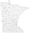
Indian Reserves (IR)
Red Lake IR
White Earth IR
Leech Lake IR
Fond du Lac IR
Vermilion Lake IR
Mille Lacs IR
Upper Sioux IR
Lower Sioux IR
Shakopee IR
Grand Portage IR
Prairie Island IR
Red Lake IR
Bois Forte IR
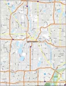
Minnesota Map – Landmarks and places
Minneapolis
Saint Paul
Duluth
Mankato
Moorhead
Rochester
St Cloud
Austin
Bemidji
Brainerd
Hibbing
New Ulm
Northfield
Worthington
Anoka
East Grand Forks
Fergus Falls
State capital
Saint Paul