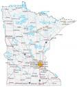
Map of Minnesota – Cities and Roads

About the map
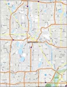
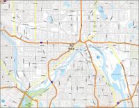
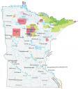
Our Minnesota map contains cities, roads, rivers, and lakes. For example, St Paul, Minneapolis, and Rochester are major cities shown in this map of Minnesota.
Minnesota is known as the “Land of 10,000 Lakes” (according to its license plates). And really, there is truth to its nickname because it has 11,842 lakes over 10 acres in area. Minnesota also is like the Finland of America because a lot of Nordic people live here.
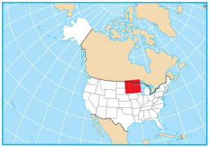
Minneapolis is situated in the north-central part of America. It shares a border with North Dakota, South Dakota, Iowa, Wisconsin, and the Canadian provinces of Manitoba and Ontario. I’ve done road trips through Minnesota. Try to have some fun counting the lakes you pass by.
Minnesota map collection

You are free to use our map of Minnesota for educational and commercial uses. Attribution is required. How to attribute?
State capital
St Paul
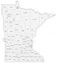
Major cities and towns
Minneapolis
St Paul
Rochester
Bloomington
Duluth
Eden Prairie
Lakeville
Mankato
Moorhead
St Cloud
Burnsville
Brooklyn
Park
Coon Rapids
Winona
Aitkin
Albert Lea
Alexandria
Austin
Bagley
Baudette
Bemidji
Blue Earth
Brainerd
Breckenridge
Cloquet
Crookston
Detroit Lakes
Elk River
Fairmont
Faribault
Fergus Falls
Grand Marais
Grand Rapids
Granite Falls
Hallock
Hibbing
Hutchinson
International Falls
Litchfield
Little Falls
Luverne
Madison
Mahnomen
Marshall
Milaca
Montevideo
Morris
New Ulm
Northfield
Northome
Olivia
Ortonville
Owatonna
Park Rapids
Pine City
Pipestone
Preston
Red Wing
Redwood Falls
Roseau
St James
St Peter
Sauk Centre
Thief River Falls
Two Harbors
Virginia
Wadena
Walker
Warren
Warroad
Willmar
Windom
Worthington
Anoka
Ely
Grand Portage
East Grand Forks
Interstate highways
Interstate-35 (I-35)
Interstate-90 (I-90)
Interstate-94 (I-94)
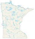
Lakes, rivers and creeks
Red Lake
Lake of the Woods
Rainy River
Rainy Lake
Upper Red Lake
Lower Red Lake
Leech Lake
Mille Lacs Lake
Mississippi River
Minnesota River
Lake Superior
Lake Traverse
Big Stone Lake
Lake Winnibigoshish
Vermilion Lake
St Croix River
Landmarks in Minnesota
Mesabi Range
Eagle Mountains