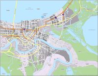
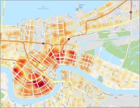
New Orleans Zip Code Map
New Orleans Zip Code Table
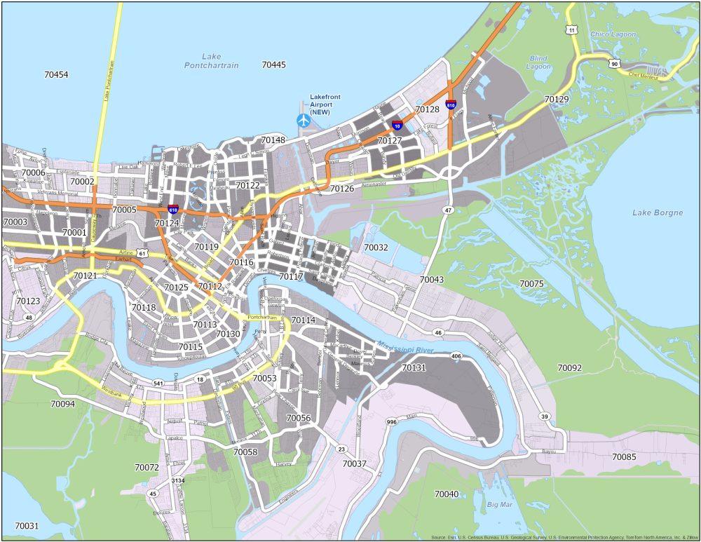
A zip code map of New Orleans is displayed above, which highlights the city’s interstate highways and postal regions. For anyone wanting to send a letter, here’s a map with the postal codes in “The Big Easy”.
| Zip Code | Name | State | Population | Square Miles |
|---|---|---|---|---|
| 70112 | New Orleans | LA | 6,166 | 0.82 |
| 70113 | New Orleans | LA | 8,777 | 1.14 |
| 70114 | New Orleans | LA | 23,774 | 5.86 |
| 70115 | New Orleans | LA | 33,712 | 4.43 |
| 70116 | New Orleans | LA | 12,783 | 1.41 |
| 70117 | New Orleans | LA | 27,767 | 6.17 |
| 70118 | New Orleans | LA | 35,514 | 5.36 |
| 70119 | New Orleans | LA | 42,166 | 4.58 |
| 70121 | New Orleans | LA | 11,640 | 3.83 |
| 70122 | New Orleans | LA | 35,933 | 6.89 |
| 70123 | New Orleans | LA | 26,255 | 9.34 |
| 70124 | New Orleans | LA | 20,998 | 6.96 |
| 70125 | New Orleans | LA | 17,070 | 2.3 |
| 70126 | New Orleans | LA | 28,789 | 17.87 |
| 70127 | New Orleans | LA | 24,382 | 5.11 |
| 70128 | New Orleans | LA | 19,439 | 5.04 |
| 70129 | New Orleans | LA | 10,544 | 154.75 |
| 70130 | New Orleans | LA | 16,055 | 2.6 |
| 70131 | New Orleans | LA | 30,241 | 14.7 |
| 70148 | New Orleans | LA | 0 | 0.3 |